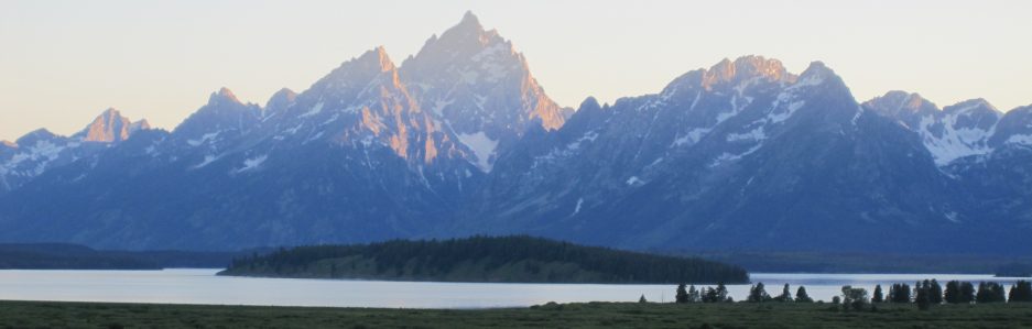
River greenway projects have been around for over 100 years, but towns and cities began to capitalize on these natural byways for tourism and community revitalization in the late 20th century. Projects usually include walkways and trails, interpretive signage, benches, picnic areas, river access for floating or boating, amphitheaters, and other amenities. Some of the largest and most popular of these outdoor facilities are the Hudson River Greenway in New York, Schuylkill River Trail in Philadelphia, the San Antonio River Walk, and Cherry Creek Greenway in Denver. But smaller communities with water resources have also invested in developing parks and recreational areas for conservation, community enhancement, and tourism.
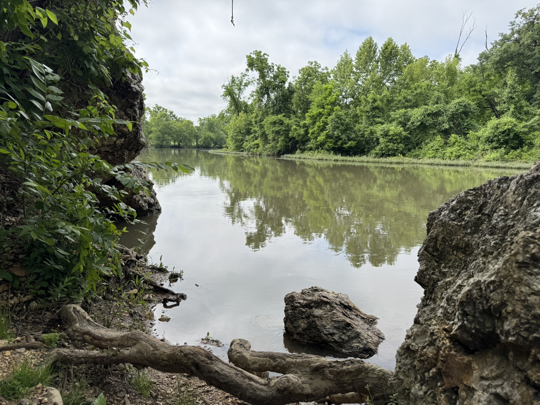
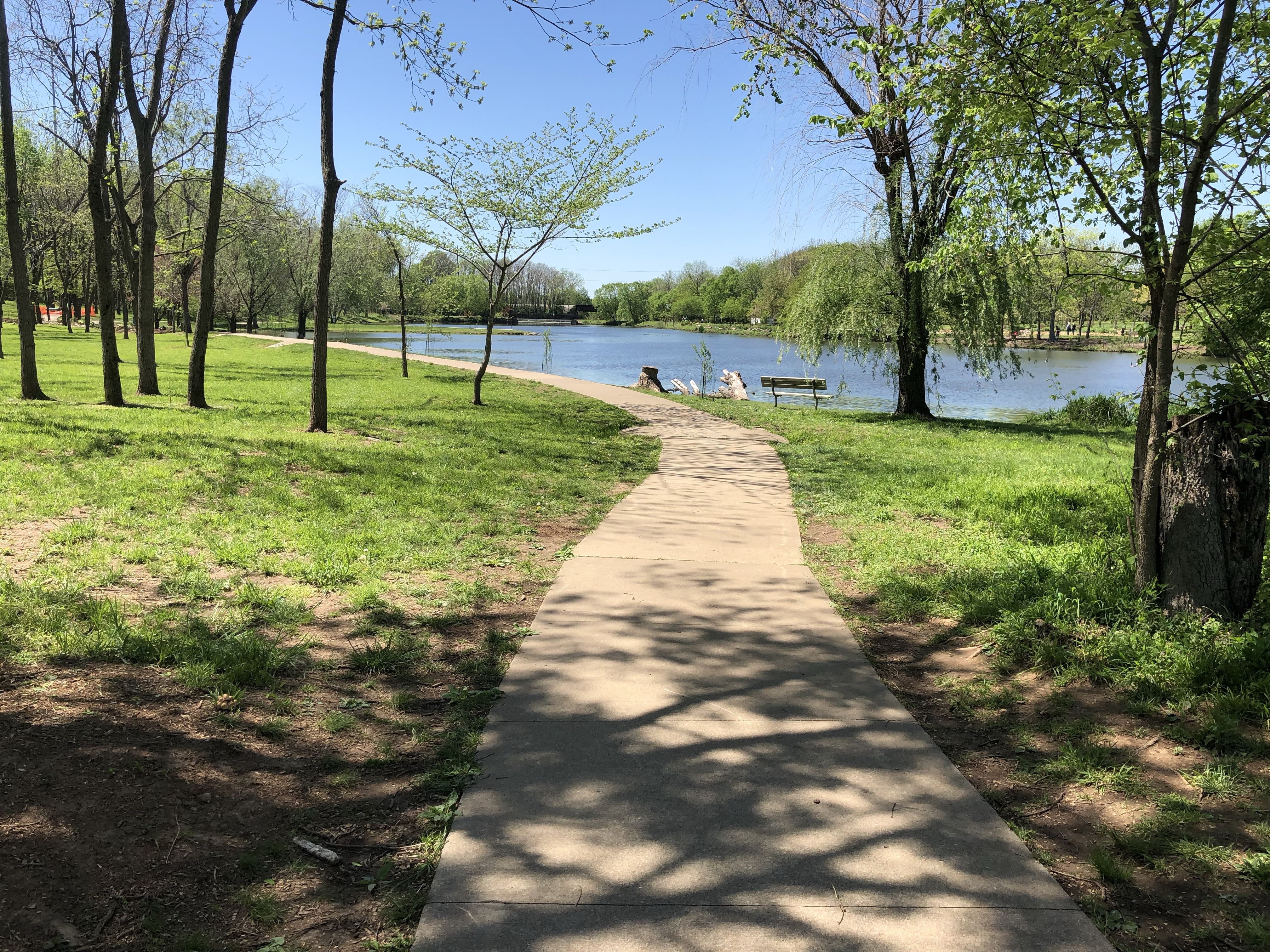
Joplin is a town with a population of about 52,000 located in the southwest corner of Missouri just a few miles from the Kansas and Oklahoma borders. Although it has a rich history of lead and zinc mining, Joplin is likely best known these days for the devastating EF-5 tornado of 2011 that cut a mile-wide path of almost total destruction right through the heart of the town. Now, Joplin is a thriving retail and commercial hub for the area, but the community has also poured money and resources into creating outdoor spaces such as the area adjacent to Shoal Creek, which is southwest of town just north of Interstate 44.
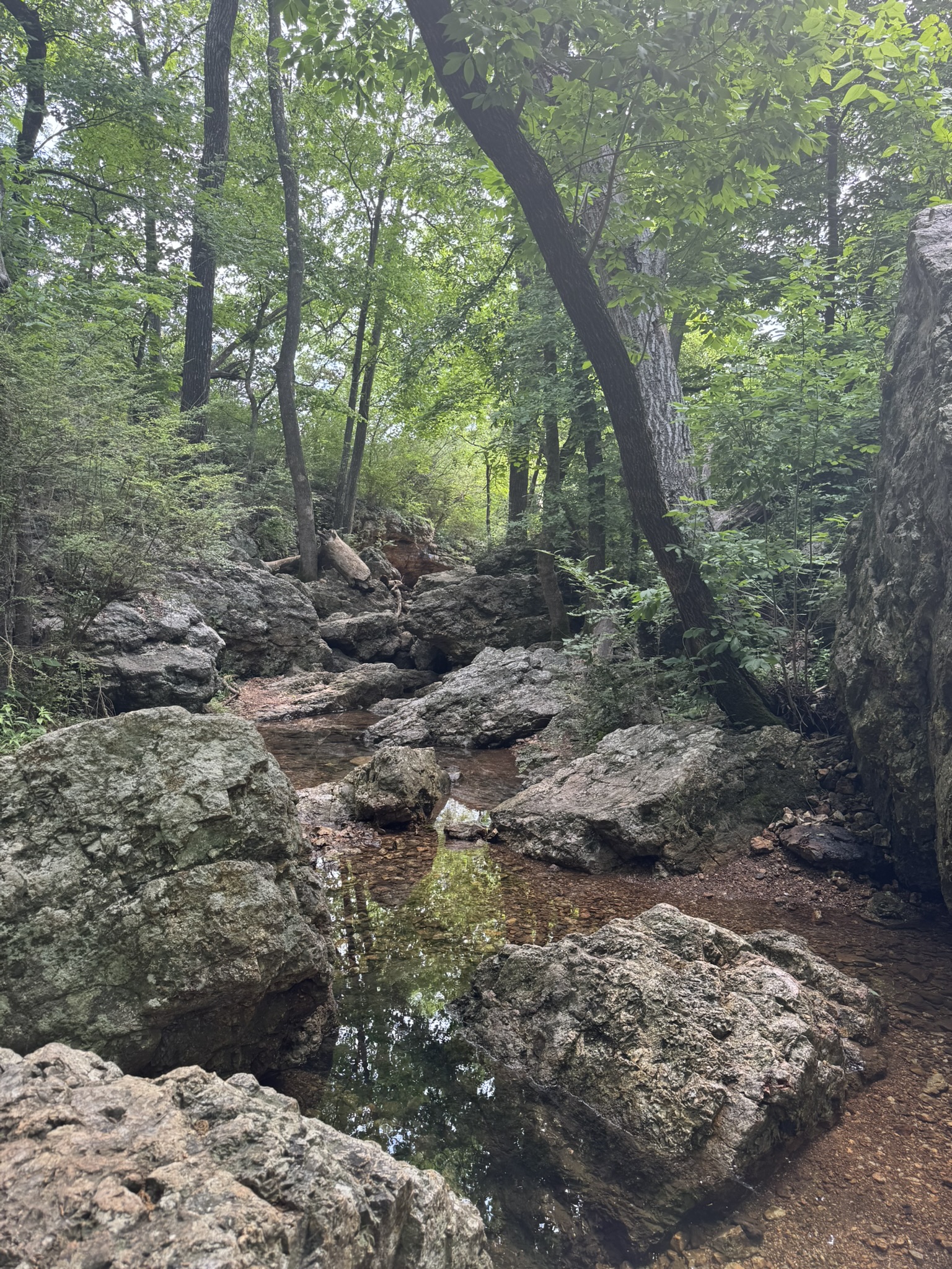
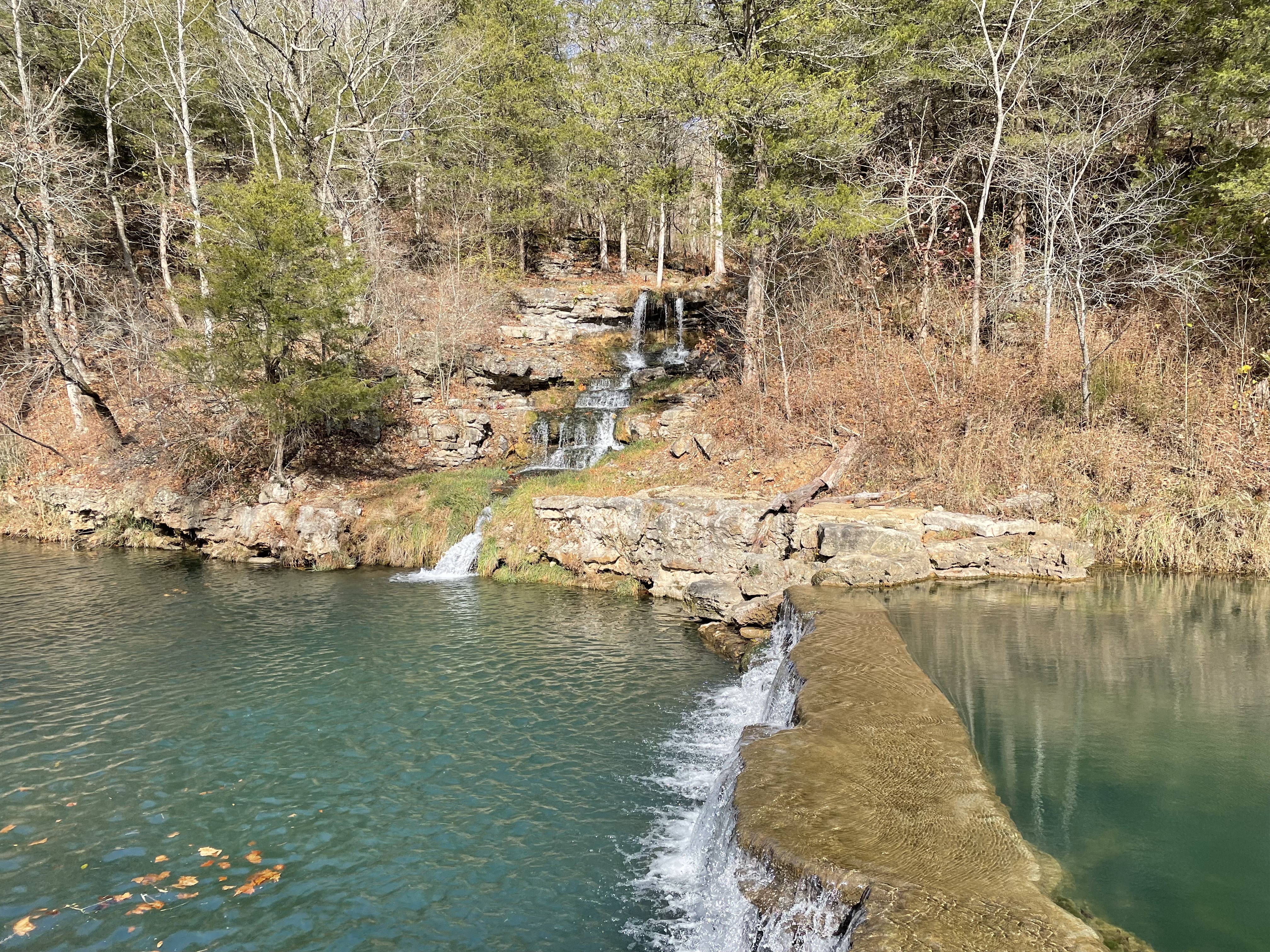
Shoal Creek, Joplin, Missouri
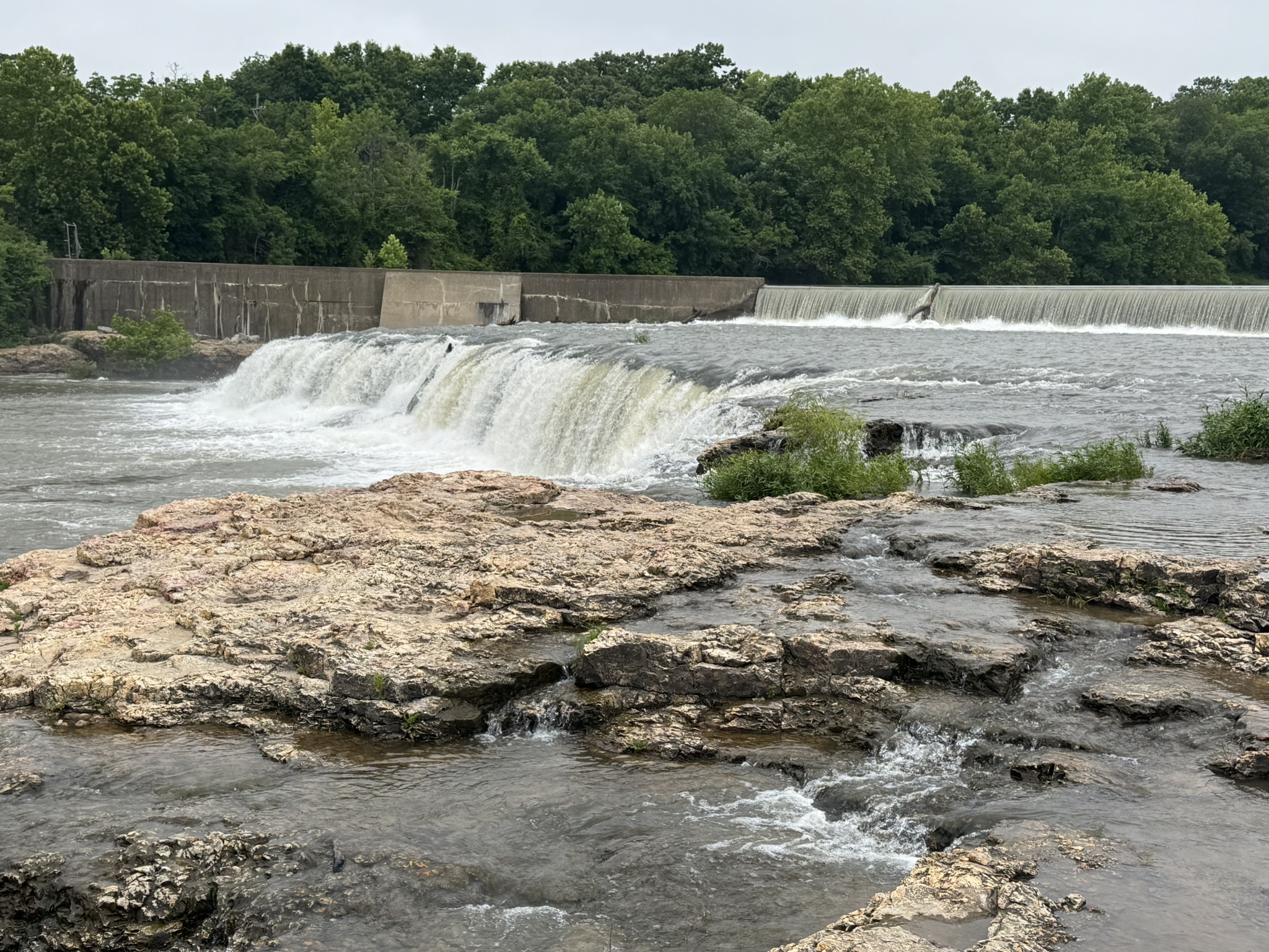
Shoal Creek looks more like a small river as it makes its way to a popular Joplin landmark called Grand Falls, which is the largest continuously flowing natural waterfall in the state. The fall plunges twelve feet down a 163-foot-wide ledge. Just above the falls on the north bank is McIndoe Park, which was purchased by the city in 1923 but in recent years has undergone considerable improvements to make it a destination for outdoor enthusiasts of all ages. Covering approximately 24 acres, McIndoe Park features a lovely paved walking trail that winds its way just a few yards from the banks of the creek. The park also has picnic facilities, pavilions, boat ramps, and plenty of fishing spots. There is ample parking in several spots close to the walking trail.
Grand Falls, Joplin, Missouri
When I visited, my first stop was Grand Falls where I spent about 30 minutes sitting on the yellow chert (or flint) rock ledges along the side of the creek just below the fall. I love the sound of crashing water, and this spot delivered in spades. I was there on a Wednesday shortly after Memorial Day (2026), and there were only a few people fishing and milling around. The area gets quite crowded on weekends and especially during the warmer months of summer.
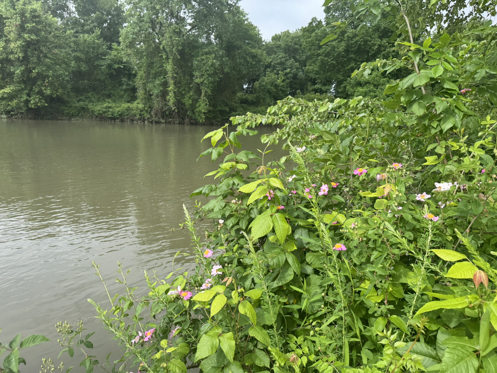
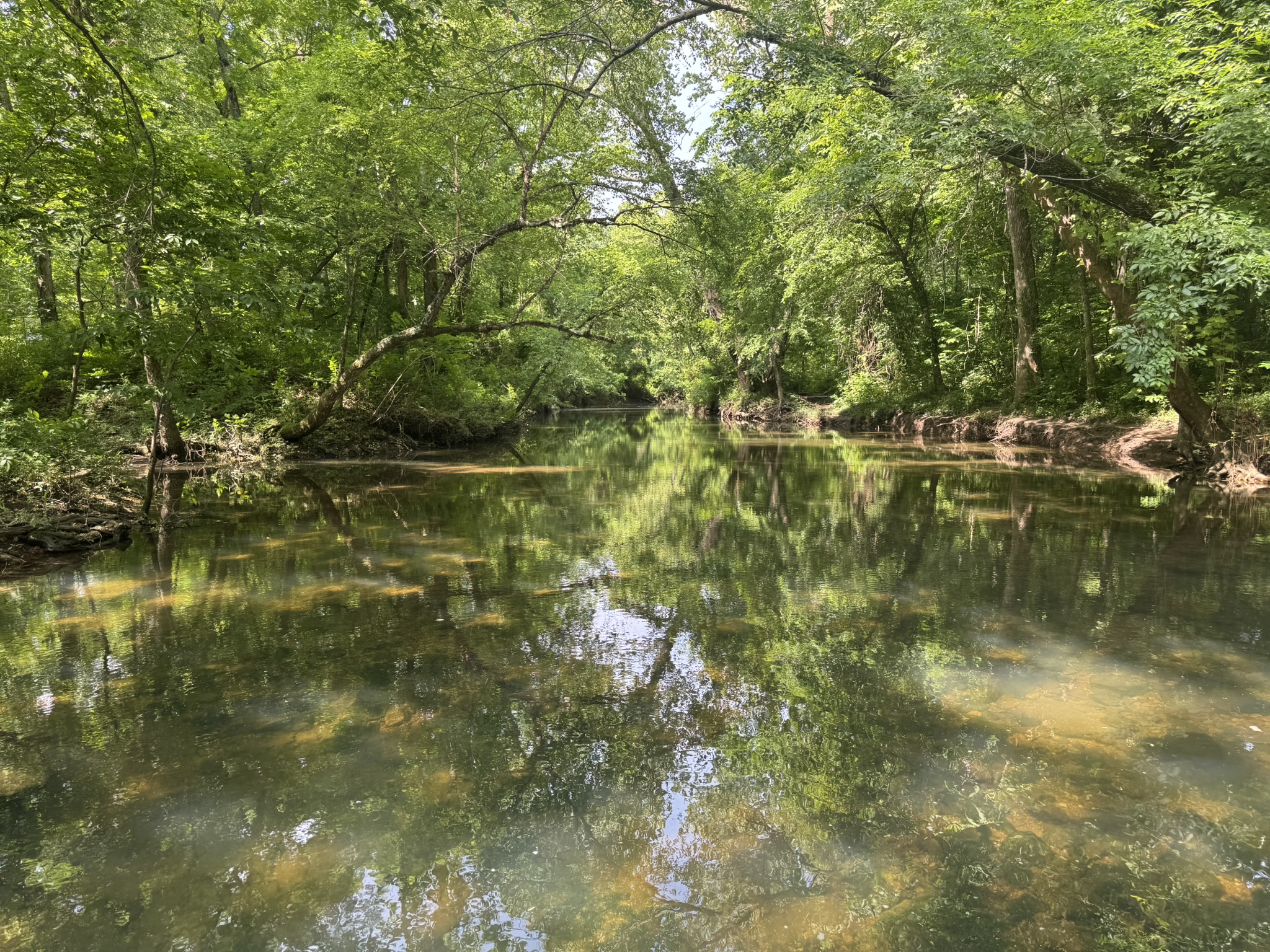
Shoal Creek, Joplin, MissouriMcIndoe Park, Joplin, Missouri
I spent the rest of my time upstream walking the trail at McIndoe Park. I made my way north along the creek until I reached another treasure: Wildcat Park. Formerly a private park, this large section of land on either side of Shoal Creek was also purchased by the city of Joplin in 1923. It features a spring, a large glade, a nature center, picnic facilities, and a series of walking trails (paved and unpaved). There is access to the water for fishing and floating. There are some beautiful places in this park to just sit and enjoy the natural setting, which I did – a restorative experience.
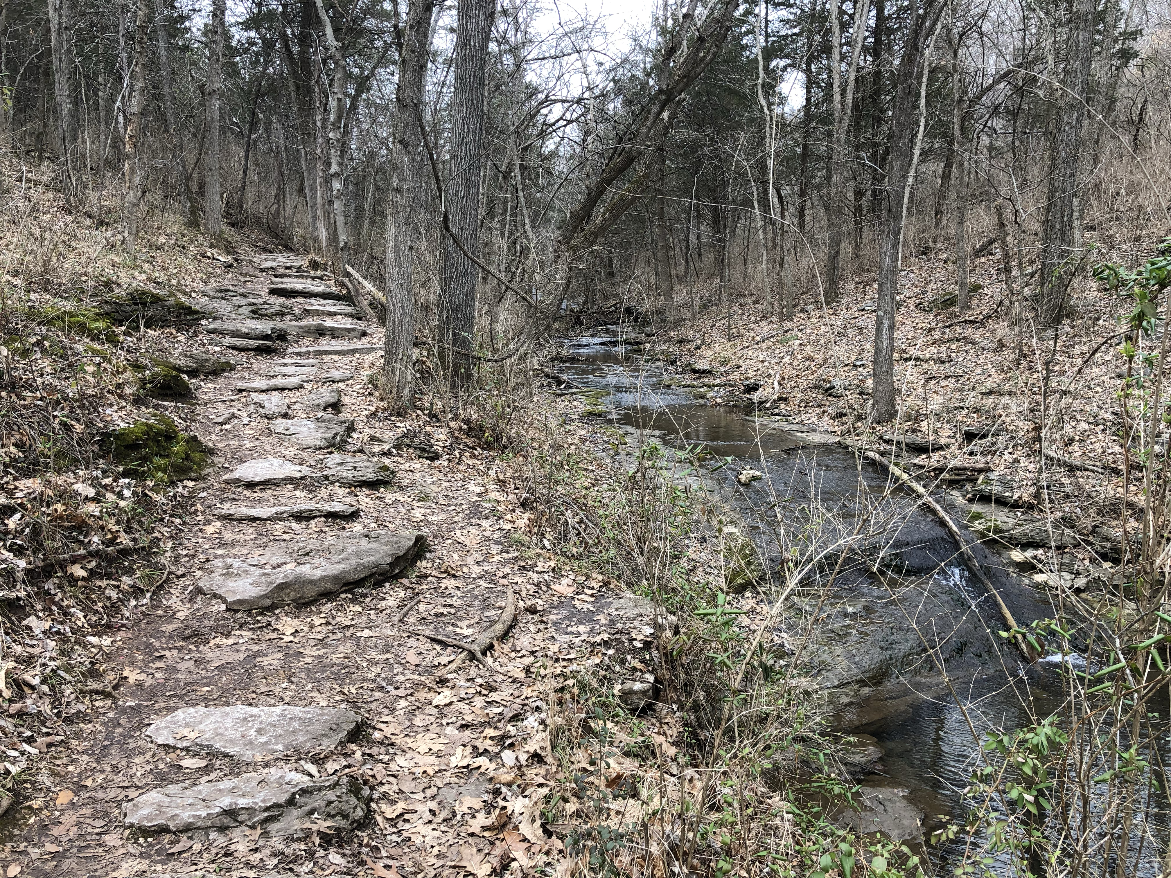
During our extended winter retreat to Phoenix for 2026, my wife and I hiked some familiar trails but also explored a few we had never tried. We also took a day trip up to Sedona, one of our favorite spots in the state. We walked around some of the shops, bought some clothes and shoes, and had a fabulous lunch at the regional airport’s cafe, of all places. They had some cocktail specials we couldn’t resist, and the food was excellent. Before all that, we drove north of town on Highway 89A towards Flagstaff for a morning walk on West Fork Trail in an area called Oak Creek Canyon.
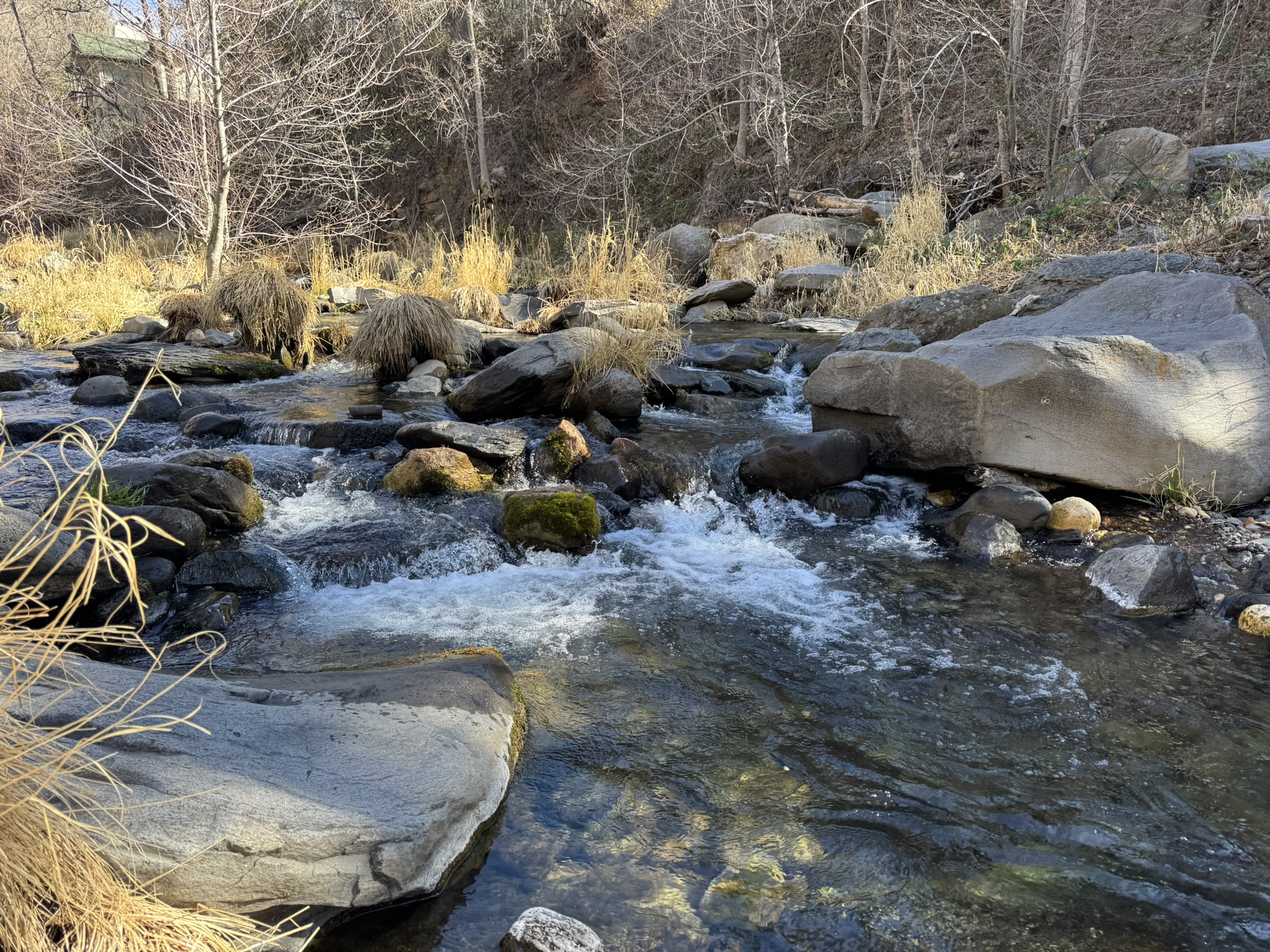
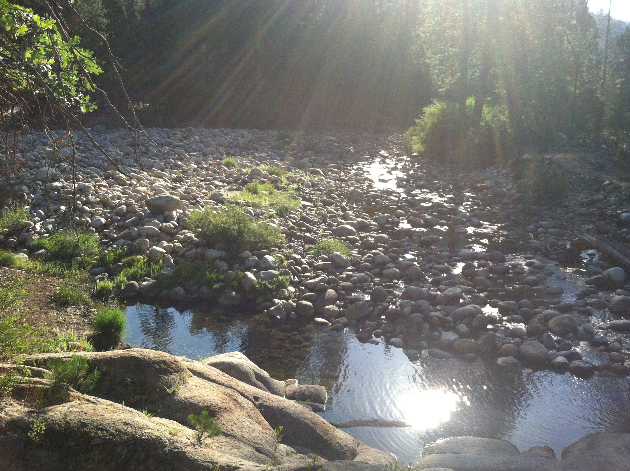
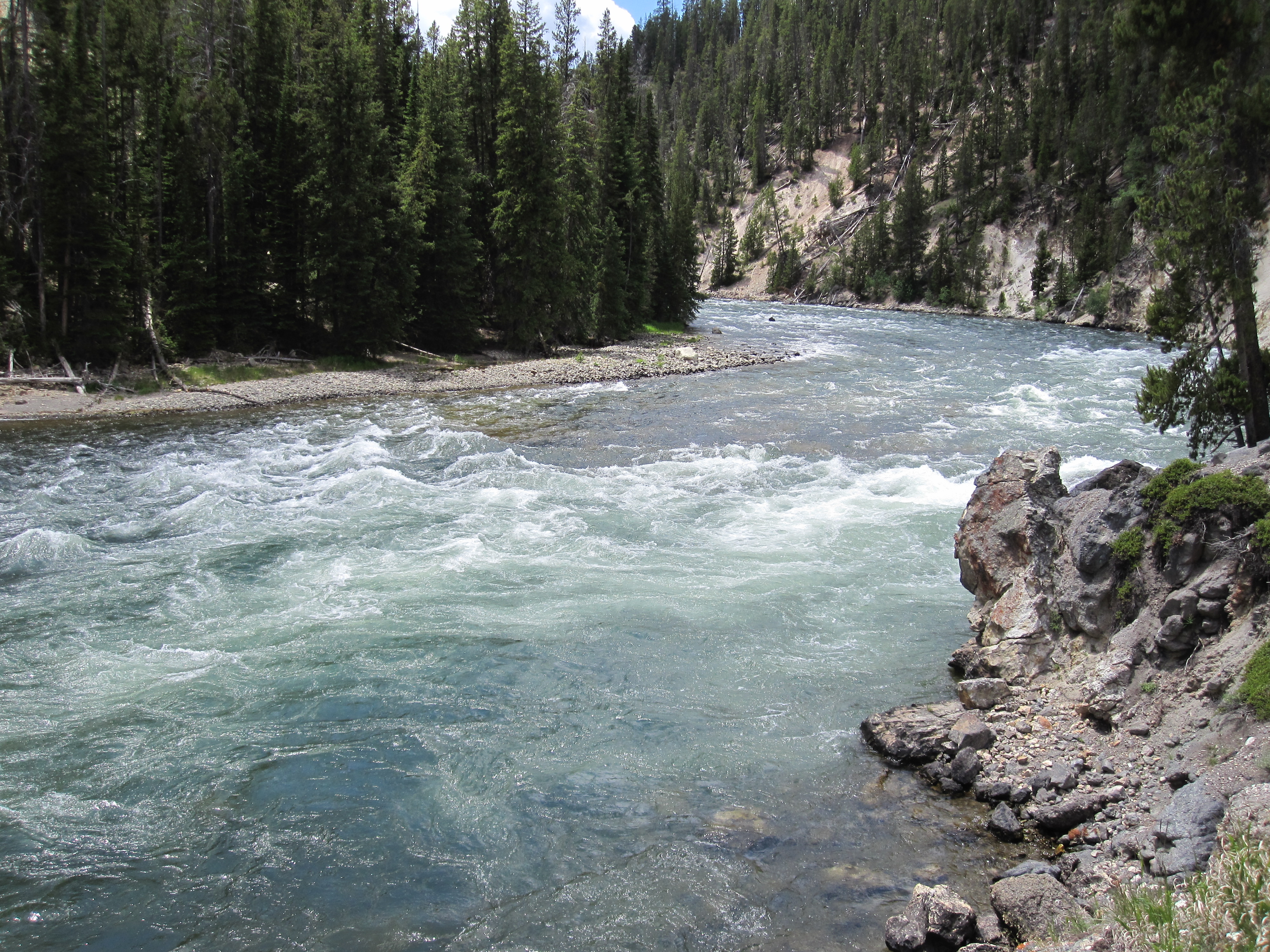
West Fork Trail of Oak Creek Canyon, Arizona
We had driven through Oak Creek Canyon many years ago but had never taken the time to explore the area, which boasts a landscape quite different from the desert environment of the Phoenix basin. The West Fork Trail is 14 miles long, but we only walked the first couple of miles. Literature and websites warn hikers to prepare to get their feet wet, which is fair considering the trail crisscrosses the creek numerous times. During our short walk we forded the creek three times over wet rocks and fallen logs. Even with our hiking poles, we decided a fourth crossing was pushing our luck, especially considering we didn’t bring a change of clothes along in case we slipped and took an unplanned dip.
West Fork Trail of Oak Creek Canyon, Arizona
The section of the trail that we walked is flat and sandy, following closely to the creek through forests of ponderosa pines, maples, and of course, oaks. Not far from the trailhead are the stone ruins of Mayhew Lodge, an old hunting cabin converted into a resort that attracted celebrities such as Jimmy Stewart, Walt Disney, Clark Gable, and President Herbert Hoover. It burned to the ground in 1980, leaving behind only the ruins that are adjacent to the first part of the trail, which is the most accessible portion of West Fork.
West Fork Trail of Oak Creek Canyon, Arizona
According to the Visit Arizona website, the trail becomes more challenging after the early creek crossings. “The canyon walls begin to close in, forcing the creek through a slot canyon. After wading through the creek to get back to the trail, hikers can expect bouldering, swimming and bushwhacking to complete the entire trek.” Visitors to Sedona who enjoy the outdoors will be well rewarded by taking the short drive north to witness the rock pinnacles, natural arches, and deep canyons on the West Fork Trail.
West Fork Trail of Oak Creek Canyon, ArizonaWest Fork Trail of Oak Creek Canyon, Arizona
In his remarkable book, Badass Retirement, author Robert Pagliarini includes a chapter titled “Upgrade Health.” His message is simple for people who want to escape average retirement: think and act like an athlete. He posits that professional athletes “invest their time and energy into improving their performance.” They work hard at it to avoid injury, recover quickly if they do get hurt, and achieve the highest possible energy and stamina for years, even decades. He stresses that retirees should have these exact same goals – and I agree one hundred percent.
My wife and I are now in our second year of retirement, and one of our top priorities since we left employment is to get in better physical shape and maintain a healthier lifestyle than we did during our working years. We are paying closer attention to what we eat and drink (well, better than we once did). We are also wearing the right kind of clothes and shoes for our new lifestyle. We are paying more attention to our bodies and making sure we get the medical care we need. We believe in the value of vaccinations and medication.
Perhaps the most significant change in retirement related to our health is our increased focus on physical fitness. Much of our time is now discretionary, and we are devoting more of it to a variety of exercise options including weight training, cardio activity, Pilates, walking, and hiking. We both have trainers we work out with at least once a week. We have pickleball paddles and hope to learn how to play this game that has swept across America and is attracting all ages, not just seniors.
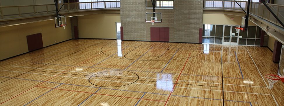
Dan Kinney Family Center, Springfield, MO
We are fortunate to live in a community that offers ample opportunities for indoor and outdoor recreational activities. Our city and county have an excellent trail system for walking, hiking, and biking. Some of the trails connect to surrounding towns. We have a nature conservation area, a botanical garden, a historical landmark park, and several outdoor green spaces with hiking trails, paved walkways, creeks, and ponds.
Springfield (MO) Botanical Center
Because we are both over age 60, we get an extra benefit through our local park board in the form of a deep discount on membership at their fitness centers. We can reach the one closest to our house in about ten minutes. This family center has a multi-use court for pickleball, basketball, volleyball, children’s inflatable bounce houses, and group exercise programs like SilverSneakers. There is a walking track on the second floor that circles the court. There is an outdoor paved walking track too. The center is equipped with a wide variety of dumbbells, weight machines, treadmills, bikes, ellipticals, stair steppers, and much more. The center also has meeting space and separate rooms for small classes and individual training.
We are making a concerted effort to exercise several times a week, with two days of weights, at least one day of cardio, and 2-3 days of alternate activity like walking or Pilates. We live in a subdivision that is great for walking. If possible, we also try to include exercise as part of our daily routine when we travel, taking advantage of hotel and condo fitness rooms or just walking nearby trails or in neighborhoods. We look for public gardens, arboretums, and greenways for walking too. When we are away from home for extended periods of time, we purchase a temporary membership at a fitness center so we can maintain our weight and cardio routines.
Springfield (MO) Conservation Center
Hiking has always been a favorite activity for both of us, even before we met and got married. I have written about our hiking adventures a few times in this blog. When we travel, we look for fun and scenic places to hike. Phoenix, the Sonoran Desert, San Francisco, Lake Erie, Joshua Tree National Park, Yosemite, Mount Hood, and various locations in the Ozarks and Appalachia are just a few places we have hiked. We have walked or hiked in temperatures from 13 to 90 degrees Fahrenheit, in light rain and sunshine, and in all four seasons.
Sometimes it’s not easy to get motivated, but we know we need to keep moving, strengthen our core, develop and maintain muscle tone, protect our bones, keep our hearts healthy, and improve our balance. Robert Pagliarini makes a valid point to keep in mind in his badass book on retirement. “The most important asset you have is your health, but knowing what to do when it comes to nutrition, supplements, and fitness feels like a moving target for a good reason. If there is one area that changes more than any other, it’s health.” Medical professionals agree that exercise is essential to staying healthy, and we intend on staying as healthy as possible as we age. After all, we’ve got places to go, people to see, things to do!
My wife and I were joined by a dear friend from Arizona recently for a trip to Louisville, Kentucky, which served as our anchor location to visit four different distilleries. These distilleries are among many in the north central part of the state that the Kentucky Distillers’ Association collectively brands as the Bourbon Trail. As most folks know, Kentucky promotes itself as the only legitimate home of bourbon production in the country, if not the world, because of its rich soil for growing corn and its limestone-rich water for ideal fermentation. By definition, bourbon must contain at least 51% corn mash, which gives the spirit its sweet taste and robust flavor. When Scots-Irish immigrants settled into what is now the state of Kentucky in the late 18th century, they brought with them their grain distilling knowledge and methods, which over time produced a product that was unique and became identified with the state.
The major bourbon distilleries are all located within an hour or so from Louisville, so we decided to stay in the city and visit two distilleries one day and another two the next day. My wife is very skilled at planning all our trips, but she knocked it out of the park this time. Taking a standard tour of all these places would have gotten quite repetitive and eventually boring. She managed to coordinate and schedule completely different experiences at each of the four distilleries we visited. We never felt rushed during the day and had plenty of time to get back to Louisville each evening for an early dinner.
We drove into the city on a Tuesday afternoon and had dinner at The Porch Kitchen & Bar, a hip after-work spot that has an impressive beverage and food menu. The signature old fashioned is made with Elijah Craig bourbon, vanilla demerara, and black walnut bitters – the second one was even better than the first. The braised short rib served on a bed of cheese grits was incredible. We all three shared two desserts: a bourbon butter cake with vanilla ice cream drizzled with bourbon sauce along with a banana foster pie. Oh my!
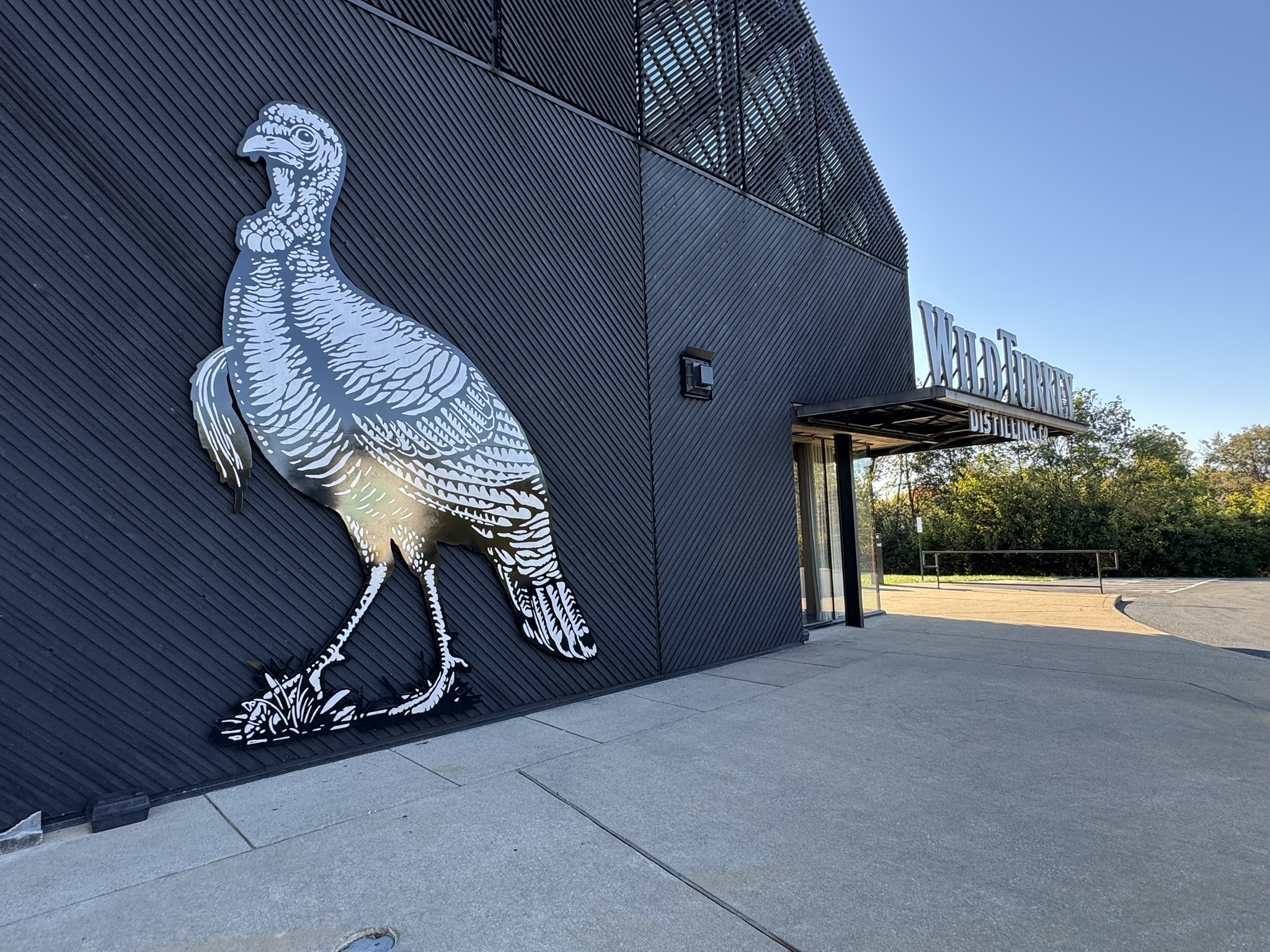
Wild Turkey Distilling Company
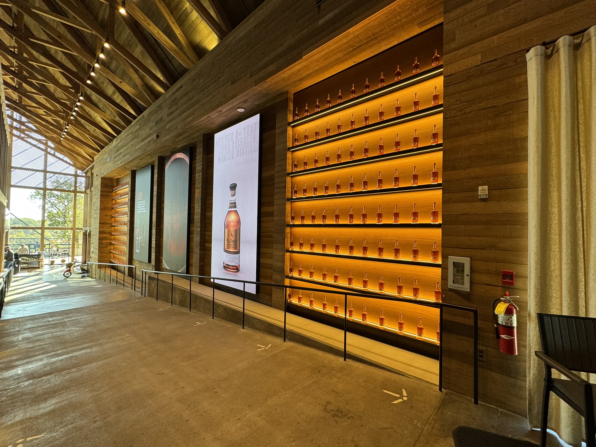
The next morning, we headed out around 9:00 to the Wild Turkey Distillery Visitor Center near Lawrenceburg. The facility was only a few months old and included a wonderful mix of old-style architecture of exposed beams and concrete floors with large video screens featuring the Wild Turkey product line. We were scheduled for a 10:30 tasting flight (yes, I know that’s early to start drinking), which also included a brief but informative history of the distillery, an overview of the master distillers, and some information about the distilling process. With origins going back to the mid-19th century, Wild Turkey bourbon has a short list of long-serving distillers. Jimmy Russell is in his 90s and is still working at Wild Turkey. He is a 60-year whiskey veteran and the longest-tenured active Master Distiller in the global spirits industry. Our presenter and server that morning was middle-age fellow who was entertaining, articulate, and impressively knowledgeable. This program and tasting offered us a perfect way to start our bourbon trail adventure because it served as an introduction to the industry and distilling process. And that first snort at 116 proof could have doubled as a tonsillectomy, although the fine folks in the industry call it the “Kentucky Hug.”
Wild Turkey Distilling CompanyMaker’s Mark DistilleryMaker’s Mark Distillery
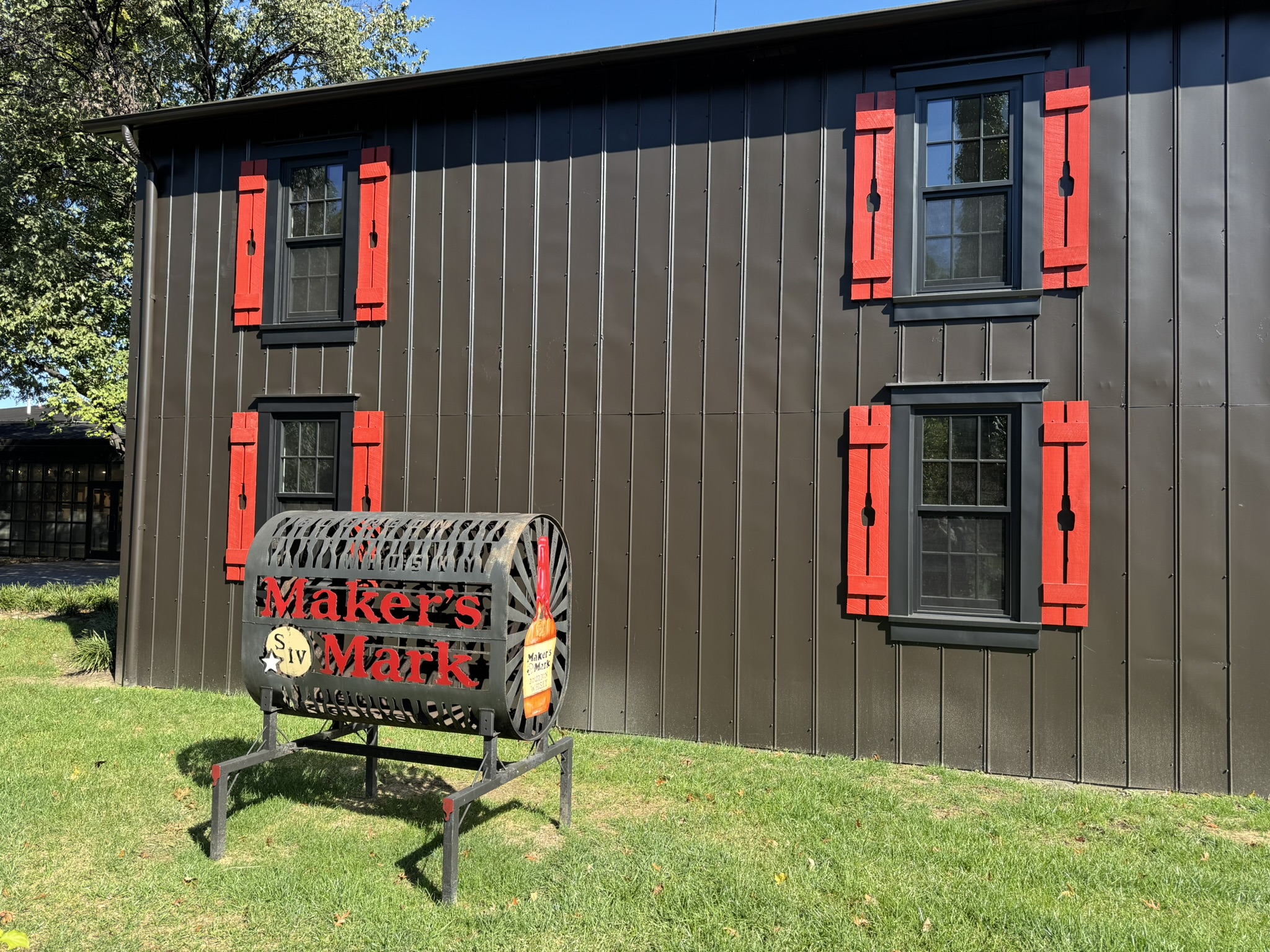
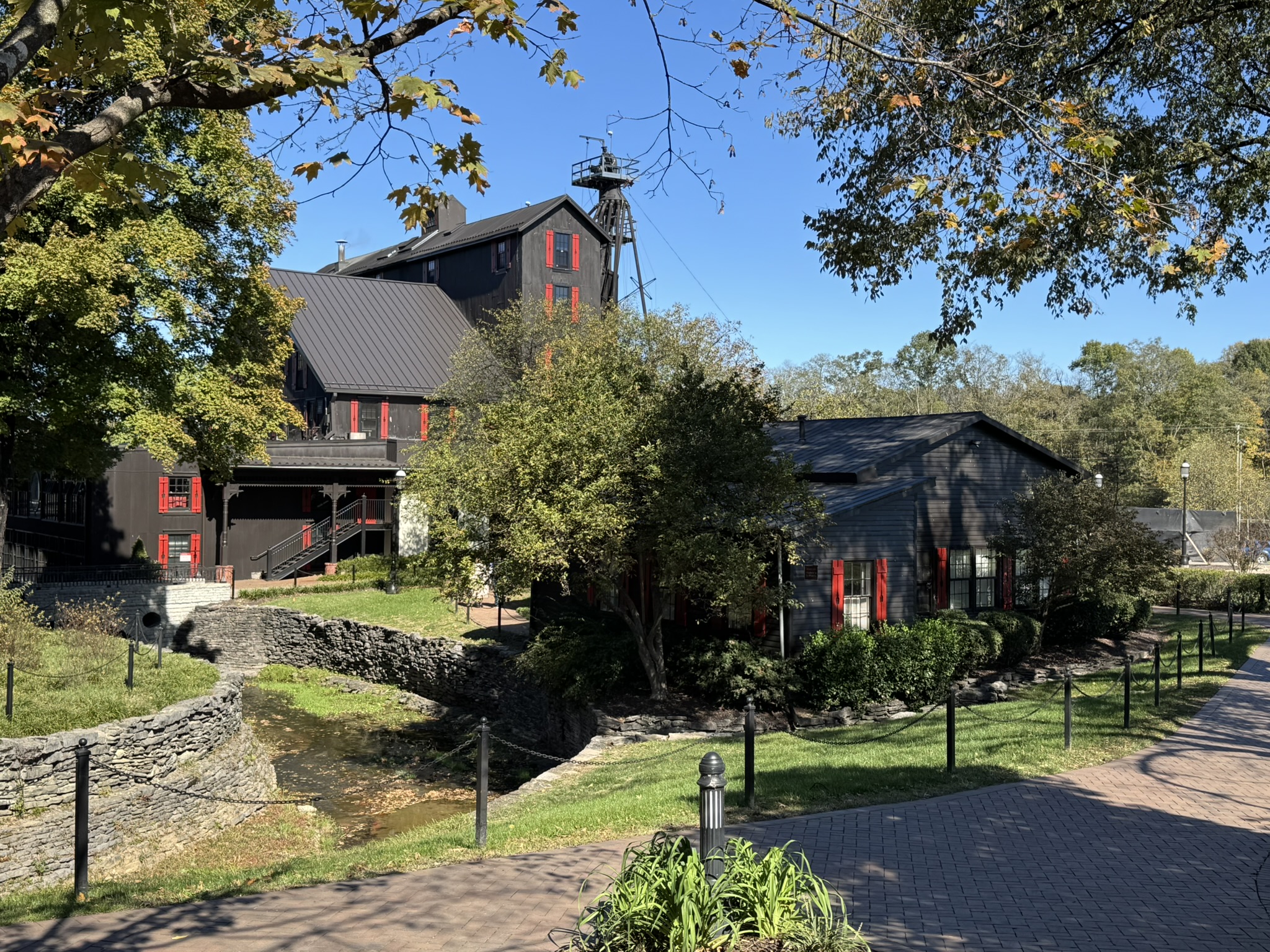
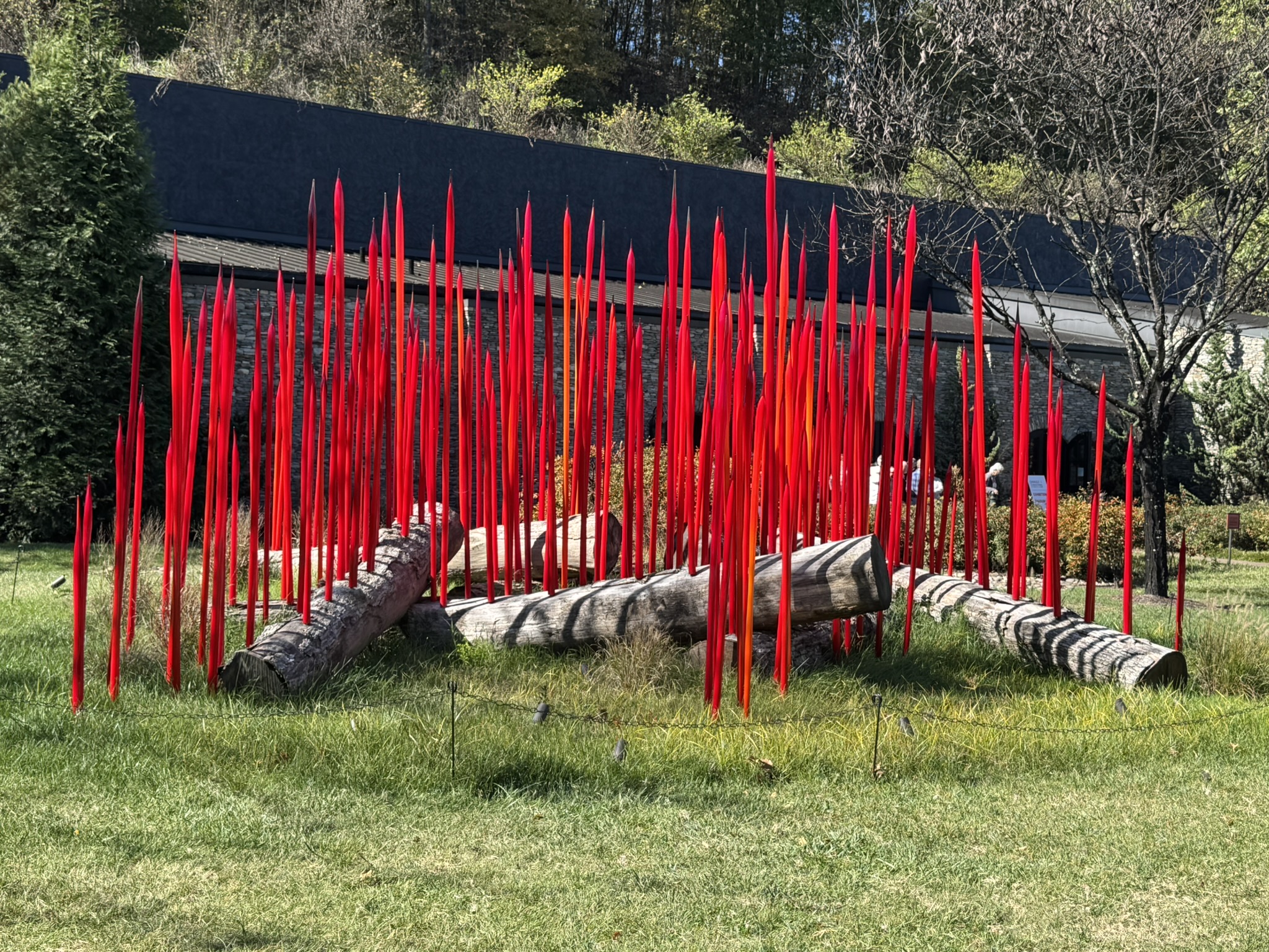
Our next stop was Maker’s Mark Distillery near Loretto. We arrived just in time for lunch at the distillery’s Star Hill farm-to-table restaurant. Before leaving the restaurant, we ordered cocktails to “stroll and sip,” an activity the management encourages because there is plenty to see on the 36-acre campus, including a visitor center, an historic residence, the restaurant, a cellar, an old barrel house, a bottling facility, a gift shop, and much more. The grounds resemble a small village with signage, murals, exhibits, and displays all among the buildings. A major highlight of the site is an indoor and outdoor installation of art by Dale Chihuly whose career in glasswork spans over fifty years. His colorful sculptures have captured the imagination of audiences worldwide.
Maker’s Mark DistilleryMaker’s Mark Distillery
We returned to Louisville for another early dinner at a fun place called Mussel & Burger Bar. Instead of a bourbon cocktail, I went with another one of my whiskey favorites: the Manhattan. I prefer this rye-based drink very cold in a chilled martini glass straight up, and the bartender was happy to indulge me. Our friend ordered a plate of mussels, which I really like, but I was craving a bacon cheeseburger. Our great waiter served it with a heaping helping of “chips” (French fries) in a paper cone nested in a metal cup, much like the Brits do. Dessert was out of the question – no room.
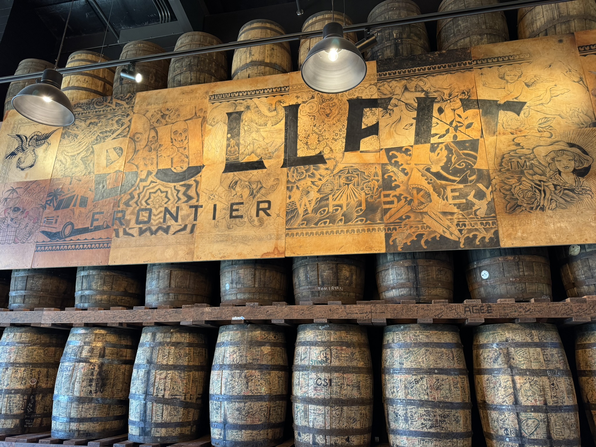
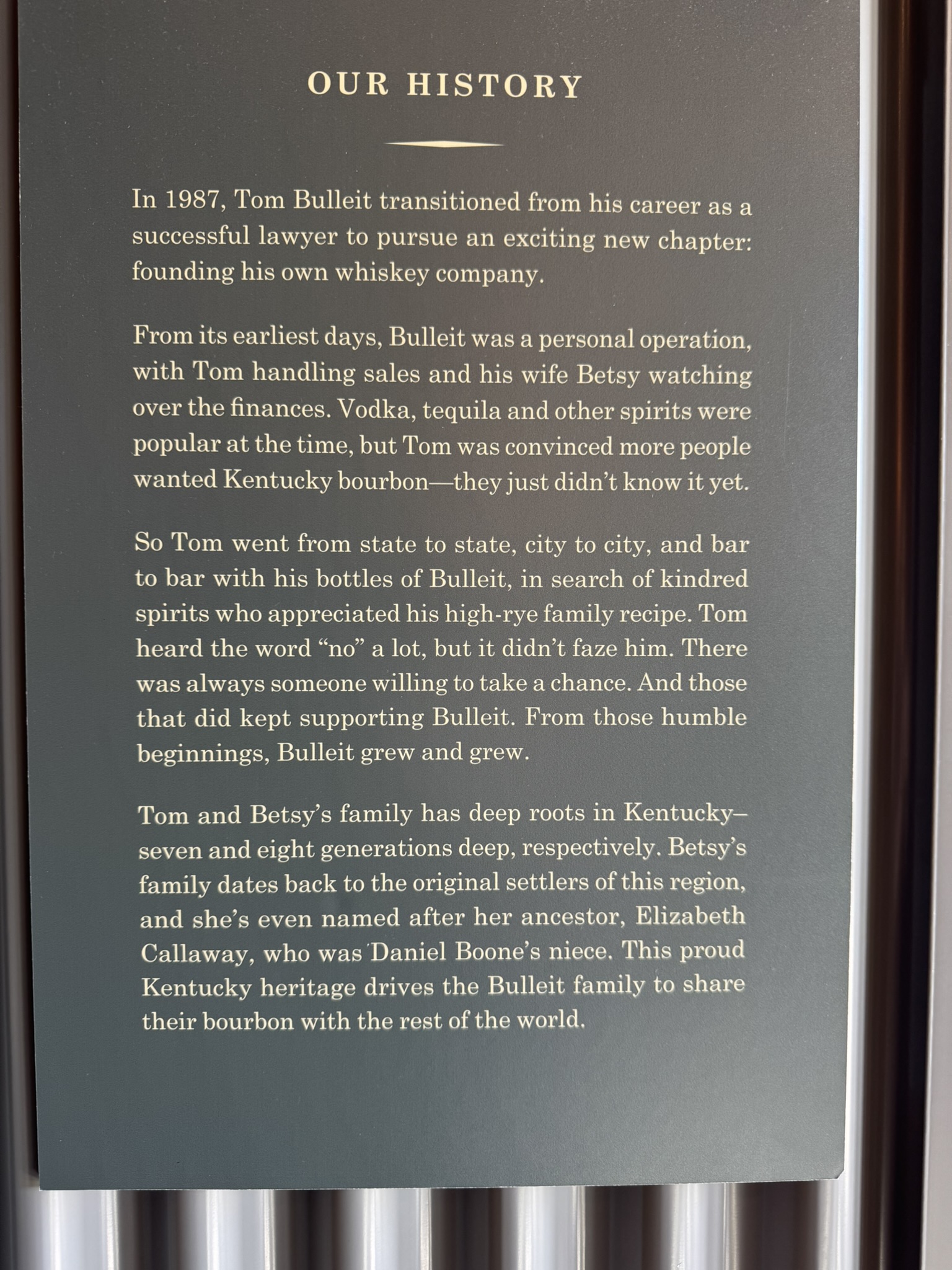
Bulleit Distilling Company
The next morning we headed out to Shelbyville, a quaint town due east of Louisville. After a short stroll up and down Main Street, we ate lunch at McKinley’s Eating Establishment. This charming little deli had delicious sandwiches, salads, soups, and a tempting selection of pastries and cookies. We were highly impressed. Just outside of town was our next Bourbon Trail destination: the Bulleit Distilling Company Visitor Center. My wife had booked us for a program called “Anatomy of a Single-Barrel,” where we were joined by seven other visitors in a private tasting room to sample three different single-barrel bottles and the flagship Bulleit Bourbon. Our guide pointed out the notes of each specific yeast strain and how they contribute to the overall flavor profile. Like our first host at Wild Turkey, this younger man was extremely knowledgeable, energetic, and entertaining. When you sip these whiskeys side-by-side over a short period of only 20 minutes, the nuances and differences become obvious. Our guide facilitated this type of discernment by offering us both palate cleansing (water) and nose cleansing (coffee beans and other fragrance devices) between the samples.
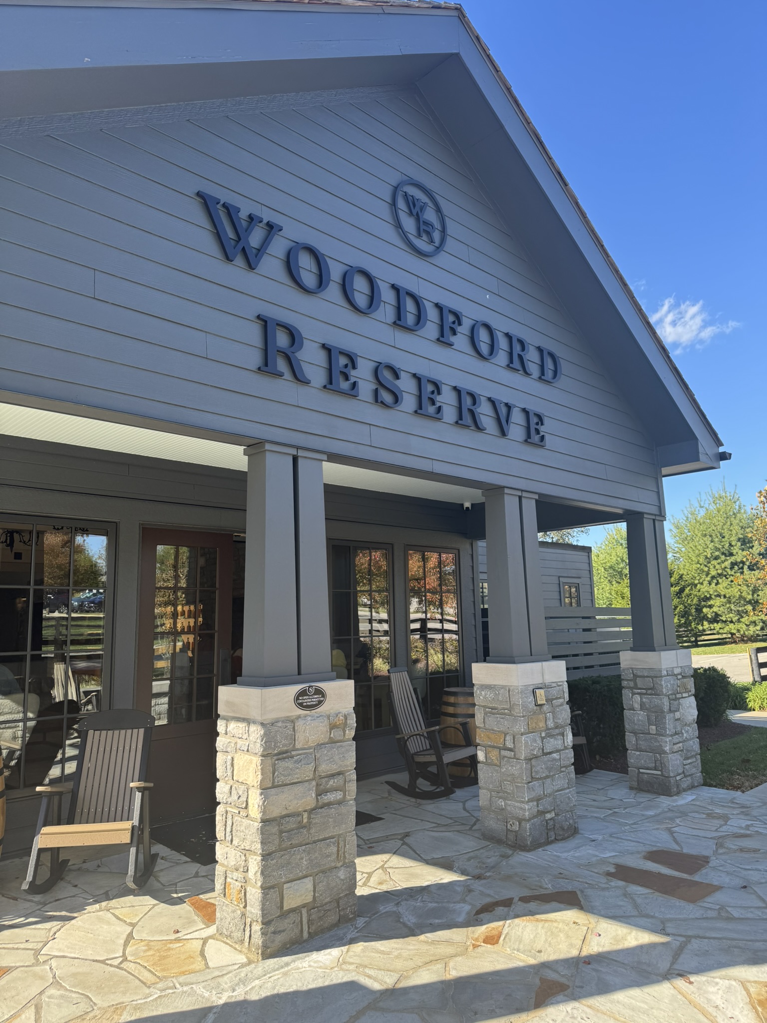
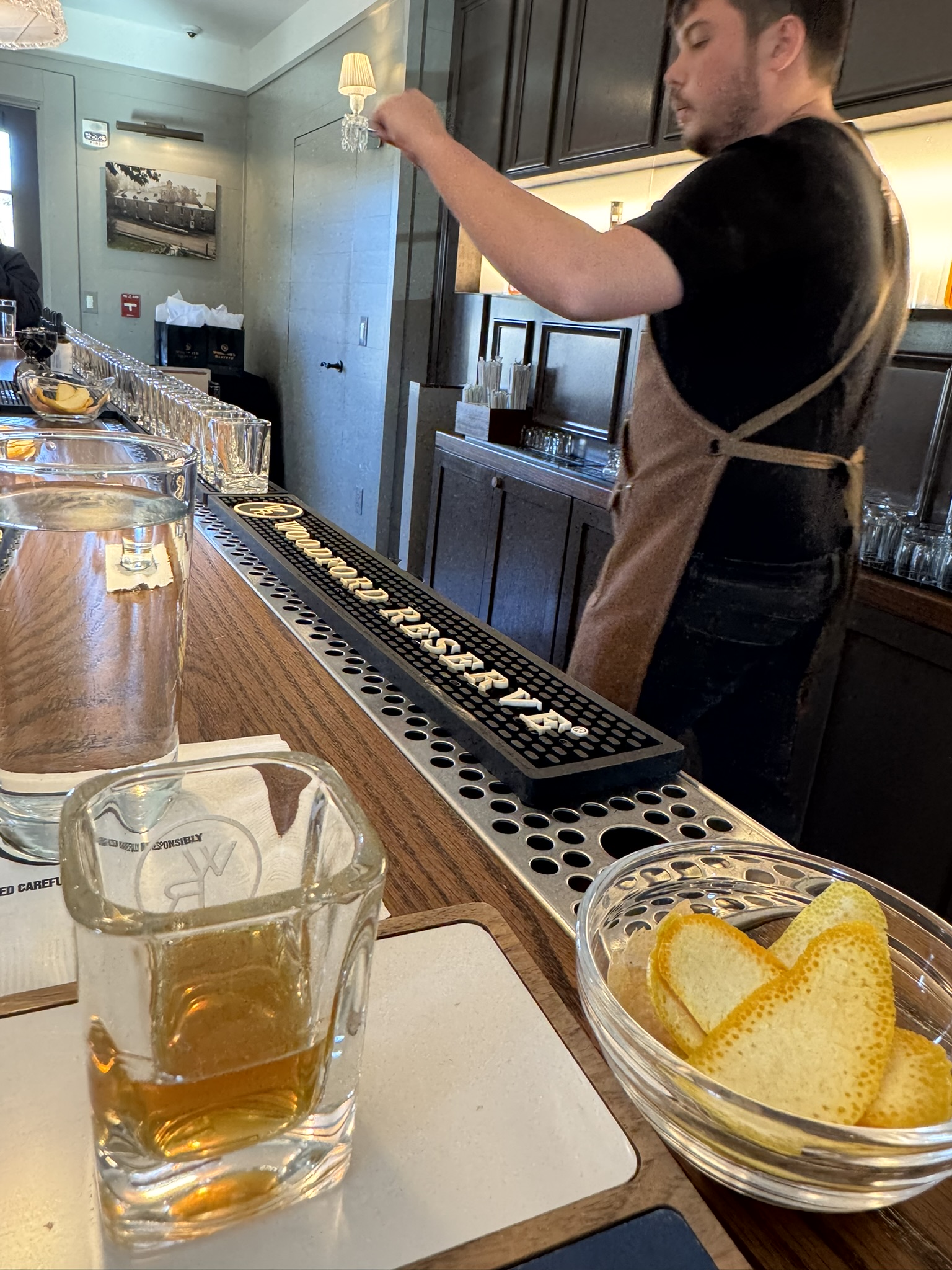
Our final stop on the trail later that afternoon was Woodford Reserve Distillery outside Versailles, which is surrounded by some of the most beautiful horse ranches and equestrian estates I’ve ever seen. After all, Louisville is the home of Churchill Downs. Woodford’s campus stretches out on either side of McCracken Pike, a country road that winds its way through horse country. Much like the Maker’s Mark campus, the Woodford site is composed of a collection of buildings, several of which are open for guided tours. Our group event this time was called “A Classic Mixology Experience.” We were joined by seven other visitors in a modern tasting room at the Gristmill House where a young bartender talked about the history of my cocktail of choice, the old fashioned. The details he shared about how the drink evolved from its origins in the 1880s at the Pendennis Club in Louisville to the variations that bartenders have created over the decades were fascinating. He then proceeded to mix five different versions of the drink, explaining as he prepared each one about the specific contents: whiskeys, sugars and syrups, flavored bitters, and citrus peels (no cherries, which were added later during Prohibition – I asked). He expertly poured each mixture, one after another, into small cube-shaped glasses, and the participants creased and squeezed their respective citrus peels, including orange, lemon, and grapefruit. The audience did not agree on their favorites. As for me, the classic one he mixed at the very beginning was the best. It’s hard to improve on perfection.
To round out our trail excursion, we returned to Louisville that evening for an amazing dinner at Porcini, an Italian restaurant located in the city’s historic Crescent Hill neighborhood. We drank wonderful wine and splurged on some of the best fried calamari I have ever tasted. My entrée was the chef’s special for the evening: pan-seared redfish dressed with cream sauce served with green beans – oh my goodness. Our waiter was a seasoned professional who had been a server at the restaurant twenty years before and had returned. He made our dining experience even more enjoyable. Dinner at Porcini presented us with the perfect opportunity to reflect on our Bourbon Trail trek, a trip I’m sure we will remember for a long time. And of course, we took home treasures and souvenirs from the gift shops of each of the distilleries: magnets, hats, shirts, cocktail glasses, flavored bitters, and bottle openers to name a few. We consider ourselves travelers, but our touristy tendencies are never far away. Cheers!
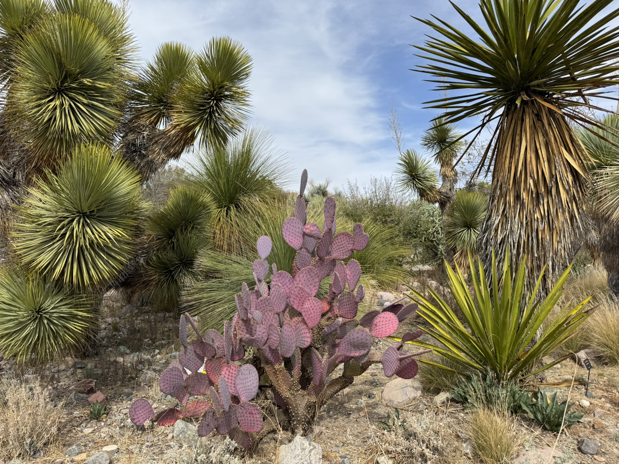
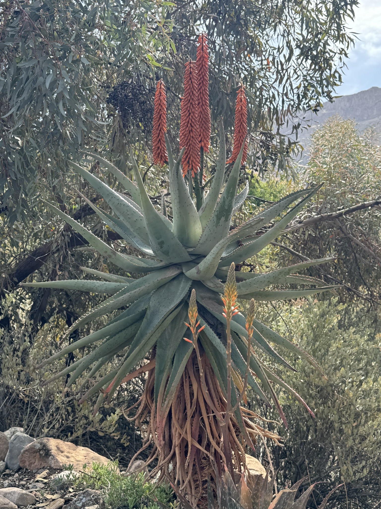
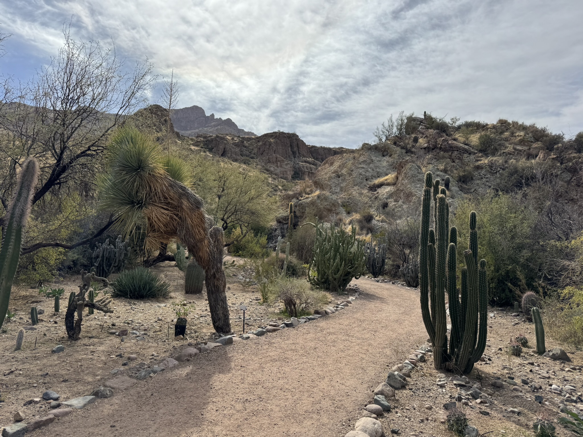
During our annual winter vacation to Arizona for 2025, my wife and I got out of Phoenix for a half day and drove an hour southeast to visit the Boyce Thompson Arboretum. Situated on 372 acres of scenic upland Sonoran Desert, it is Arizona’s oldest and largest botanical garden. The arboretum was founded by William Boyce Thompson, an American engineer, financier, and philanthropist who created his fortune in the mining industry. He built a winter home, the Picket Post House, in the early 1920s overlooking Queen Creek near Superior, Arizona. He then established an arboretum in 1924 on the land surrounding his house. Thompson understood the importance of plants as the ultimate source of our survival and well-being, and even today his appreciation of the power of nature is evident at Boyce Thompson Arboretum State Park.
Boyce Thompson Arboretum, Arizona
The arboretum is the home of desert plant collections from around the world, arranged in clearly defined sections of the park, from the United States, Mexico, Australia, Madagascar, India, China, Japan, Israel, South America, the Middle East, Africa, the Mediterranean, and the Arabian Peninsula. The park contains over 20,000 plants with winding paths leading visitors through trees, shrubs, grasses, cacti, and a cornucopia of flowering species. The signage is just right – not obtrusive but offering plenty of detailed information. The park also includes some beautiful artwork, arbors, shade structures, water features, and benches. There is a lovely gift shop and nice restrooms at the entrance.
Boyce Thompson Arboretum, Arizona
We strolled around the paths and through the various sections of the park, marveling at the incredible diversity of specimens, from tall trees to the tiniest thorny cacti. Most of the plants obviously belong in a desert climate, but some of the trees look like they would be right at home in a city park anywhere in the world. Color abounds, texture is all over the place, and the shades of green seem almost limitless. Everything looked so lush, so alive when we were there. We did notice signs of a drip irrigation system in several areas, which may mean that some of the species require more water than is available in the Sonoran Desert environment. There are even a few endangered species in the park, and plant conservation is a big part of the organization’s mission.
Boyce Thompson Arboretum, Arizona
The drive over to Superior from Phoenix is a pleasant one, with magnificent views of the desert landscape and Superstition Mountains to the north. The park is open most days of the year, with hours of operation changing according to the seasons. They have a great website at https://btarboretum.org/ from which most of the information in this post is gleaned. Arizona is a hiker and cyclist paradise, with thousands of miles of trails throughout the state. Outdoor recreation opportunities are almost endless. I would include the Boyce Thompson Arboretum in the long list of places where visitors can enjoy the beauty of nature in a confined space, where the physical challenge isn’t so great, but the rewards are substantial.
The last day was November 13, 2024. The thought of it filled me with excitement, relief, happiness, and maybe just a hint of anxiety. I have contemplated this date for decades but only gave it serious thought during the last five years or so. I have been preparing for this moment over a good portion of my adult life. My ideas about how it would look and the impact it would have on me have changed over the years. I’m extremely grateful to be reaching such a pivotal point in my life, and I am even more thankful that I got to celebrate the occasion with my spouse/best friend. November 13, 2024, was the day my professional career ended, and retirement began.
time clock (source: Wikimedia Commons)
My wife retired earlier in 2024, and although I cut back to halftime hours for my final year, I still went to work several days a week, every week. The thought of never again having to drag out of bed at dawn, down a cup of coffee, grab a bite to eat, shower, shave, get dressed, and head out the door for work is just lovely, if not a bit scary. No work means no paycheck. Yes, like many Americans we will have sources of retirement income, including social security. No, it’s not the same as a regular earned paycheck, which is more a difference in the mind than the wallet. For many people, retirement is a huge shift in thinking and practice; in short, we transition from spending and saving what we are earning to spending what we saved, either on our own or through our employers and/or the government. It takes some getting used to for most of us, I suspect.
The joys of being retired are slowly revealing themselves with each passing week. The stress that comes from adhering to a daily schedule and meeting deadlines pretty much disappeared on day one. The luxury of rarely setting an alarm for waking in the morning is heaven, although I still tend to wake up between 5:30 and 6:30 a.m., although there have been a few mornings I have slept past 8:00, especially in a hotel with blackout curtains. Retirement offers so many scheduling options, such as traveling and vacationing on whatever days of the week that works best for our planned activities, assuming we have set plans. Sometimes we just get a whim and go off on an adventure, which is so liberating and fun. We can book flights now based on the optimum prices, availability, airline, time of year, and choice of destination, rather than how we can fit air travel into a work week.
Money can buy so many things, but the most precious commodity we cannot purchase for any amount of cash is more time. However, retirement puts more of the time we have back in our hands to do with as we please. I love to read, and during the years I was working, I typically would get up early enough to spend at least 30 minutes to an hour reading with my first cup of coffee. Reading at night has never been a good option for me because I tend to lose attention and retention after dinner. Now, I can read for hours on end at almost any time of the day that works for me, which is heavenly. I am also devoting more time to reading online subscriptions to newspapers like the New York Times and Wall Street Journal. One slight downside of not driving back and forth to work each day is less time spent listening to audiobooks, so I will need to carve out time each week for that relaxing and engaging activity too.
pocket watch (source: Wikimedia Commons)
I have been an amateur musician for over fifty years, and another huge benefit to retirement is the amount of time devoted to learning new music, improving my skills, and performing more often. I am even spending an hour each week working with a friend and gifted guitar player who is expanding my knowledge and abilities on that instrument. I also have more opportunities now to sit down for blocks of time to work on the keyboard, learning new songs and getting better at playing in general. I am hoping that retirement will free up more time for songwriting too. Being able to sleep in also means I can stay out later to participate in open mic and jam sessions around town or take in live music shows in the area. My wife and I love going out in the evenings to live music shows.
Another benefit that is more related to our ages than retirement specifically is our eligibility for Medicare, the federal government’s medical insurance program for people age 65 and over. We will save a bundle on premiums and on most medical services and procedures in the coming years, which will free up more money for travel and the many other interests we have. I am baffled by people who tell me that retirement did not meet up to their expectations. Some of them even went back to work. I suppose there are retirees out there who fill up their days watching hours and hours of television. Yes, we do watch television, but mostly we watch sports programming (Go CHIEFS!!!) and a few series now and again. We also love the idea that we can now catch matinee movies at the cinemas during the week and get better deals on admission and concessions. Speaking of discounts, we have become much more aware of lower prices for seniors at restaurants, grocery stores, and other retailers. Those savings really add up over time.
Admittedly, I have become quite obnoxious about the freedom retirement affords. When I’m shopping for seed at our local Wild Birds Unlimited store around mid-day, I often look around at some of the other shoppers and think, “Damn, I bet you’re here on your lunch break, aren’t you?” Or if I’m driving around town mid-morning and the traffic is heavy, I find myself saying out loud in my car, “Why aren’t all you people at work?” I know, I know. I’m a terribly smug person. Eventually I’ll settle in to this wonderful rhythm of retired life, and in so doing, perhaps I will become a bit more humble and gracious. But for now, let me rub it in just a tiny bit.
My wife and I took a brief trip to Cleveland, Ohio in August, 2024. We had hoped to do so in 2020 while my wife was working temporarily in Fort Wayne, Indiana, when I could fly in, and we could then drive over to Cleveland. But the world shut down when COVID struck. We both love rock music, and as an amateur rock and pop musician, I was interested in visiting one of the top destinations the city has to offer: the Rock & Roll Hall of Fame. However, we both agreed that we would need more than a single objective to justify flying from our home in Springfield, Missouri, through O’Hare airport in Chicago, and then on to Cleveland. We found one. We discovered that one of our favorite bands, Hootie and the Blowfish, was touring in 2024 and that Cleveland was one of their stops. They were going to be playing at the magnificent Blossom Music Center in Cuyahoga Falls, Ohio, about 20 minutes south of Cleveland. We had a twofer and were good to go!
Neither one of us knew much about Cleveland and didn’t have high expectations beyond what we planned to do while in the city. We were pleasantly surprised. Situated on the southwestern shore of Lake Erie, Cleveland is taking advantage of tourism with great parks and beaches right on the water. The views are breathtaking. With a scenic skyline, good hotels and restaurants, stadiums, arenas, and several major attractions, Cleveland really is a place to explore. The city claims to be the birthplace of Rock & Roll music, primarily because radio station WJW disc jockey Alan Freed coined the phrase “Rock & Roll” to describe the upbeat black rhythm and blues music he was playing in 1951. Of course, the Rock & Roll Hall of Fame was ground zero for us, and it also exceeded our expectations.
Rock & Roll Hall of Fame, Cleveland, OH
The building is a modern structure with a huge glass atrium at the entrance. It has six levels beginning on the entrance floor, but the tour starts one level below with the Ahmet Ertegun Main Exhibit Hall, which carries visitors from rock’s earliest stars to those newly emerging contemporary musicians. There are thousands of items on display, along with feature films, videos, interactive kiosks, reading material, and plenty of music. This exhibit has the museums largest displays devoted to single artists, bands, subgenres, and movements of Rock & Roll history and the industry: Revolutionary Women in History, Hip Hop, Roots of Rock, Pioneers of Rock, Sun Records, Cities & Sounds, the music of Cleveland and the Midwest, and so much more.
Rock & Roll Hall of Fame, Cleveland, OH
Level 1 has a ticket booth, a café, large museum store, and the Klipsch Stage where performances are scheduled throughout the year. Level 2 is called “The Garage” where visitors can sign up to play various instruments with or without a house band in a setting that looks very much like a real garage. I played an electric guitar (something I never do) and sang “Midnight Rider” by the Allman Brothers Band with the help of a house drummer and a bass player, who also sang harmony with me. Although it wasn’t my best performance of that song, it was still fun to play in such an iconic venue. This level also has a large collection of different types of instruments and sound booths for visitors to jam on their own. The Les Paul exhibit is on this floor too, paying homage to the American jazz, country, and blues guitarist, songwriter, luthier, and inventor. He was one of the pioneers of the solid-body electric guitar, and his prototype served as inspiration for the Gibson Les Paul guitar.
Level 3 is focused almost completely on the Hall of Fame inductees, with the Inductee Signature Gallery, New Inductee exhibit, and the Connor Theater featuring the Power of Rock Experience. Visitors can look through alphabetic lists of inductees and a large chronological display of the all the inductees going back to the Hall of Fame’s inception in 1986. This floor also has the New Inductee and the In Memoriam exhibits. The Connor Theater is on this floor, where visitors can watch a 15-minutes video highlighting the Hall of Fame induction nights from the past.
Level 4 features the Pink Floyd tour replica of The Wall, designed to mirror the Berlin performance in July 21, 1990. This level is also the location of the Foster Theater, which is used for onsite education programs or private rentals. The theater has hosted hundreds of rock star talks and legendary rock films over the years. Level 5, along with some of the ramps in the museum, has individual display cases devoted to the legends of Rock & Roll, from the Bee Gees and the Doobie Brothers to Public Enemy to Tom Petty.
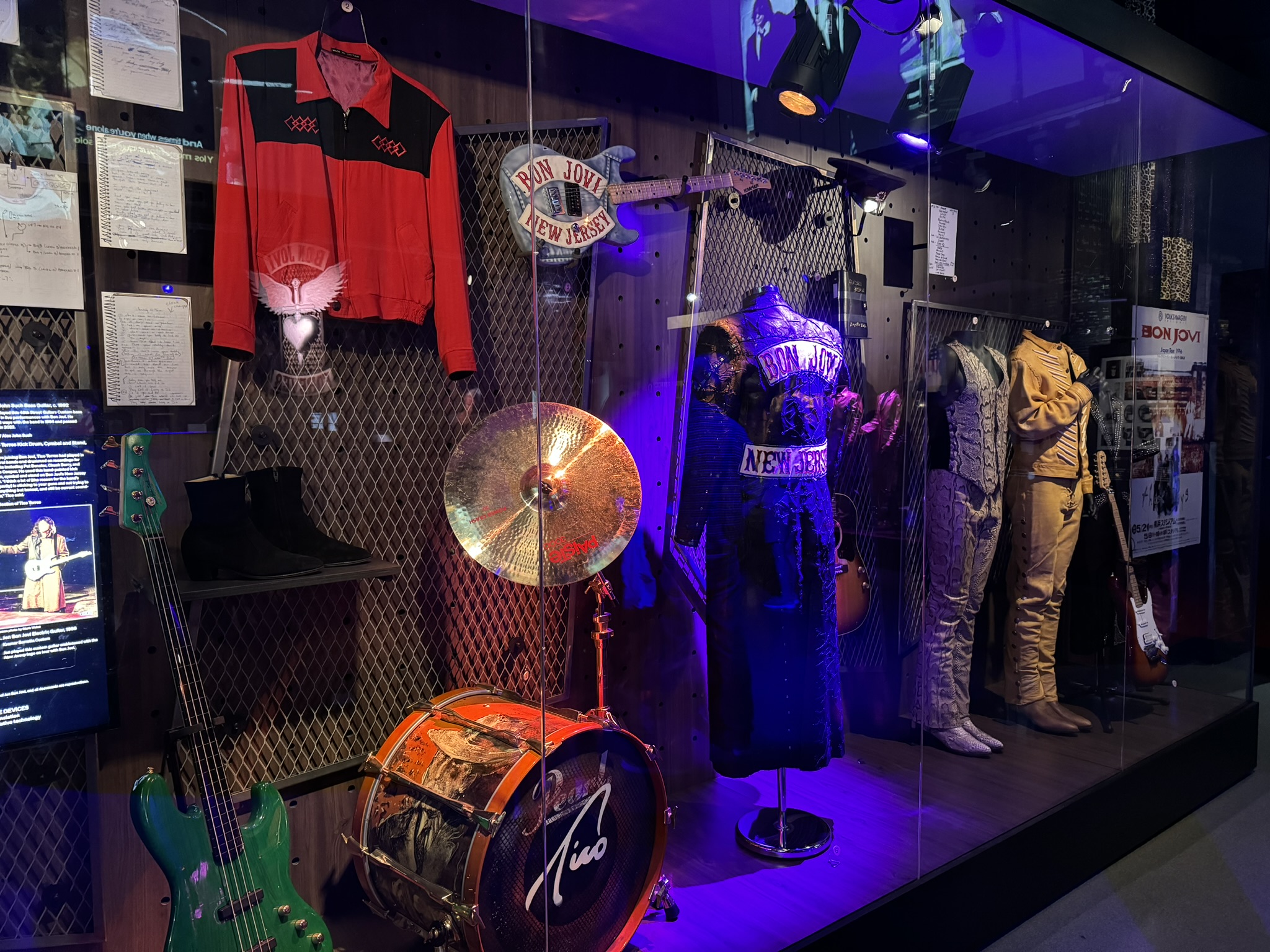
Level 6 is devoted to an exclusive exhibit that Bon Jovi unveiled with the museum in 2018. This full-floor showcase spans four decades of the band’s career along with never-before-seen artifacts from each of the band members. Visitors are immersed in the band’s story and music from inception to the present. Huge video presentations are joined by text panels and display cases filled with musical instruments, clothing, and loads of memorabilia from the band.
Rock & Roll Hall of Fame, Cleveland, OH
Organizations like the Rock & Roll Hall of Fame that establish themselves as authorities of a particular subject area all have one thing in common. They always stir up controversy, mostly about who or what is included, but more contentiously, excluded from their lists. This museum obviously recognizes this dilemma and even seeks to address it by allowing visitors to submit names of performers or bands they think should be inducted into the Hall of Fame. Many writers over the years have discussed this topic, and some of them have challenged the Hall of Fame on its choices of inductees through the decades. One of the most ironic exclusions is Huey Lewis and the News, the band that had a major hit with “The Heart of Rock & Roll,” which actually mentions Cleveland at the very end of the song!
Rock & Roll Hall of Fame, Cleveland, OH
I certainly had my share of questions come to mind as we strolled through each level of the museum. I was disappointed to see how much more space and almost reverential attention was given to Elvis Presley on one wall, while on the opposite wall a smaller display featured Chuck Berry, often considered the Father of Rock & Roll. I think those two positions should have been swapped. One of my favorite wall displays was for Jimi Hendrix, probably the greatest guitarist in rock history. I was baffled to learn that bands with place names such as Chicago were inducted fairly late in the game and that the bands Kansas and Boston still haven’t made it. At the same time, I was delighted to see so much attention given to Wanda Jackson, an Oklahoma native who got her start on ABC Television’s “Ozark Jubilee” broadcast out of Springfield, Missouri from 1955 to 1960. She later became known as the Queen of Rockabilly, a title she still holds to this day. As of this post date, she is still with us.
Rock & Roll Hall of Fame, Cleveland, OH
We were able to pack a lot in just two full days while still having some down time walking along the shore of Lake Erie, enjoying some great meals and drinks, and exploring the public spaces on the water around the Hall of Fame. On top of all that, we were lucky enough to catch Hootie and the Blowfish back together again for a national tour. Oh, and their opening acts were Edwin McClain and Collective Soul. For people who love rock music, it just doesn’t get much better than our quick trip to Cleveland.
Hootie and the Blowfish at Blossom Music Center (Ohio)
“You will always find an answer in the sound of water.” –Zhuang Zhou, Chinese Taoist philosopher
The ancient Chinese master may have been a tad optimistic with this simple maxim, but from my personal experience, he wasn’t too far off the mark. For as long as I can remember, I have been drawn to water: the coast, waterfalls, lakes, ponds, rivers, and streams. Stationary water has its charm, but running water really seduces me. Even fabricated water sources like garden ponds and public fountains exert a gravitational pull on me. I photograph or video record flowing water. If I have the spare time and a place to sit nearby, I will pause as long as possible to watch and listen to the soothing sounds of rocky cascades and bubbling brooks. I am equally overwhelmed by the display of power and the deafening roar of huge or towering waterfalls. I have written about these experiences frequently in this blog.
Missouri Botanical Garden
As much as I have enjoyed exploring nature trails over many decades, I must admit that a major incentive to lather up with insect repellent, pull up ankle boots, and strike out with a hiking pole in each hand is to find some source of flowing water. I also look for it at botanical gardens, arboretums, conservation centers, and even at city parks and plazas. The sound beckons me. When I am within ear shot of it, I can immediately feel a sense of serenity. I am connected to the natural world most intensely in those moments. It is impossible to capture or recreate this encounter with audio, photo, or video recording equipment. The results are only a reminder, not a replication. Nevertheless, I offer here some of my favorite photos of rushing water, or at least water in motion.
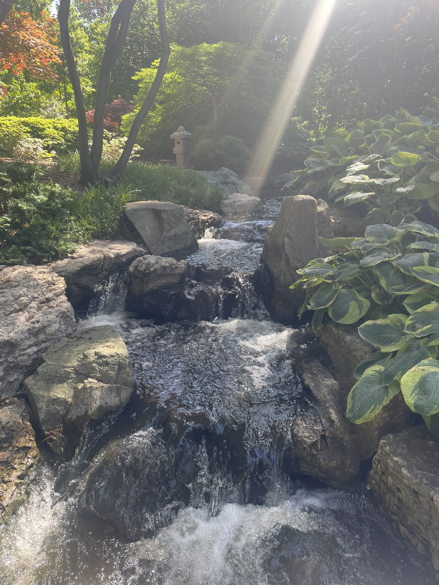
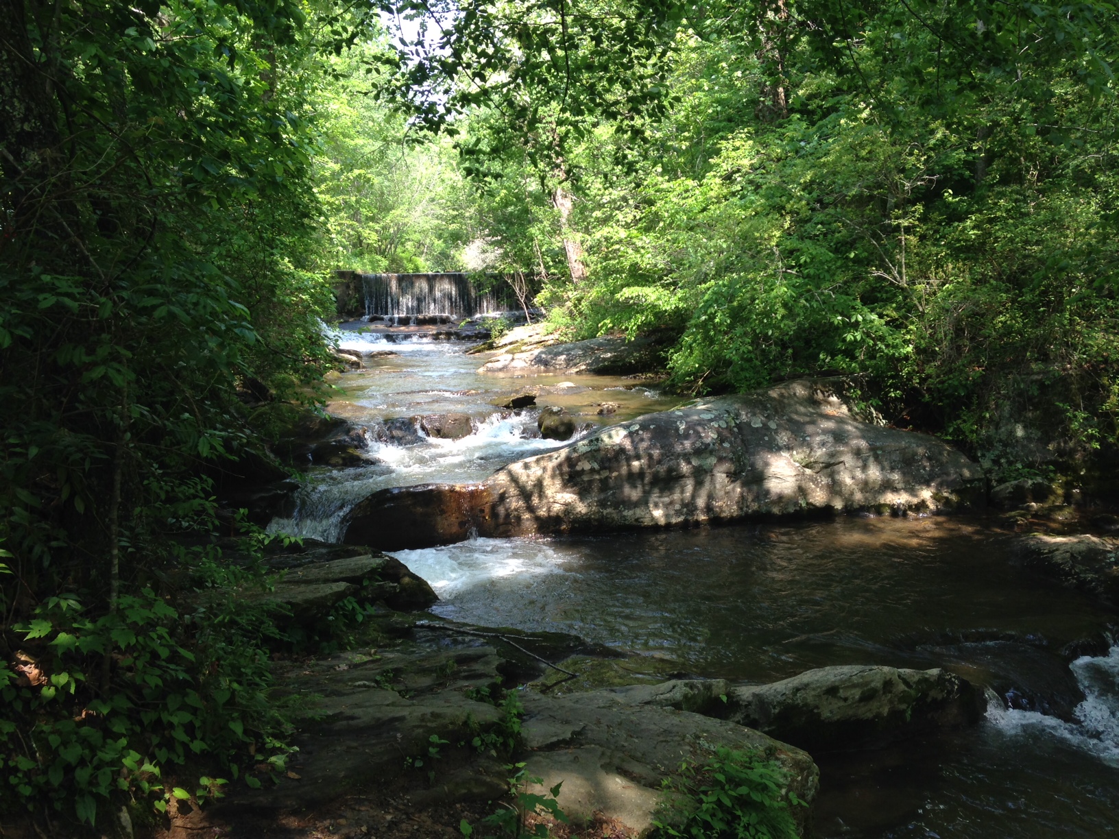
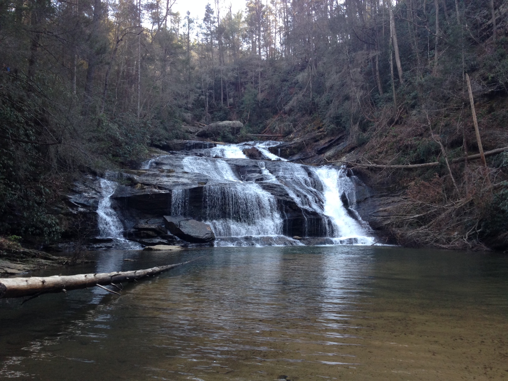
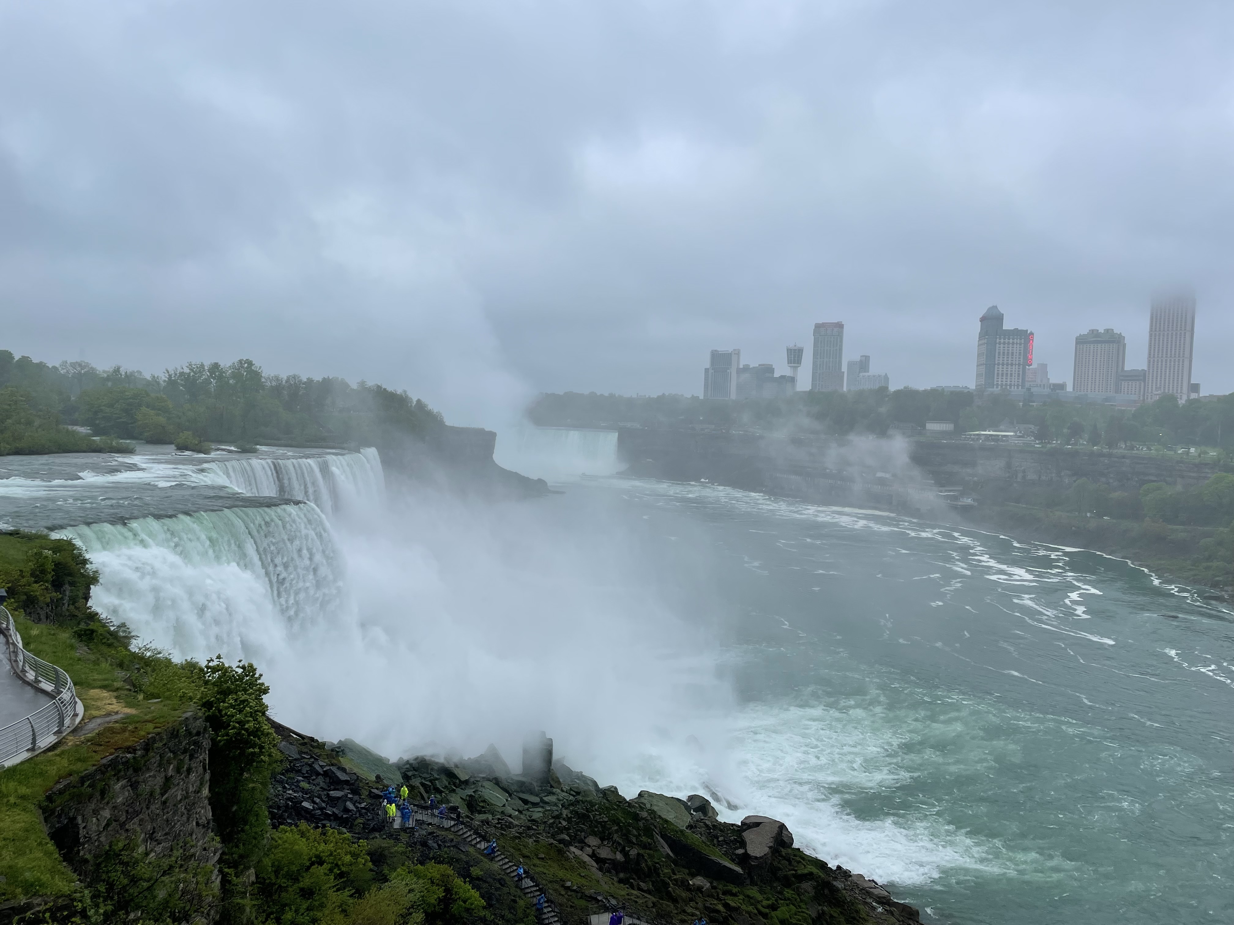
Moccasin Creek, Rabun County, GAPanther Creek Falls, Habersham County, GANiagara Falls, NYDogwood Canyon Nature Park, Missouri OzarksYosemite National ParkYellowstone National Park
My wife and I are at a point in our careers where we are mostly working because we want to and not out of absolute necessity. We have not reached the age to be eligible for full social security and Medicare, but we’re close. Yes, continuing to work makes sense given how the average life span of Americans has increased for our generation. We all must consider how long we will depend on social security, pensions, retirement savings, investments, and other assets. However, we want to spend fewer hours in the office and more time with each other involved in activities that are rewarding, fulfilling, and fun! So, we have pulled back to part time status and consulting gigs as a way to make this happen. A term we heard a few years back that adequately describes this stage in our lives is “work optional.” We like it.
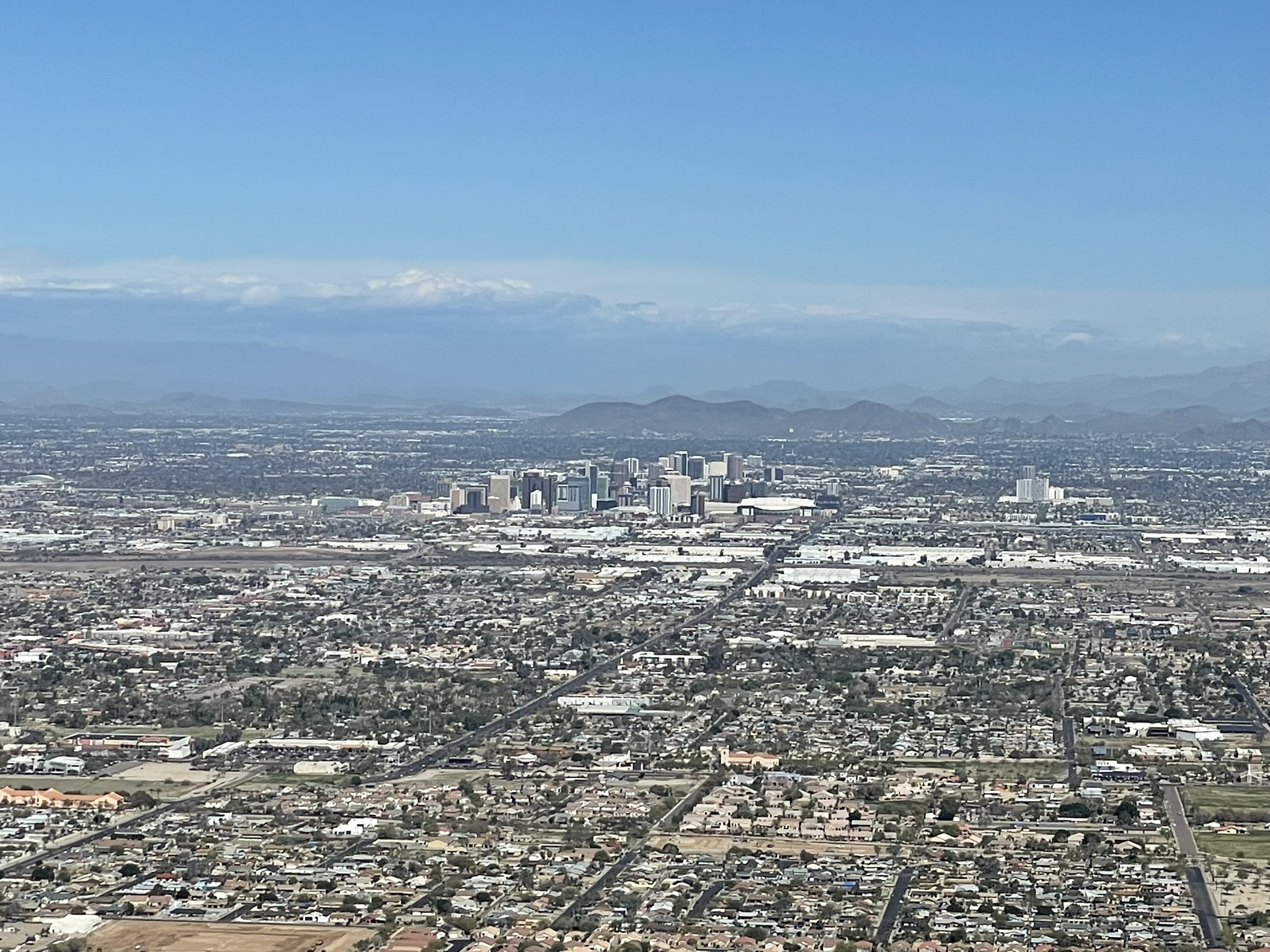
View of Phoenix, AZ, from South Mountain
I have written in previous posts about several of our trips to Arizona, specifically the Phoenix area, which is where my wife lived for nineteen years of her adult life. She built relationships there that she has maintained over the years, and now, I consider her friends in Arizona my friends as well. They certainly make me feel welcome and embrace me as a life partner to someone they obviously adore. As we made our way through the last quarter of our professional lives, we often dreamed about spending several weeks a year in Arizona, a place that still feels like home to my wife and one that has enchanted me since the first time I felt that soft desert air and radiant sunshine. Starting this year, we took the plunge. We loaded up the car and drove 1,253 miles from our home in Springfield, Missouri to Phoenix, stopping for overnight stays in Amarillo, Texas and Gallup, New Mexico. It was a comfortable pace, and driving allowed us to see the countryside as we made our way through Oklahoma, the Texas Panhandle, New Mexico, and into Arizona. We also made good use of the hours together in the car planning future trips and dreaming about how our days might look once we fully retire.
Camelback Mountain, Phoenix, AZTrails at Dreamy Draw Park, Phoenix, AZ
We intentionally designed this first extended stay in Arizona to be a time of relaxation and restoration, but we ended up fitting in some great side trips and fun excursions around the greater Phoenix area. The location of the house we rented was convenient and close to shopping, restaurants, grocery stores, and hiking trails in the city (and there are plenty). The house was within a few blocks of the base of Camelback Mountain, one of the most recognizable landmarks in the Phoenix valley. We found some fine restaurants, not so much high-end but such good food. We scoped out several different venues that support live music and host open mic nights, and I played at three of those locations. It was a blast. Of course, we entertained ourselves with reading, going to movies, walking, and just being together. Most importantly, we were able to spend quality time with close friends and their families, some of whom we saw several times while we were there. We even went to a youth community theater production with close friends whose daughter was working backstage – it was wonderful.
The following photos illustrate some of the highlights of our time in Arizona this year. We have trips planned to several different locations, domestic and foreign, over the next eighteen months, and we look forward to many more extended vacations in Arizona in the years ahead.
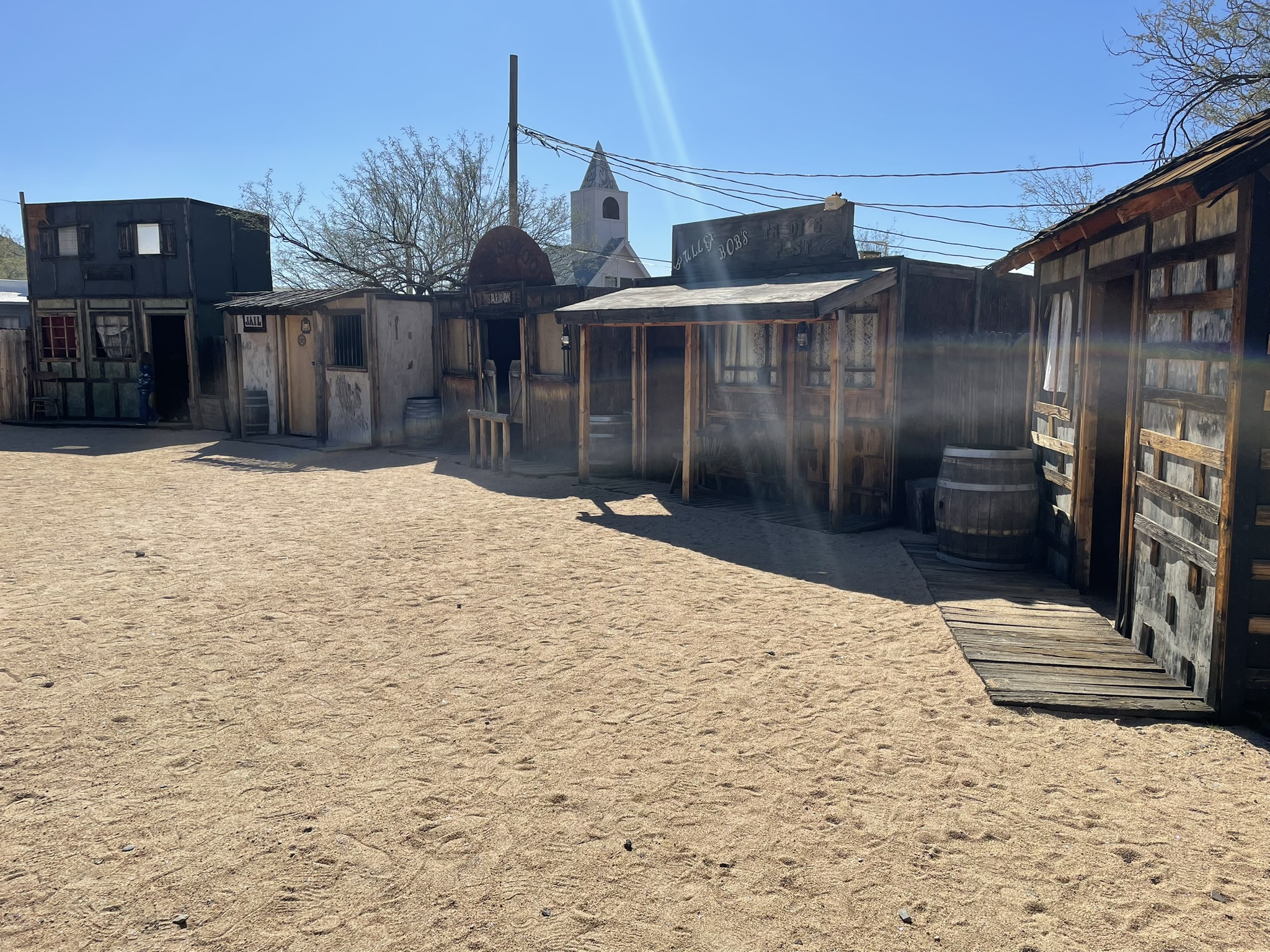
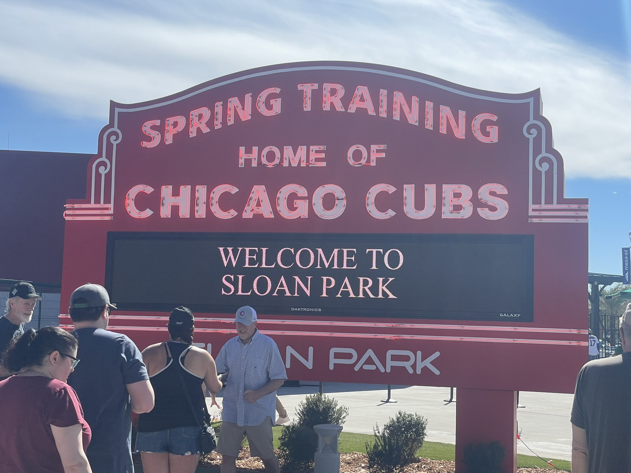
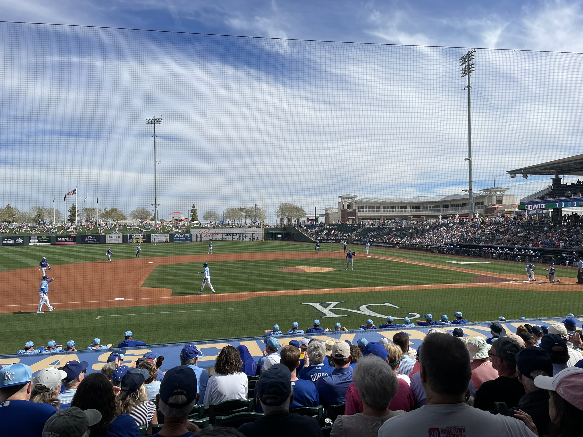
Annexus Pro-Am Phoenix Open in Scottsdale, AZFrontier Town at Cave Creek, AZMusical Instrument Museum, Phoenix, AZChicago Cubs Spring Training at Sloan Park in Mesa, AZKansas City Royals Spring Training in Surprise, AZCattle ranch near Prescott, AZ
On several occasions I have written about my strong attraction to the coast, how it grounds me and is so good for my soul. My first love in this regard was the Atlantic along the coasts of Florida, Georgia, and the Carolinas, simply because I was raised in the Southeast. Places such as Myrtle Beach, Isle of Palms, Hilton Head, Tybee Island, St. Simons, Jekyll, Sapelo Island, Amelia Island, St. Augustine, Ormond, and Daytona are all popular vacation destinations. I have fond memories from summer and early fall trips to all these locations, from within the last few years and going all the way back to my childhood.
In the last decade or so I have had several opportunities to visit the west coast in San Diego, Huntington Beach, Los Angeles, Laguna Beach, Carmel-by-the-Sea, San Francisco, and multiple locations in northern Oregon. It’s a completely different experience from the Atlantic, but no less enjoyable and with some spectacular landscape features you don’t see in Florida or Georgia.
Growing up, my family sometimes went to beaches along the Gulf Coast, and I even went there with friends in college, places such as Panama City Beach and Clearwater. However, I never found the Gulf Coast beaches as attractive as the Atlantic ones. The waves were usually much smaller, and the beaches were not as wide, both of which were important because I typically spent my days as a child and a young man either body surfing in the breakers or baking my skin on the sand. The atmosphere was probably thicker and provided more protection back in the day, and my skin was much more resilient to the sun’s rays. I tanned well and rarely burned much. Those days are over, even for this generation’s youngsters.
Living in the great state of Missouri now, a quick trip to the Gulf is much more manageable, even when flying. We have short direct flights that get us close to multiple Gulf beaches. We tried out Galveston in Texas a few years back, and I was pleasantly surprised how great it was experiencing the beach from the deck chairs at the house we rented with family and friends. Come to think of it, when we took a pre-Christmas holiday trip to Jamaica in 2015, we spent very little time out on the beach but certainly feasted on the views from the expansive balcony of our hotel room.
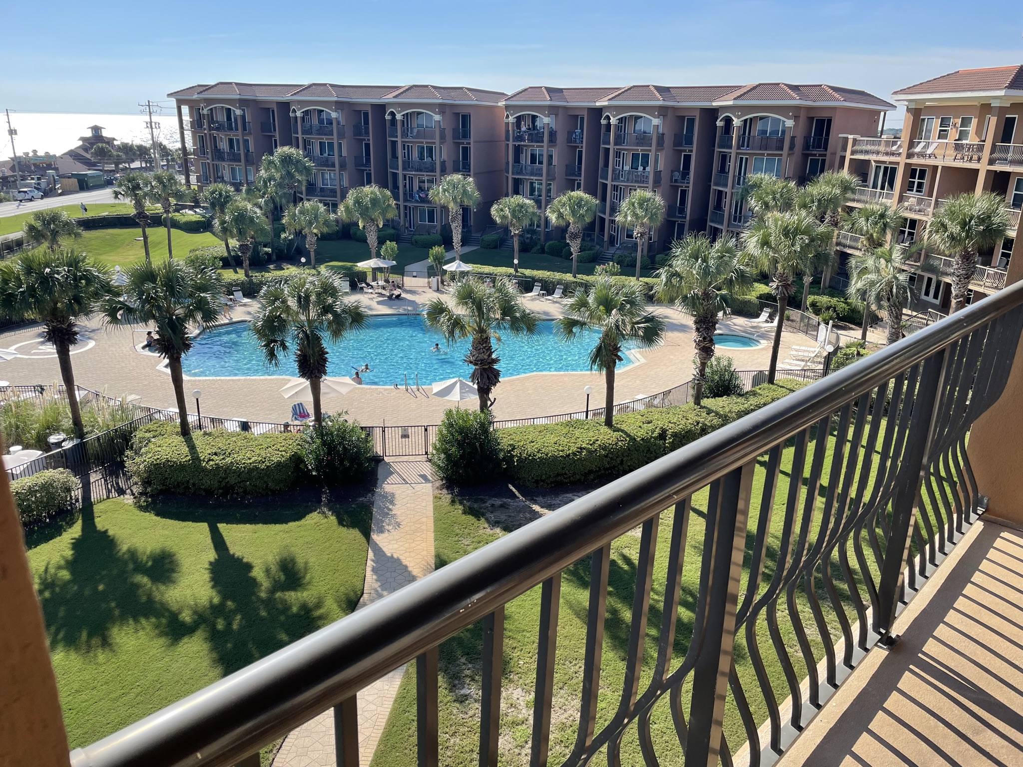
One place I had never seen was the stretch of the Gulf known as the Emerald Coast that lies west of Panama City and covers about 100 miles of seashore featuring destinations such as Navarre Beach, Fort Walton Beach, Destin, and Miramar Beach. My wife and I were in Destin for a memorial service in February of 2023, and while we were there, we took a few walks out on the beaches. The contrast of the brilliant white sand against the blue-green water makes for a breathtaking vista that goes on forever. It is magnificent.
Miramar Beach, FL
When I planned a solo trip for September this year, I decided to give the Emerald Coast a try. My wife, who also graciously serves as our ever-resourceful travel planner, was kind enough to book my flight, rent a car for me, and reserve a fourth-floor condo unit at a lovely complex just across the road from the beach called the Mediterranea. It was conveniently located to restaurants, bars, coffee shops, and retailers, many within walking distance. It was a perfect getaway. I was able to take long strolls on the white sand and on paved walkways just across the street. Although I didn’t take advantage of it, the pool was beautiful and added to the overall aesthetic. The view from the balcony was easy on my eyes whenever I looked up from the book I spent so much time reading while smelling the salty air and feeling the constant breeze on my skin.
Mediterranea at Miramar Beach, FL
It’s a good idea to break away from traditions and time-worn habits to explore other possibilities, especially when traveling. We have discovered all kinds of unexpected adventures and curiosities by going in new directions. I am certain we will return to the Emerald Coast, but there are so many other beaches to see, trails to walk, and sights to behold. As we approach the “work optional” stage of our lives, we plan to spend a whole lot more time doing just that.