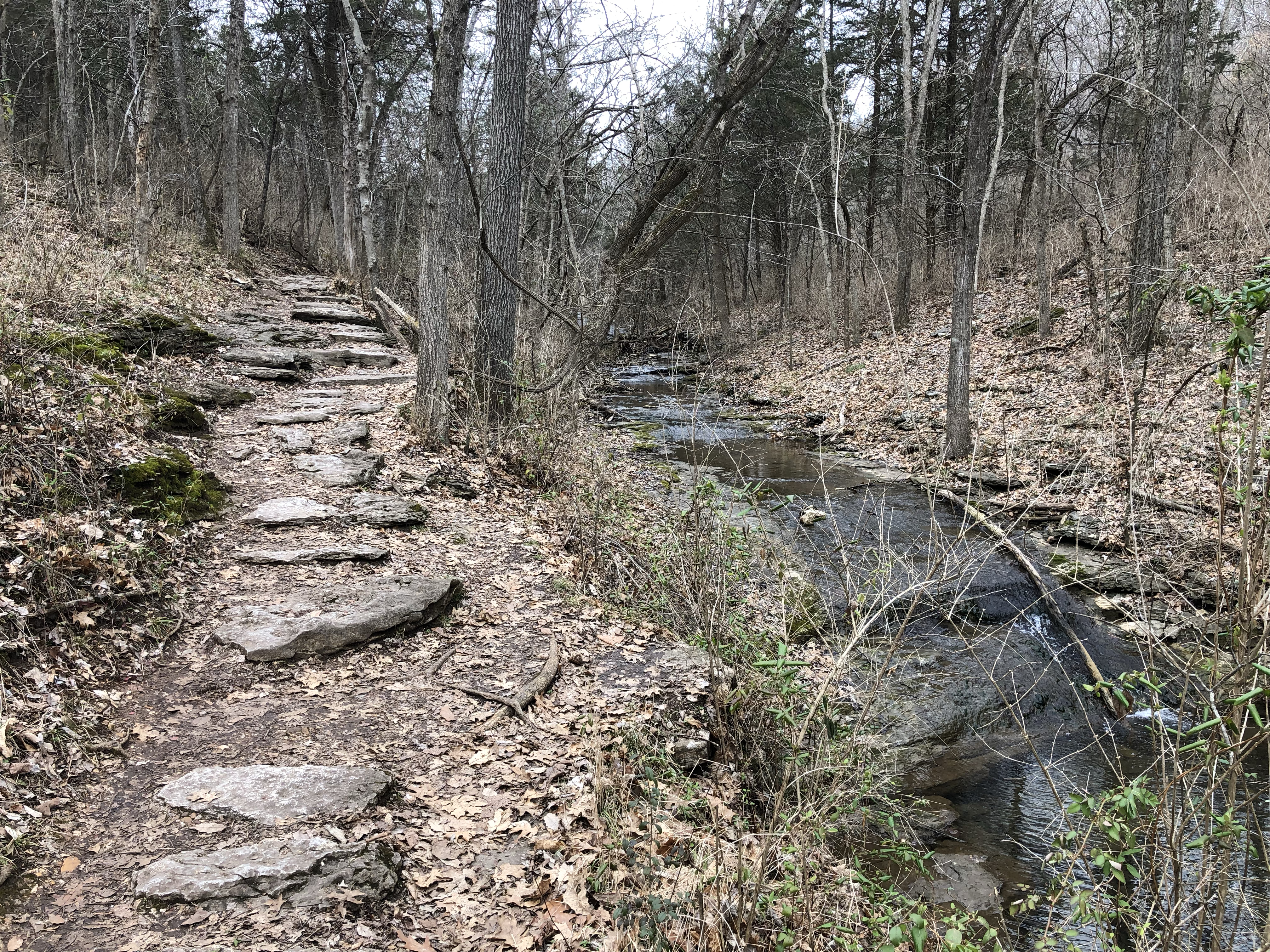
During our extended winter retreat to Phoenix for 2026, my wife and I hiked some familiar trails but also explored a few we had never tried. We also took a day trip up to Sedona, one of our favorite spots in the state. We walked around some of the shops, bought some clothes and shoes, and had a fabulous lunch at the regional airport’s cafe, of all places. They had some cocktail specials we couldn’t resist, and the food was excellent. Before all that, we drove north of town on Highway 89A towards Flagstaff for a morning walk on West Fork Trail in an area called Oak Creek Canyon.
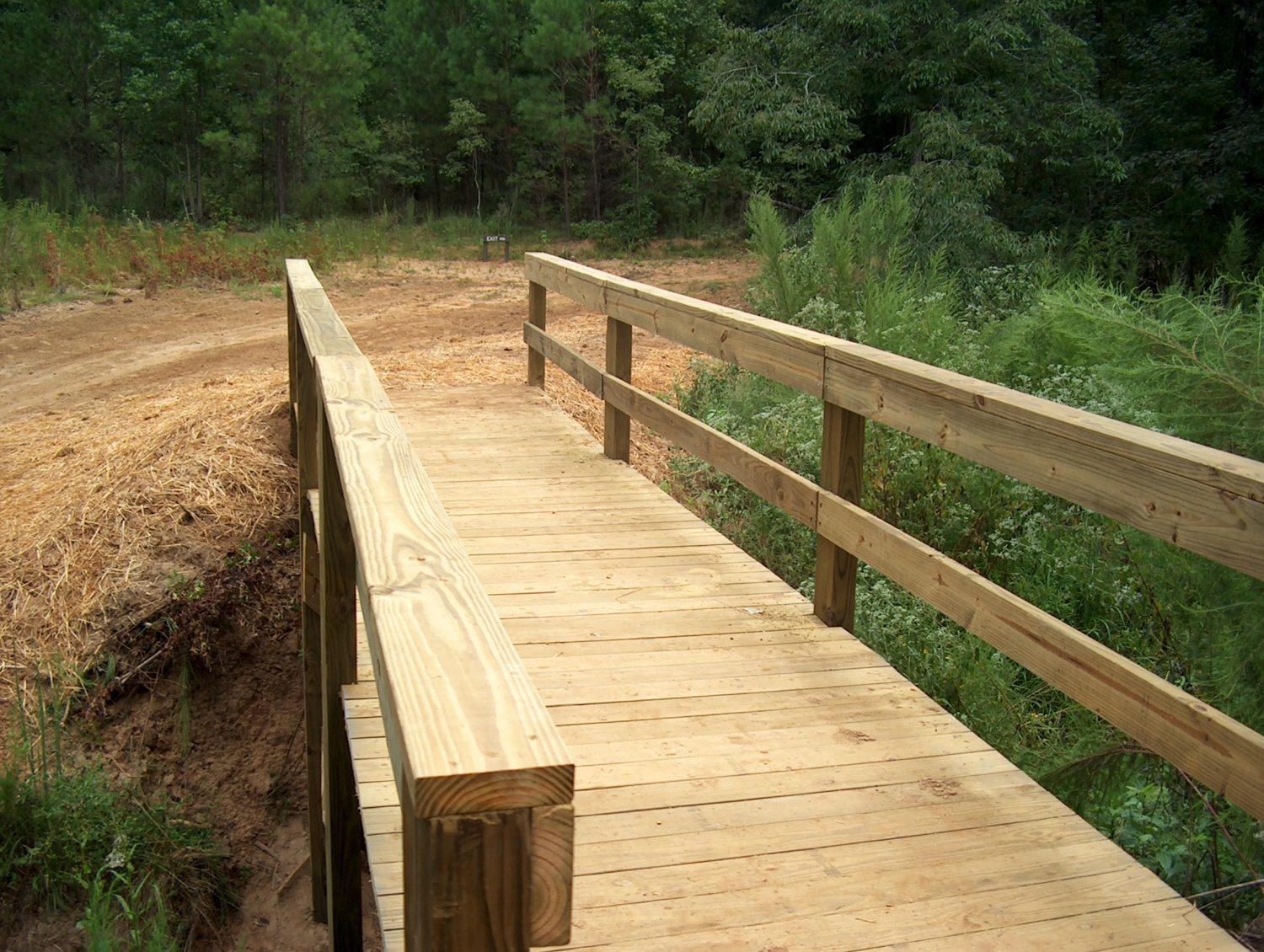
West Fork Trail of Oak Creek Canyon, Arizona
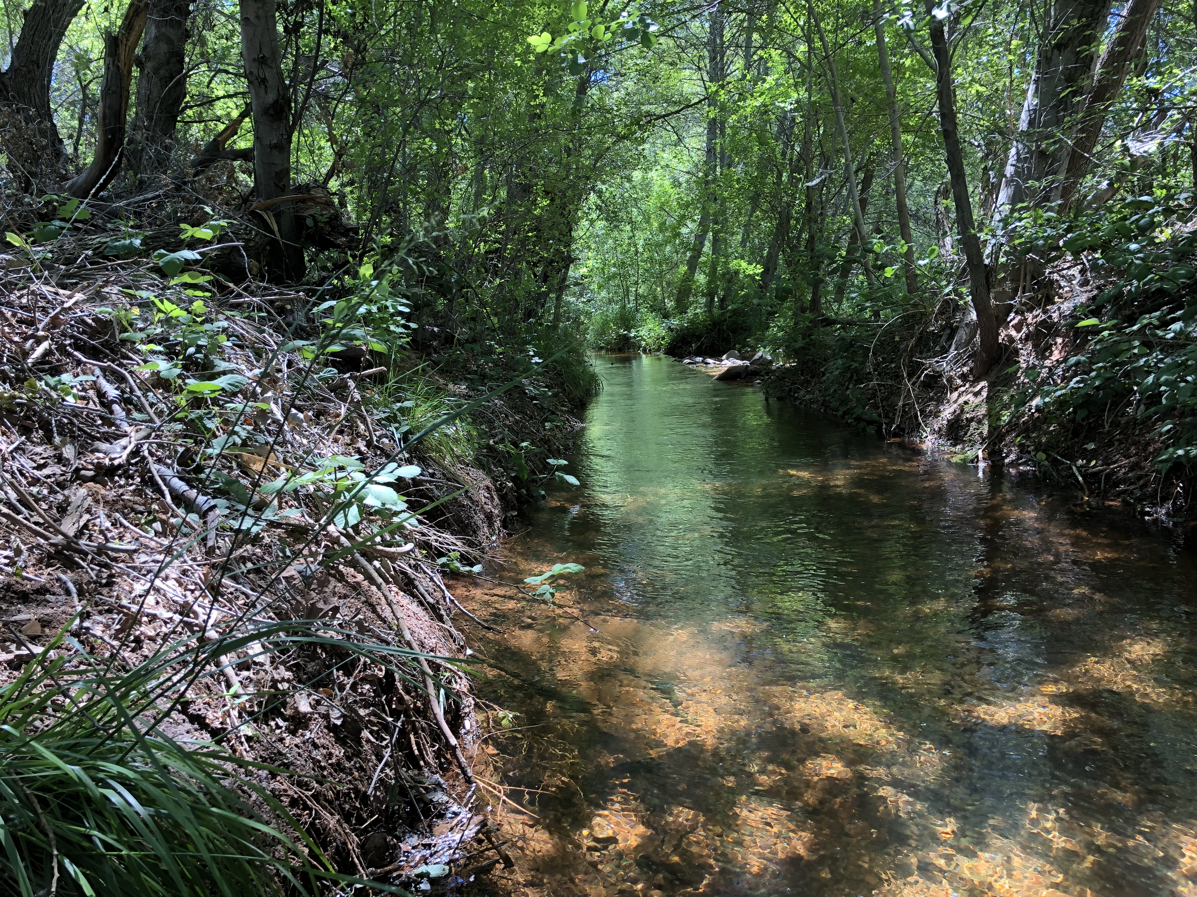
We had driven through Oak Creek Canyon many years ago but had never taken the time to explore the area, which boasts a landscape quite different from the desert environment of the Phoenix basin. The West Fork Trail is 14 miles long, but we only walked the first couple of miles. Literature and websites warn hikers to prepare to get their feet wet, which is fair considering the trail crisscrosses the creek numerous times. During our short walk we forded the creek three times over wet rocks and fallen logs. Even with our hiking poles, we decided a fourth crossing was pushing our luck, especially considering we didn’t bring a change of clothes along in case we slipped and took an unplanned dip.
West Fork Trail of Oak Creek Canyon, Arizona
The section of the trail that we walked is flat and sandy, following closely to the creek through forests of ponderosa pines, maples, and of course, oaks. Not far from the trailhead are the stone ruins of Mayhew Lodge, an old hunting cabin converted into a resort that attracted celebrities such as Jimmy Stewart, Walt Disney, Clark Gable, and President Herbert Hoover. It burned to the ground in 1980, leaving behind only the ruins that are adjacent to the first part of the trail, which is the most accessible portion of West Fork.
West Fork Trail of Oak Creek Canyon, Arizona
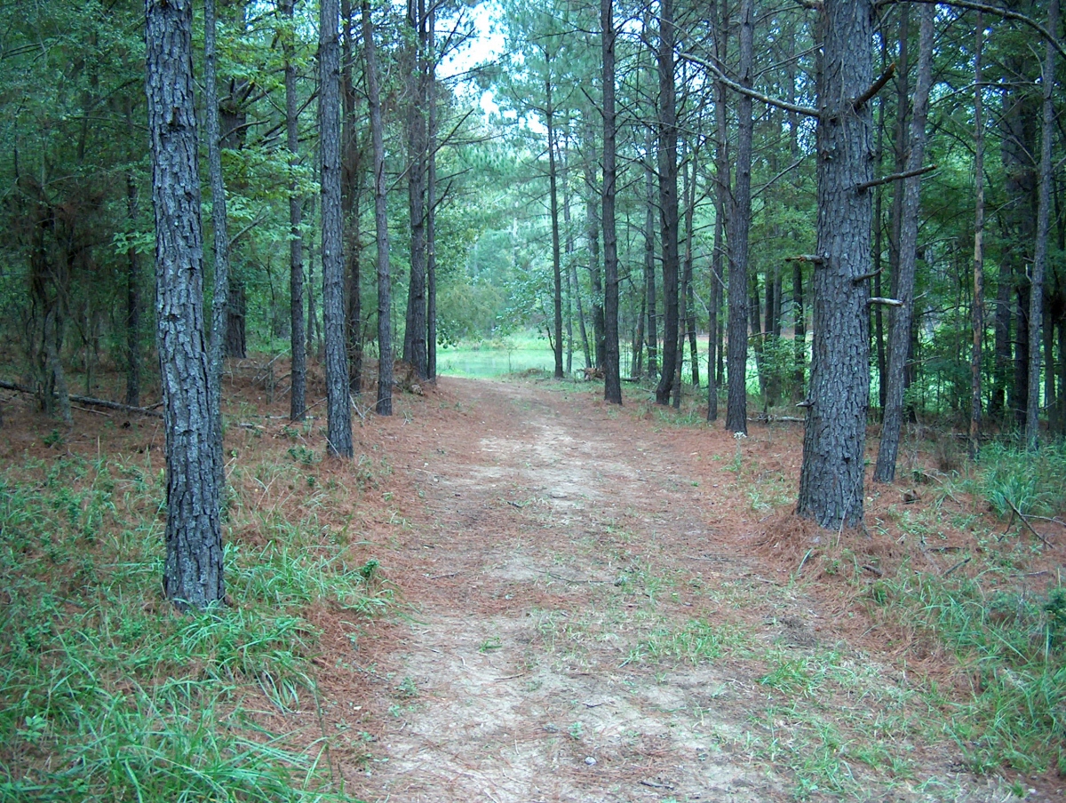
According to the Visit Arizona website, the trail becomes more challenging after the early creek crossings. “The canyon walls begin to close in, forcing the creek through a slot canyon. After wading through the creek to get back to the trail, hikers can expect bouldering, swimming and bushwhacking to complete the entire trek.” Visitors to Sedona who enjoy the outdoors will be well rewarded by taking the short drive north to witness the rock pinnacles, natural arches, and deep canyons on the West Fork Trail.
West Fork Trail of Oak Creek Canyon, ArizonaWest Fork Trail of Oak Creek Canyon, Arizona
In his remarkable book, Badass Retirement, author Robert Pagliarini includes a chapter titled “Upgrade Health.” His message is simple for people who want to escape average retirement: think and act like an athlete. He posits that professional athletes “invest their time and energy into improving their performance.” They work hard at it to avoid injury, recover quickly if they do get hurt, and achieve the highest possible energy and stamina for years, even decades. He stresses that retirees should have these exact same goals – and I agree one hundred percent.
My wife and I are now in our second year of retirement, and one of our top priorities since we left employment is to get in better physical shape and maintain a healthier lifestyle than we did during our working years. We are paying closer attention to what we eat and drink (well, better than we once did). We are also wearing the right kind of clothes and shoes for our new lifestyle. We are paying more attention to our bodies and making sure we get the medical care we need. We believe in the value of vaccinations and medication.
Perhaps the most significant change in retirement related to our health is our increased focus on physical fitness. Much of our time is now discretionary, and we are devoting more of it to a variety of exercise options including weight training, cardio activity, Pilates, walking, and hiking. We both have trainers we work out with at least once a week. We have pickleball paddles and hope to learn how to play this game that has swept across America and is attracting all ages, not just seniors.
Dan Kinney Family Center, Springfield, MO
We are fortunate to live in a community that offers ample opportunities for indoor and outdoor recreational activities. Our city and county have an excellent trail system for walking, hiking, and biking. Some of the trails connect to surrounding towns. We have a nature conservation area, a botanical garden, a historical landmark park, and several outdoor green spaces with hiking trails, paved walkways, creeks, and ponds.
Springfield (MO) Botanical Center
Because we are both over age 60, we get an extra benefit through our local park board in the form of a deep discount on membership at their fitness centers. We can reach the one closest to our house in about ten minutes. This family center has a multi-use court for pickleball, basketball, volleyball, children’s inflatable bounce houses, and group exercise programs like SilverSneakers. There is a walking track on the second floor that circles the court. There is an outdoor paved walking track too. The center is equipped with a wide variety of dumbbells, weight machines, treadmills, bikes, ellipticals, stair steppers, and much more. The center also has meeting space and separate rooms for small classes and individual training.
We are making a concerted effort to exercise several times a week, with two days of weights, at least one day of cardio, and 2-3 days of alternate activity like walking or Pilates. We live in a subdivision that is great for walking. If possible, we also try to include exercise as part of our daily routine when we travel, taking advantage of hotel and condo fitness rooms or just walking nearby trails or in neighborhoods. We look for public gardens, arboretums, and greenways for walking too. When we are away from home for extended periods of time, we purchase a temporary membership at a fitness center so we can maintain our weight and cardio routines.
Springfield (MO) Conservation Center
Hiking has always been a favorite activity for both of us, even before we met and got married. I have written about our hiking adventures a few times in this blog. When we travel, we look for fun and scenic places to hike. Phoenix, the Sonoran Desert, San Francisco, Lake Erie, Joshua Tree National Park, Yosemite, Mount Hood, and various locations in the Ozarks and Appalachia are just a few places we have hiked. We have walked or hiked in temperatures from 13 to 90 degrees Fahrenheit, in light rain and sunshine, and in all four seasons.
Sometimes it’s not easy to get motivated, but we know we need to keep moving, strengthen our core, develop and maintain muscle tone, protect our bones, keep our hearts healthy, and improve our balance. Robert Pagliarini makes a valid point to keep in mind in his badass book on retirement. “The most important asset you have is your health, but knowing what to do when it comes to nutrition, supplements, and fitness feels like a moving target for a good reason. If there is one area that changes more than any other, it’s health.” Medical professionals agree that exercise is essential to staying healthy, and we intend on staying as healthy as possible as we age. After all, we’ve got places to go, people to see, things to do!
“You will always find an answer in the sound of water.” –Zhuang Zhou, Chinese Taoist philosopher
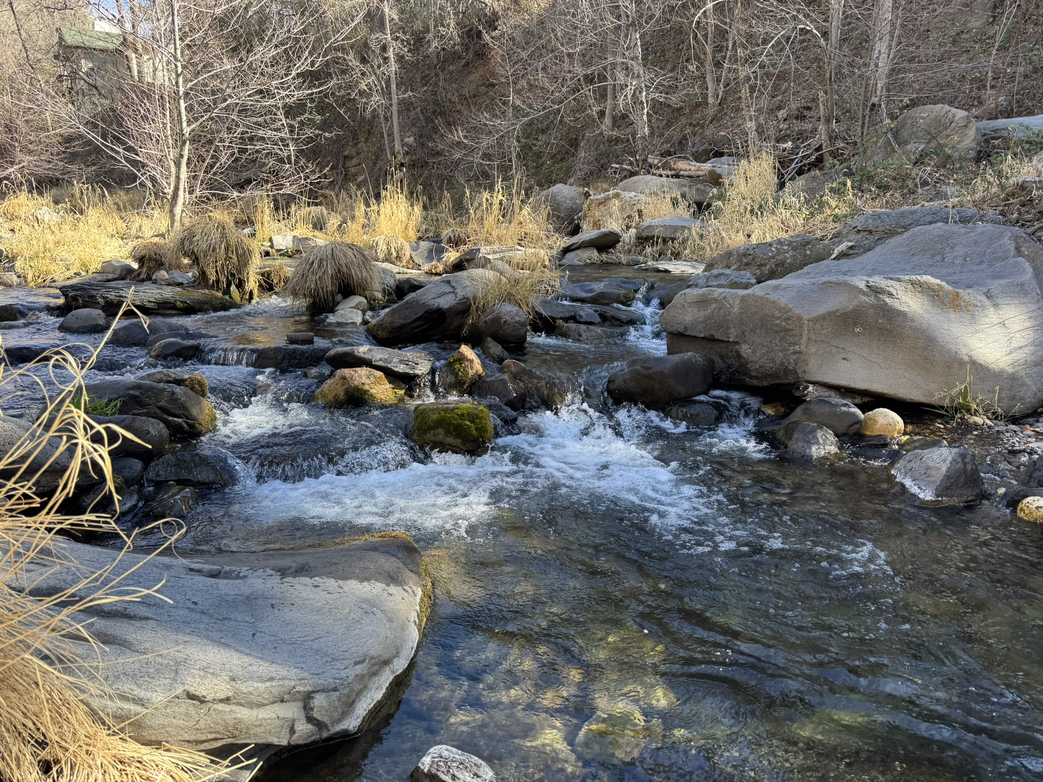
The ancient Chinese master may have been a tad optimistic with this simple maxim, but from my personal experience, he wasn’t too far off the mark. For as long as I can remember, I have been drawn to water: the coast, waterfalls, lakes, ponds, rivers, and streams. Stationary water has its charm, but running water really seduces me. Even fabricated water sources like garden ponds and public fountains exert a gravitational pull on me. I photograph or video record flowing water. If I have the spare time and a place to sit nearby, I will pause as long as possible to watch and listen to the soothing sounds of rocky cascades and bubbling brooks. I am equally overwhelmed by the display of power and the deafening roar of huge or towering waterfalls. I have written about these experiences frequently in this blog.
Missouri Botanical Garden
As much as I have enjoyed exploring nature trails over many decades, I must admit that a major incentive to lather up with insect repellent, pull up ankle boots, and strike out with a hiking pole in each hand is to find some source of flowing water. I also look for it at botanical gardens, arboretums, conservation centers, and even at city parks and plazas. The sound beckons me. When I am within ear shot of it, I can immediately feel a sense of serenity. I am connected to the natural world most intensely in those moments. It is impossible to capture or recreate this encounter with audio, photo, or video recording equipment. The results are only a reminder, not a replication. Nevertheless, I offer here some of my favorite photos of rushing water, or at least water in motion.
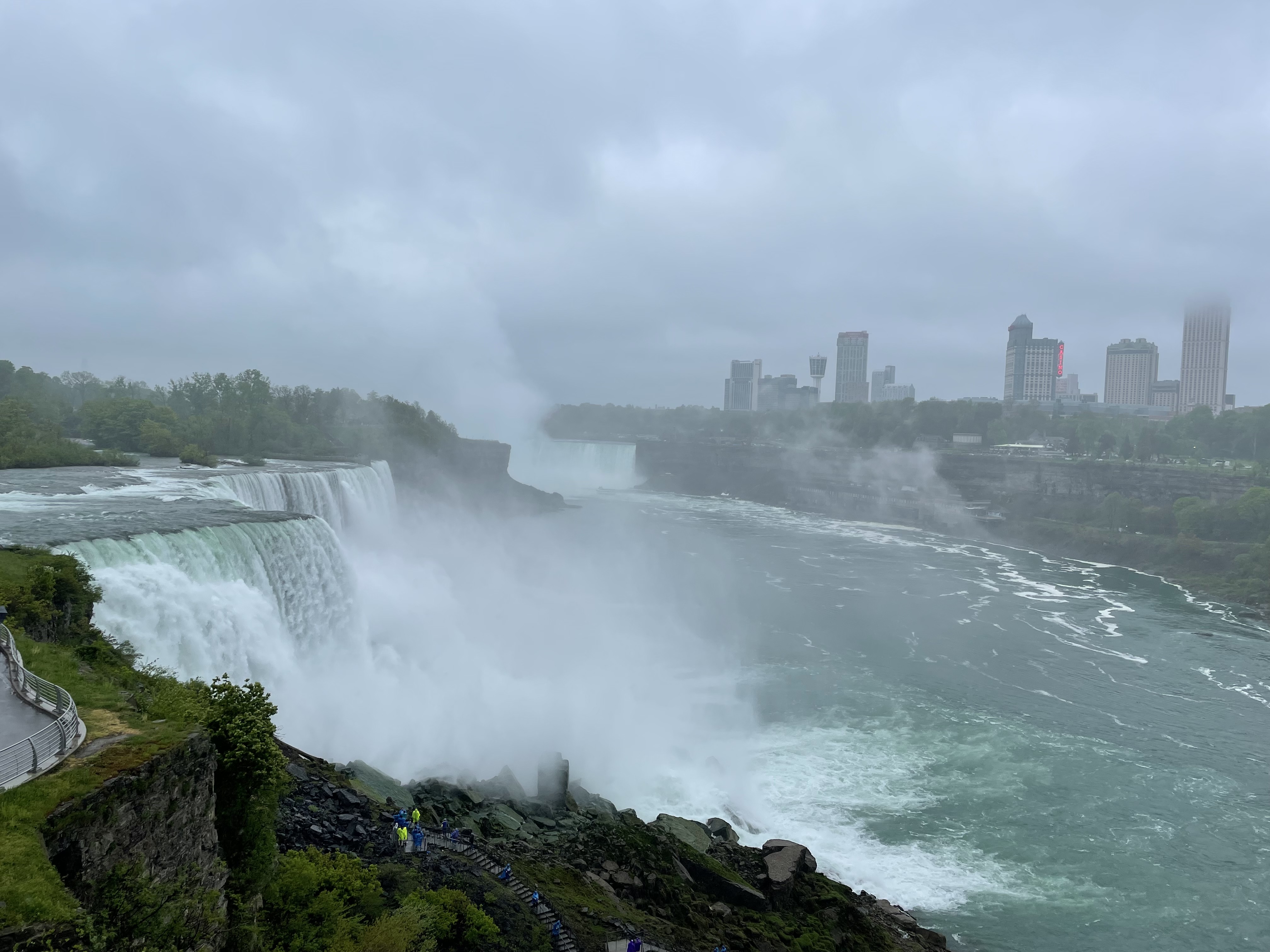
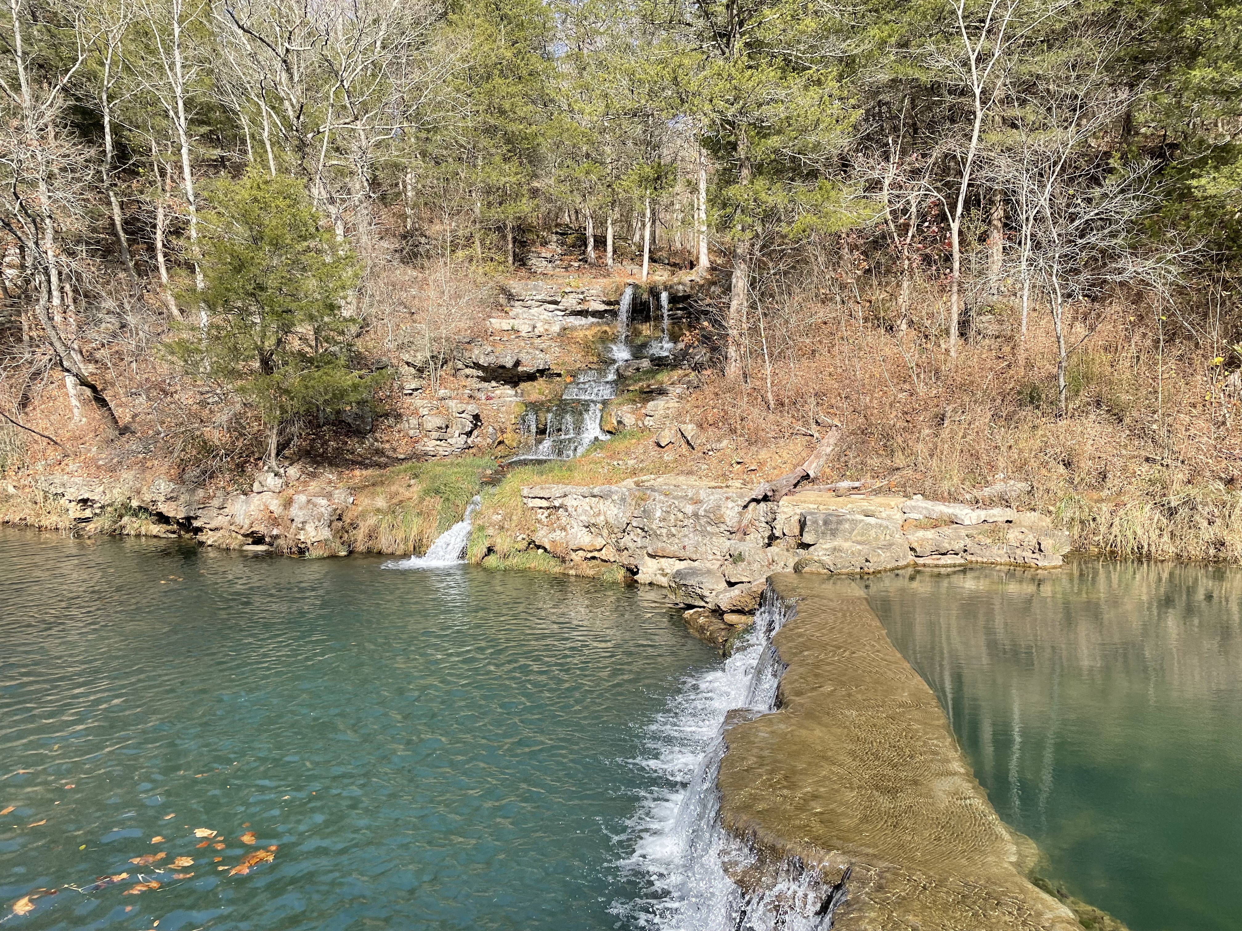
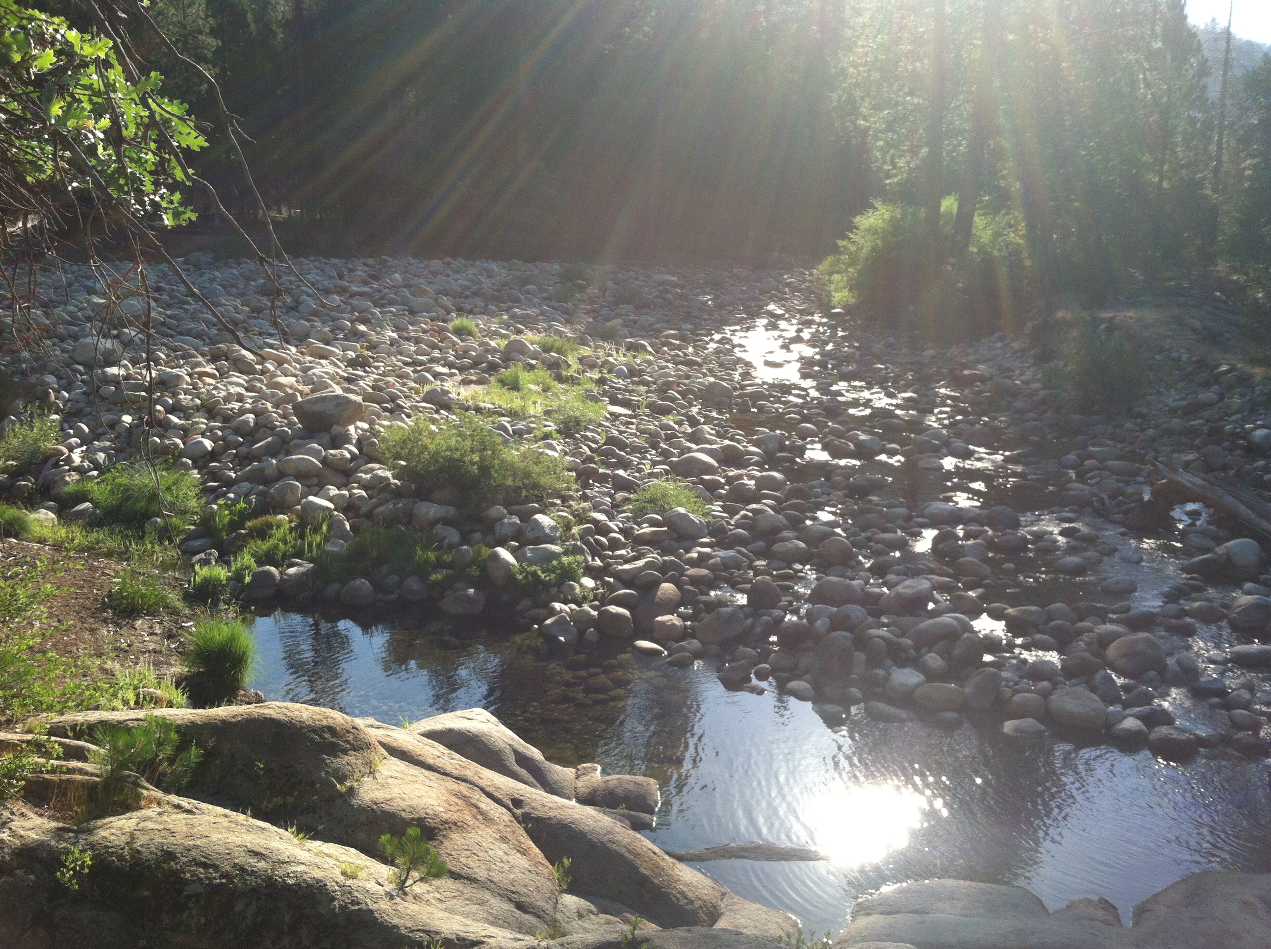
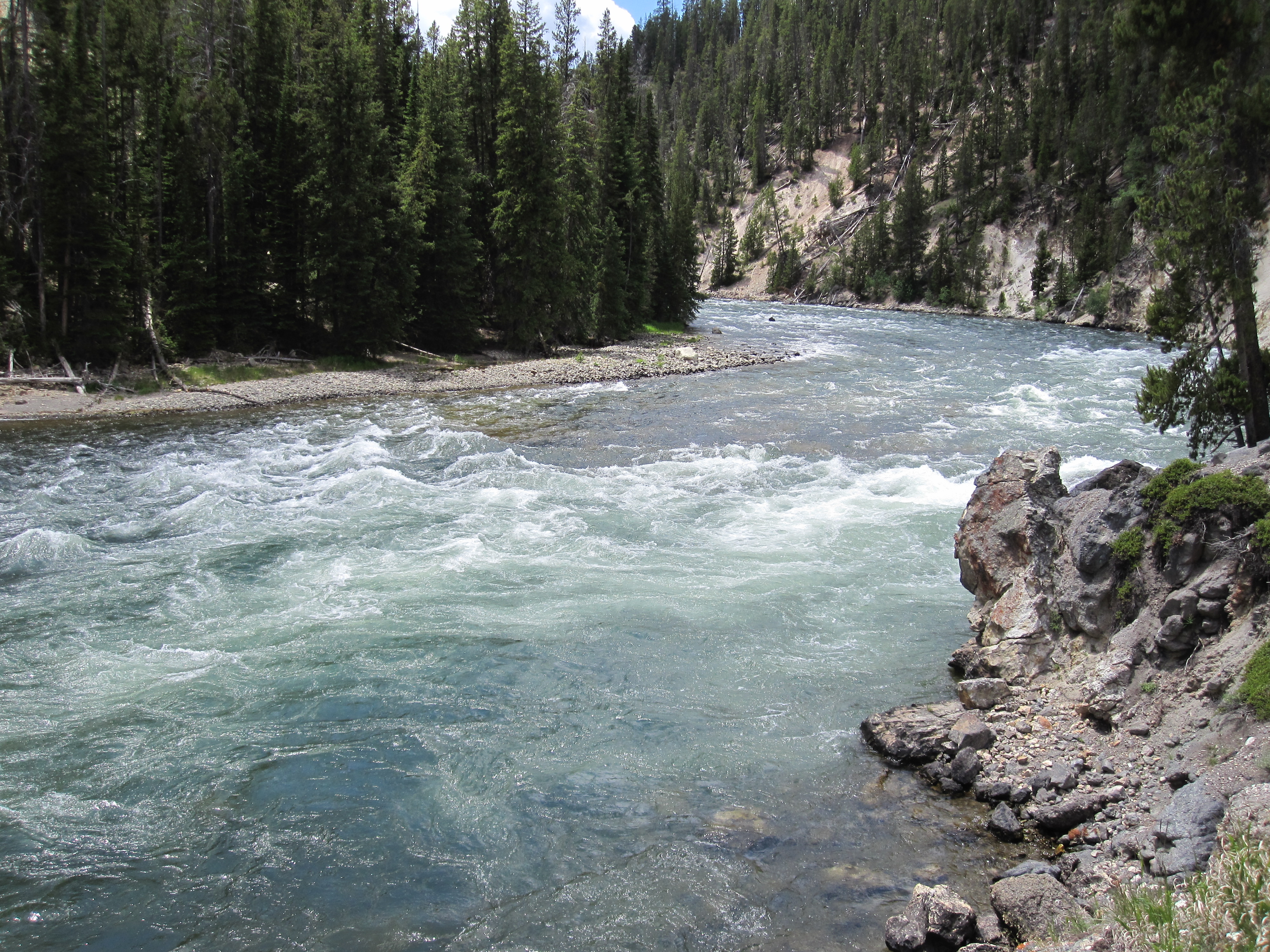
Moccasin Creek, Rabun County, GAPanther Creek Falls, Habersham County, GANiagara Falls, NYDogwood Canyon Nature Park, Missouri OzarksYosemite National ParkYellowstone National Park
The Ozarks is one of those regions of the country that is diverse and interesting enough to be a tourism gold mine. From the bright lights and music of Branson, Missouri, to the gentle flowing current of the Buffalo River in Arkansas, there is something for just about everyone. Although there are no large cities in the Ozarks, there are towns with a few city amenities, like the restaurants, shopping, museums, and entertainment spots available in Springfield, Missouri and Fayetteville and Bentonville, Arkansas. On the other hand, Ozarks visitors can head off grid and commune with nature at any number of conservation areas, state parks, national parks and forests, national rivers, and wilderness regions.
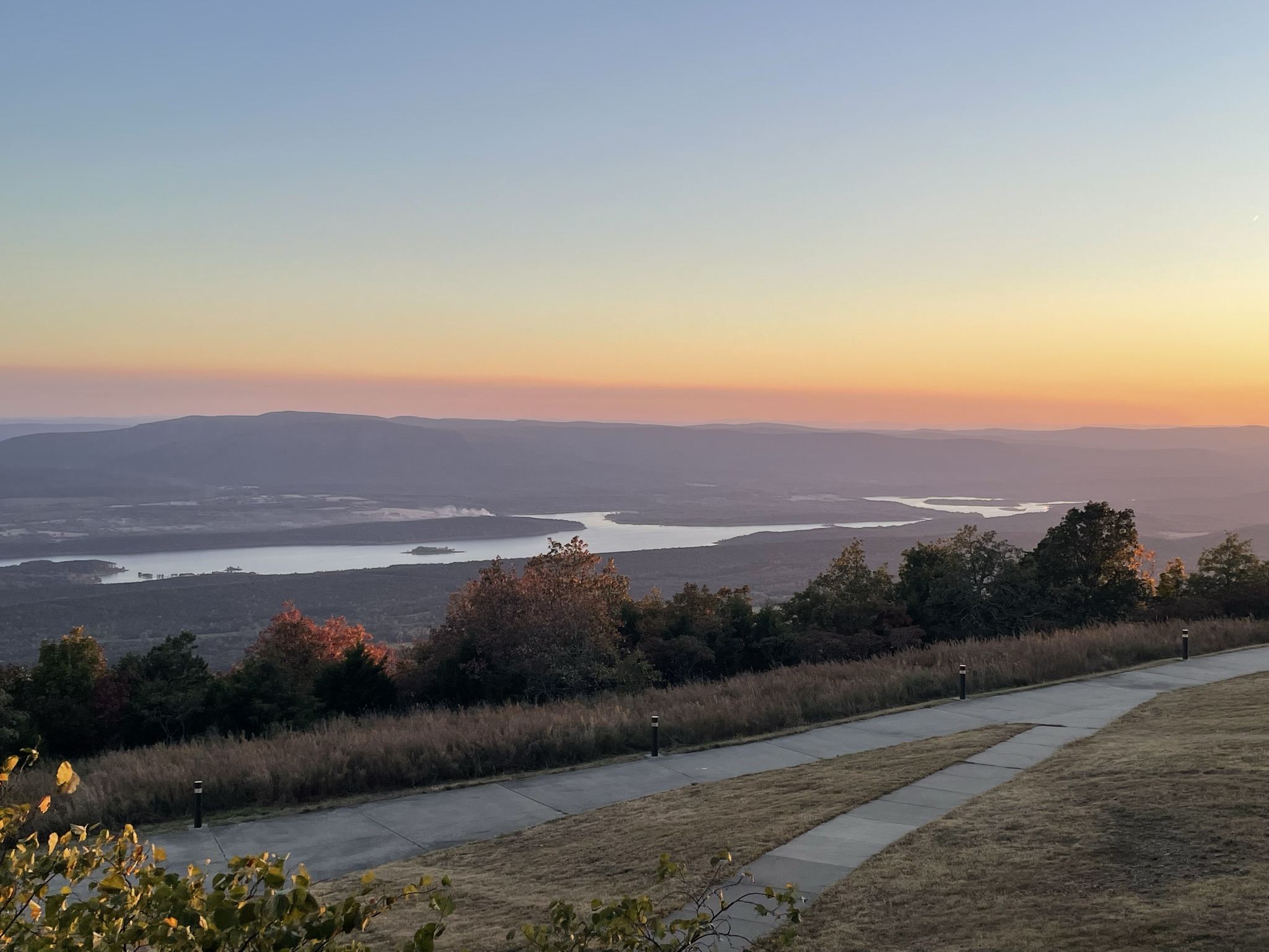
Mount Magazine State Park, Arkansas
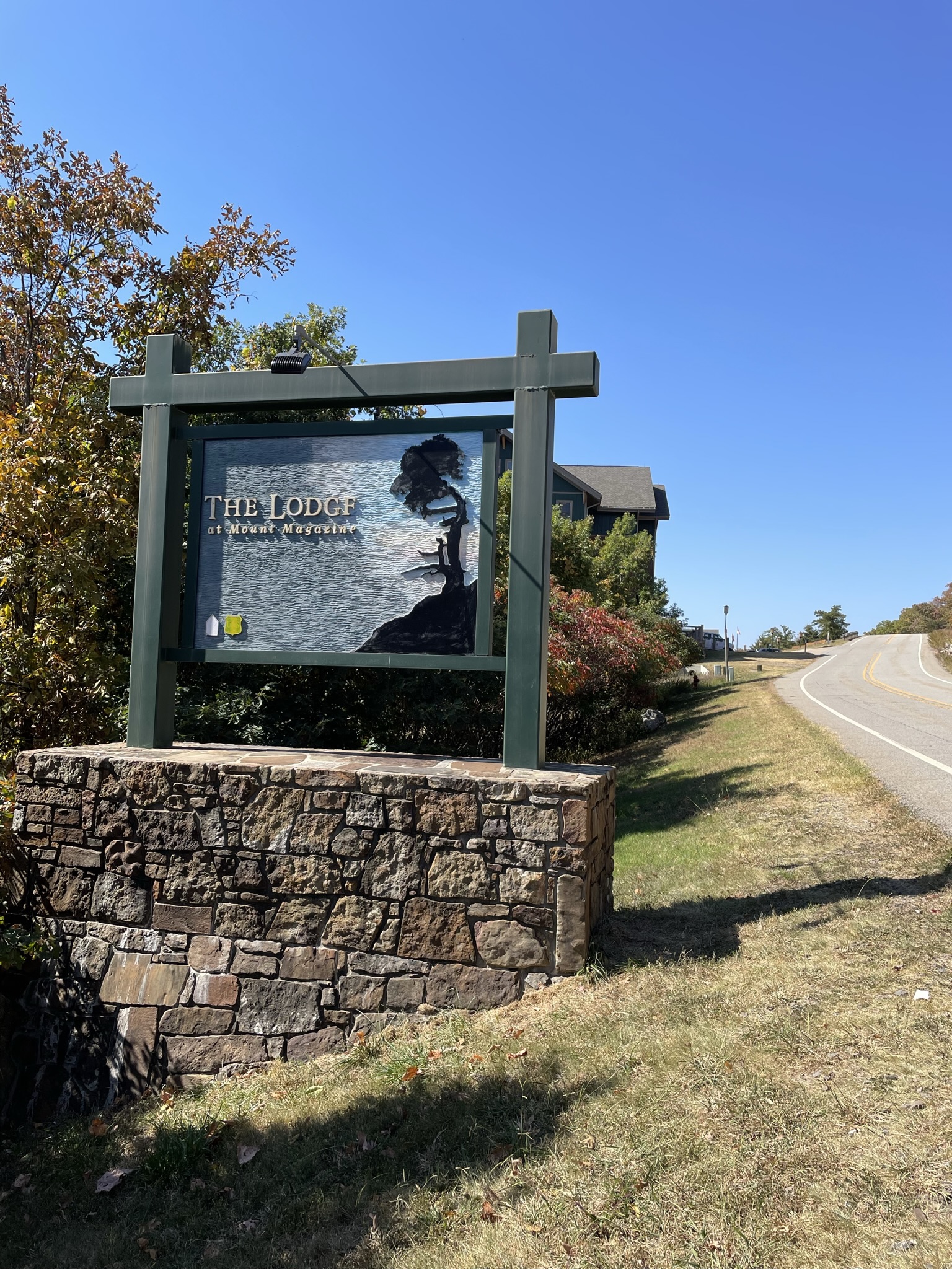
Between those opposite ends of the destination scale, there are a few spots that offer a nice blend of the outdoors with the comforts of the built environment. One of those is the Lodge at Mount Magazine State Park near Paris, Arkansas. Located just below the crest of the highest peak in the state (2,753 feet), the lodge is situated on Mount Magazine’s south bluff overlooking the expansive Petit Jean River Valley and Blue Mountain Lake. Because this ridge is so high above the valley floor, the park includes a launch area for hang gliders within walking distance of the lodge. Other activities to enjoy include mountain biking, horseback riding, backpacking, and ATV riding. The park visitor’s center is within walking distance of the lodge on one of several nearby easily accessible nature trails.
The Lodge at Mount Magazine State Park, ArkansasThe Lodge at Mount Magazine State Park, Arkansas
The term “lodge” may be a bit misleading to potential vacationers to the site. Other than the rural setting, the exposed pine log beams, the nature-themed art, and the natural rock accents, the lodge has many of the comforts of a resort. The rooms are well appointed, many of which have a whirlpool spa. The indoor pool is spacious, and there is a fitness center and a game room too. There are multiple seating areas with large glass panels looking out over the valley. The dining room and bar are a real cut above what most guests would associate with a state park. Accommodations range from individual rooms and suites in the main lodge to cabins of various sizes flanking the building on either side, all overlooking the valley. Each cabin has a fully equipped kitchen, fireplace, and covered deck with an outdoor hot tub. The lodge also houses a conference center.
The Lodge at Mount Magazine State Park, Arkansas
What attracted me most about the lodge and prompted me to book a room for my wife and me in the fall of 2022 was the view. It is magnificent. We spent many hours on the balcony of our lodge room looking out at that incredible vista. The pleasant surprise was how nice the whole facility was. The service was great. The food was quite delicious and plentiful considering the price and the somewhat rustic setting, with buffets offered for most meals, although ordering from a small menu was an option. The park is in a remote part of the Ozark-St. Francis National Forests, but there are small towns only thirty minutes away. It’s a great place for the family that enjoys nature but doesn’t want to sleep in a tent or camper, although the park has plenty of campsites. The lodge and cabins are also perfect for a romantic getaway, and we are always ready for that kind of excursion.
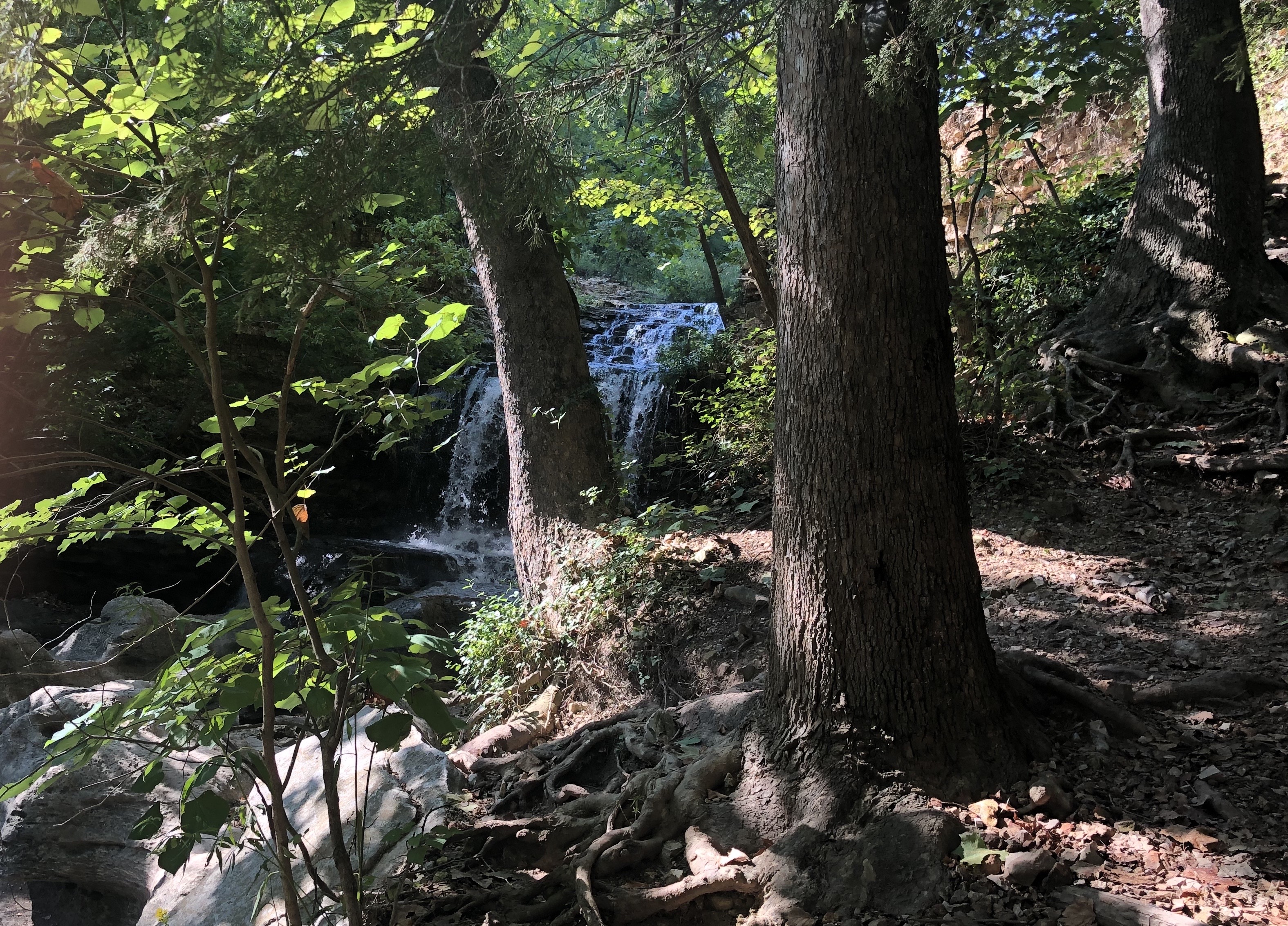
Waterfalls are a recurring theme for me in this blog. I am drawn to the sound of rushing water: waves crashing on the shore; rivers and streams; fountains in ponds; and waterfalls. I have hiked miles just to hear water running over rocks into a natural pool or to see it cascading over boulders. If possible, I take photographs when I find these bold exhibitions of nature. I often make videos too. Sometimes I will pause for a few minutes, or more, to simply look and listen. There is something about the sight and sound that soothes me and helps me appreciate how much beauty there is on this planet. For this post, I have collected photos of a few of my favorite waterfalls.
Multnomah Falls near Portland, Oregon
When I look at waterfalls, I am reminded how all life on Earth originated in the water, how essential water is in sustaining life, and how much of our bodies are composed of water. I think about how rapidly running water has been a source of power for people for as long as civilization has existed. I am amazed that the same liquid that quenches our thirst and caresses our skin can, over time, wear down and erode some of the hardest substances on the planet.
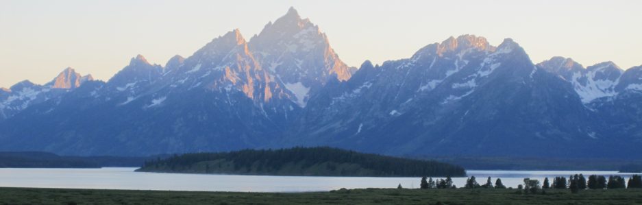
Lower Yellowstone Falls in Yellowstone National Park
I have chased waterfalls in so many places in the United States, from coast to coast. I have stood in awe with throngs of other sightseers in national parks gazing at some of the largest falls in the country. I have visited state parks and scenic byways, looking skyward as the spray falls over cliffs to jagged rocks below. As magnificent as the most popular waterfalls are, I am still humbled and even mesmerized by a small stream spilling over a ridge deep in the forest. I can’t help wondering how long water has been flowing at such places. I am often by myself when this happens, which always presents an opportunity to reflect on how lucky I am to be alive and how precious the short time is that I have here.
Tanyard Creek near Bella Vista, ArkansasLatourell Falls near Portland, OregonWaterfall at Vogel State Park in GeorgiaBridalveil Falls at Yosemite National ParkWaterfall near Tate City, Georgia
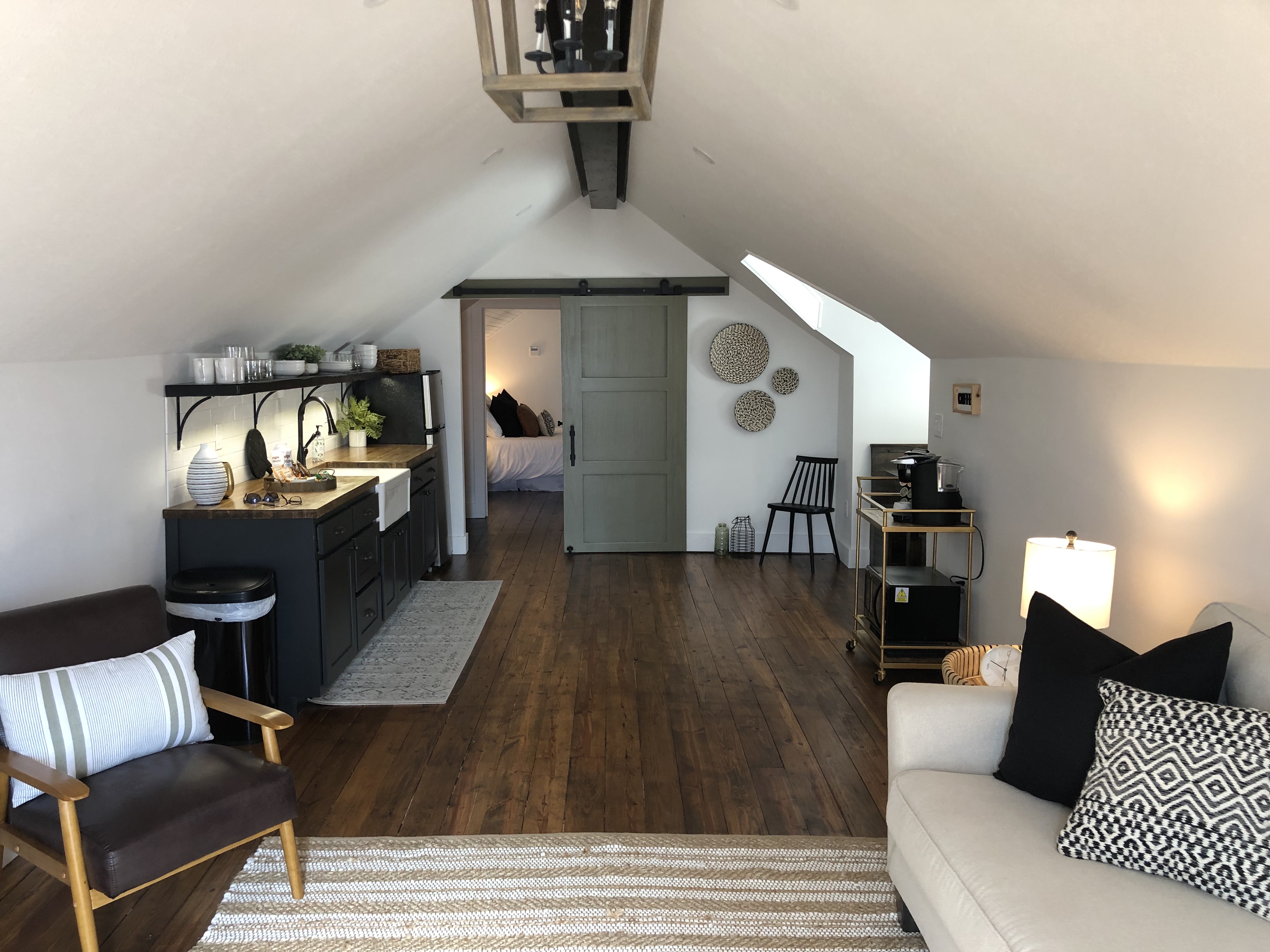
I had the pleasure of spending a long solo weekend in Mountain Home, Arkansas, earlier this summer. I began taking solo weekends about five years ago, in my mid-fifties, to recalibrate my head, get creative with writing and music, devote large chunks of time to reading, and explore the outdoors hiking. My wife is an incredible partner who not only tolerates these self-indulgent excursions but encourages them. I’m a lucky guy. I have written posts about previous solos, which have taken me to places like Cherokee and Blowing Rock in North Carolina and Lake of the Ozarks in Missouri. This trip to Mountain Home was my first solo weekend in Arkansas and my first time doing so in an Airbnb.
The Attic Airbnb in Mountain Home, AR
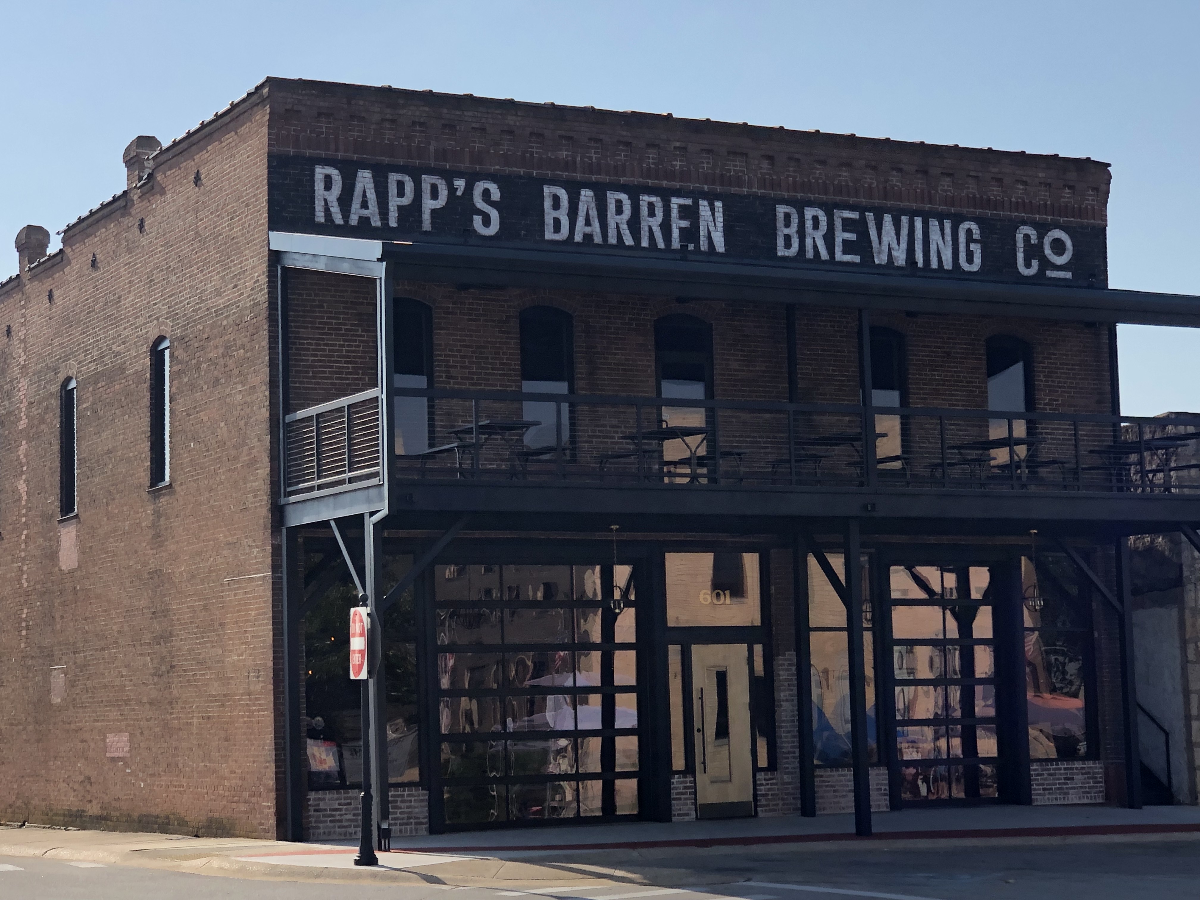
My accommodations were perfect. “The Attic” is a recently renovated upstairs apartment over several professional medical offices located a few blocks from the quaint downtown square of Mountain Home. My host was a gracious and extremely attentive woman whose brother had just opened a new location on the square for his business, Rapp’s Barren Brewing Company. This modern rustic brewery occupies the Baker Building, the oldest on the square that dates to 1892 according to some sources. Rapp’s Barren was the name of a trading post near this location settled in the early 19th century by a legendary European character named Henry Rapp. White settlers probably considered the land in this region of the Ozarks to be barren because it was composed of tall prairie grass with very few trees. By the time the town was incorporated in 1888, the name had changed to Mountain Home. At any rate, I made more than one stop at Rapp’s Barren Brewing Company during the three days I was in the town – great spot.
Rapp’s Barren Brewing Company, Mountain Home, AR
In addition to playing my guitar for hours each day and reading a good novel by Ron Rash, I drove outside of town to explore this scenic part of the Ozarks. Mountain Home is positioned between Norfork and Bull Shoals lakes and is flanked by the White and North Fork rivers. Obviously, Mountain Home is a popular destination for anglers and those who enjoy other water-related activities such as boating, skiing, paddle boarding, and floating. Campsites are abundant along the banks of the rivers and lakes.
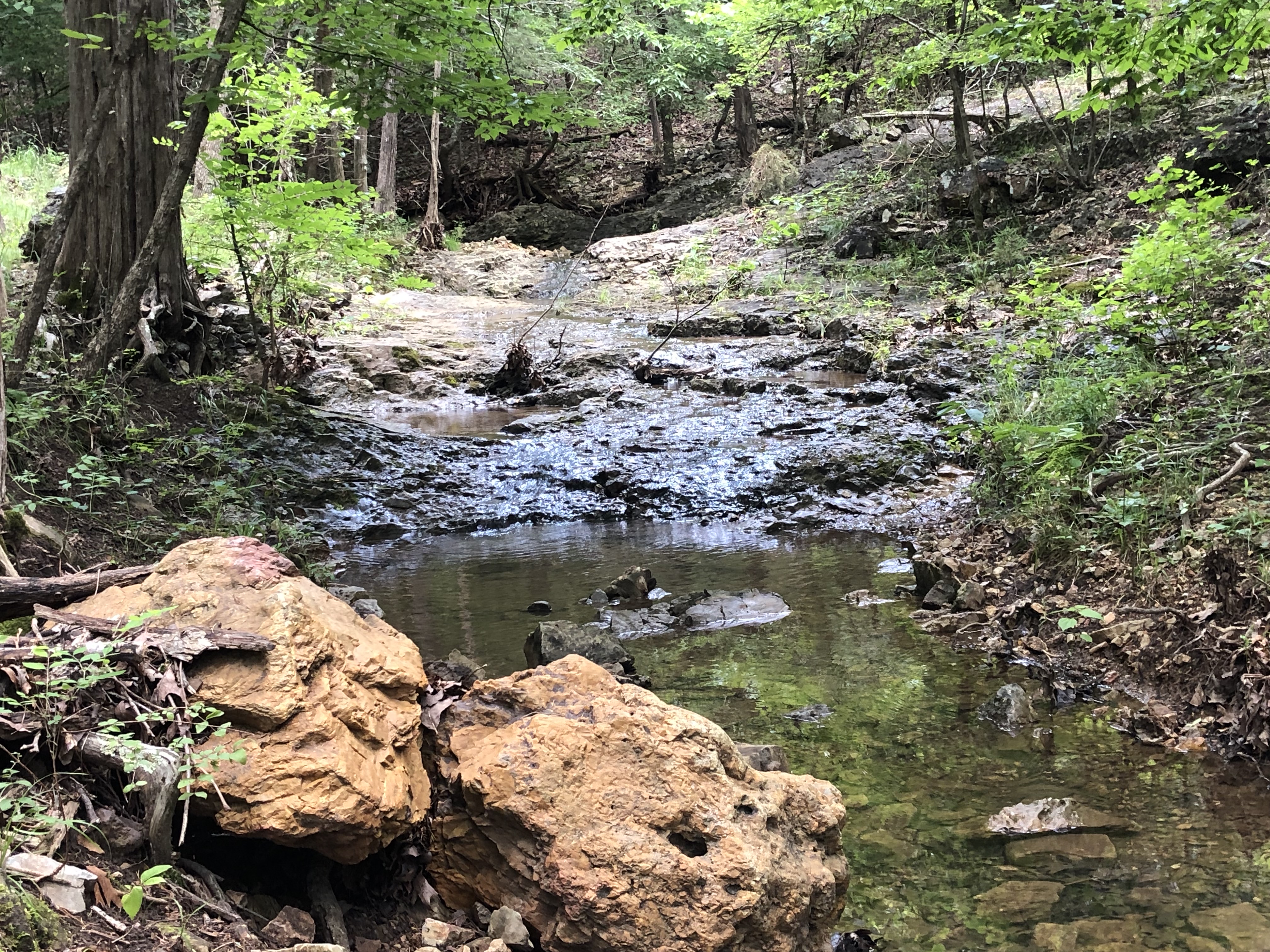
David’s Trail at Norfork Lake, AR
I was particularly interested in hiking, which on my first day led me to David’s Trail along the shore of Norfolk Lake about nine miles east of town. The trail honors the memory of David Floyd, a local outdoor enthusiast and community activist. I took a four-mile trek in and out from one of the trailheads, which gave me great views of the lake and several of its tributaries, in addition to some lovely plants, a timid snake, a well-camouflaged deer, and a couple of pileated woodpeckers that refused to let me get close enough for a photo. The portion of the trail I hiked had some moderate hills and featured some shady fern banks and moss-covered rock outcroppings that were lush and green. I never saw another human being the whole time I was on the trail. It was a warm morning, but I was in the shade of the tree canopy for most of my hike. I felt invigorated and extremely hungry afterwards.
David’s Trail at Norfork Lake, ARDavid’s Trail at Norfork Lake, AR
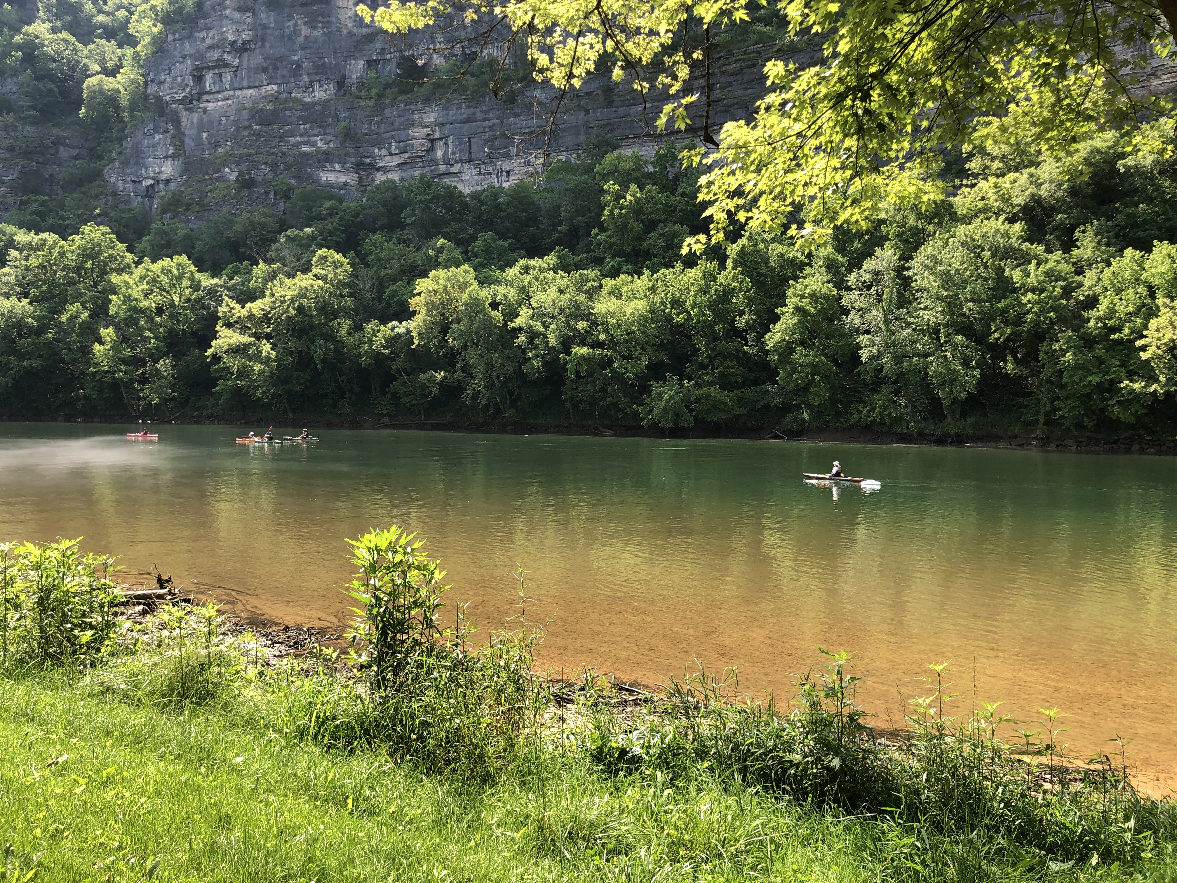
On my second day, I took another short road trip to see the White River. Meandering its way 722 miles through Arkansas and Missouri, the White River is ranked as one of the top trout fishing waterways in the country, although white bass, catfish, walleye, and sunfish populate the river too. The river also presents the opportunity for one of the most common pastimes in the Ozarks – floating. Climbing in a canoe, kayak, or johnboat and letting the river carry you downstream at a slow, relaxing pace has been a popular form of recreation in the Ozarks for ages. I visited Buffalo Shoals access area at the little hamlet of Buffalo City where the Buffalo River merges with the White River just south of Mountain Home. Stair Bluff rises 689 feet along the southside of the White River and is a spectacular site. There is a parking area at the river’s edge with access to boat ramps and a sandy bank. I enjoyed watching families wading and fishing in the chilly water while others launched canoes and kayaks and drifted with the current. I found several other walk-in access points for the White River, where I could soak up the tranquil environment all alone.
Stair Bluff at Buffalo Shoals on the White RiverFloating on the White River at Buffalo Shoals in Arkansas
In an unpublished journal, the famous naturalist John Muir wrote a brief sentence that has become one of his most famous quotes: “I only went out for a walk, and finally concluded to stay out till sundown, for going out, I found, was really going in.” I suspect many people realize that, to get in touch with ourselves in a profound way, we must be reminded occasionally how small we are. We need to take external journeys to probe internal mysteries. We search for our place in the realm of nature. These solo weekends that I am privileged to experience allow me to go out, then go in, and come back home with a new perspective on just about everything.
Missouri is often referred to as the “Show Me” state, a reference to a late 19th century lawmaker’s observation that its citizens as a rule prefer visible proof over blind faith. Given the political climate in Missouri in 2021, I would argue that this moniker is no longer applicable. A much more accurate appellation would be the “Float Me” state. River and stream floating trips are a major source of relaxation in Missouri with a long history and a strong tradition. According to multiple sources, flat-bottom jon boats originated, or were at least made popular, in the late 19th century in the Ozarks because they were perfect for navigating the shallow waterways characteristic of the region of southern Missouri and northern Arkansas. With an abundance of large lakes, rivers, and streams, water recreation is a huge business in Missouri attracting millions of tourists each year; however, native inhabitants have been enjoying the simple pleasures of just floating downstream for many generations.
Not only is Missouri blessed with plenty of water resources, but the Ozarks comprises one of the nation’s richest concentrations of natural springs. There are well over a thousand of them in the state. The maximum daily discharge from some of these overflowing aquifers can exceed 500 million gallons. On average, more than a billion gallons of water flow from the ten largest springs in Missouri every single day. For many centuries, springs provided drinking water for settlements and towns throughout this region of the country and were later used for powering mills and producing salt. Some springs purportedly had healing qualities. In recent decades, these groundwater flows have predominately functioned as recreational resources centered around fishing, camping, hiking, and other outdoor activities.
One of the largest springs in Missouri is Bennett Spring, located in what is now Bennett Spring State Park in Dallas County. As one of the state’s oldest parks, this spring was the site for several grist and flour mills going back to 1846, the most successful of which was operated by a man named Peter Bennett, the namesake for the spring and park. In 1924-1925, the state purchased the spring and part of the surrounding area to create the park. In the 1930s, the Civilian Conservation Corps contributed much of the present-day character of the park, building cabins, a shelter house, roads, trails, the arched bridge across the spring branch, and the rustic dining lodge.
Bennett Spring branch
Bennett Spring State Park features many different ecosystems including rich bottomland and stream habitats associated with the spring valley and oak-hickory woodlands in the upland areas. Many animals native to the Ozarks make their homes here, including numerous pickerel frogs, northern water snakes, pileated woodpeckers, river otters, muskrats, and bobcats. The park’s diverse flora includes dense forests of trees, grasses, and herbaceous plants. Wildflowers such as bluebells and purple coneflowers flourish in the summer.
Bennett Spring branch headwaters
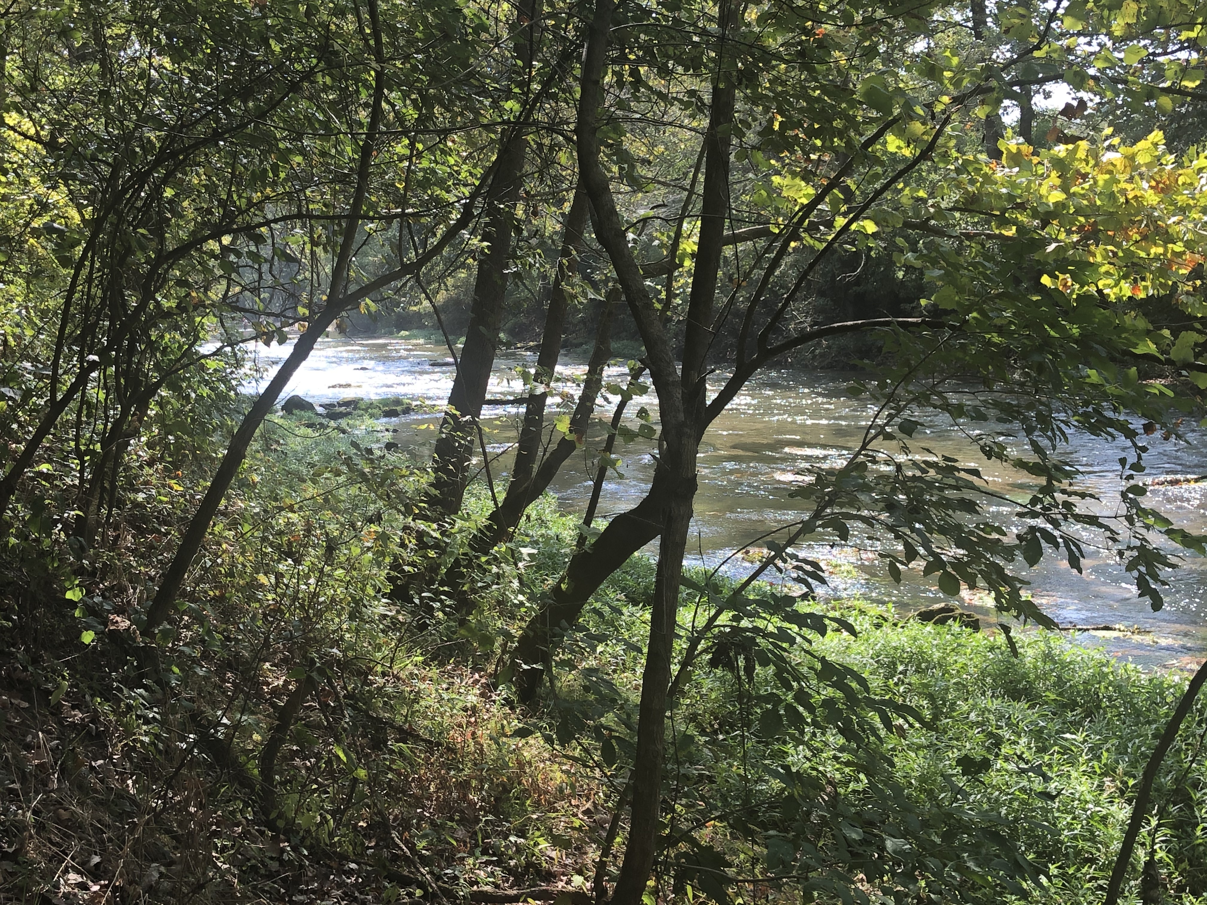
The park features a series of hiking trails, which is what sparked my interest in the late summer during the COVID pandemic and prompted a day trip to check out the site. Upon arriving at the park mid-morning, I made a quick visit to the Nature Center that serves to introduce visitors to the ecology of springs in general and to the natural resources specific to the park. I then made my way to Whistle Trail, which mostly travels along the east side of the spring’s branch, winding its way over the bluffs rising above the stream. It connects with other trails in the park that lead to the spot where the branch flows into the Niangua River, a tributary of the Osage River of south-central Missouri. According to the park’s website, Whistle Trail is likely prehistoric but was used more frequently by local inhabitants from the 1840s to the present.
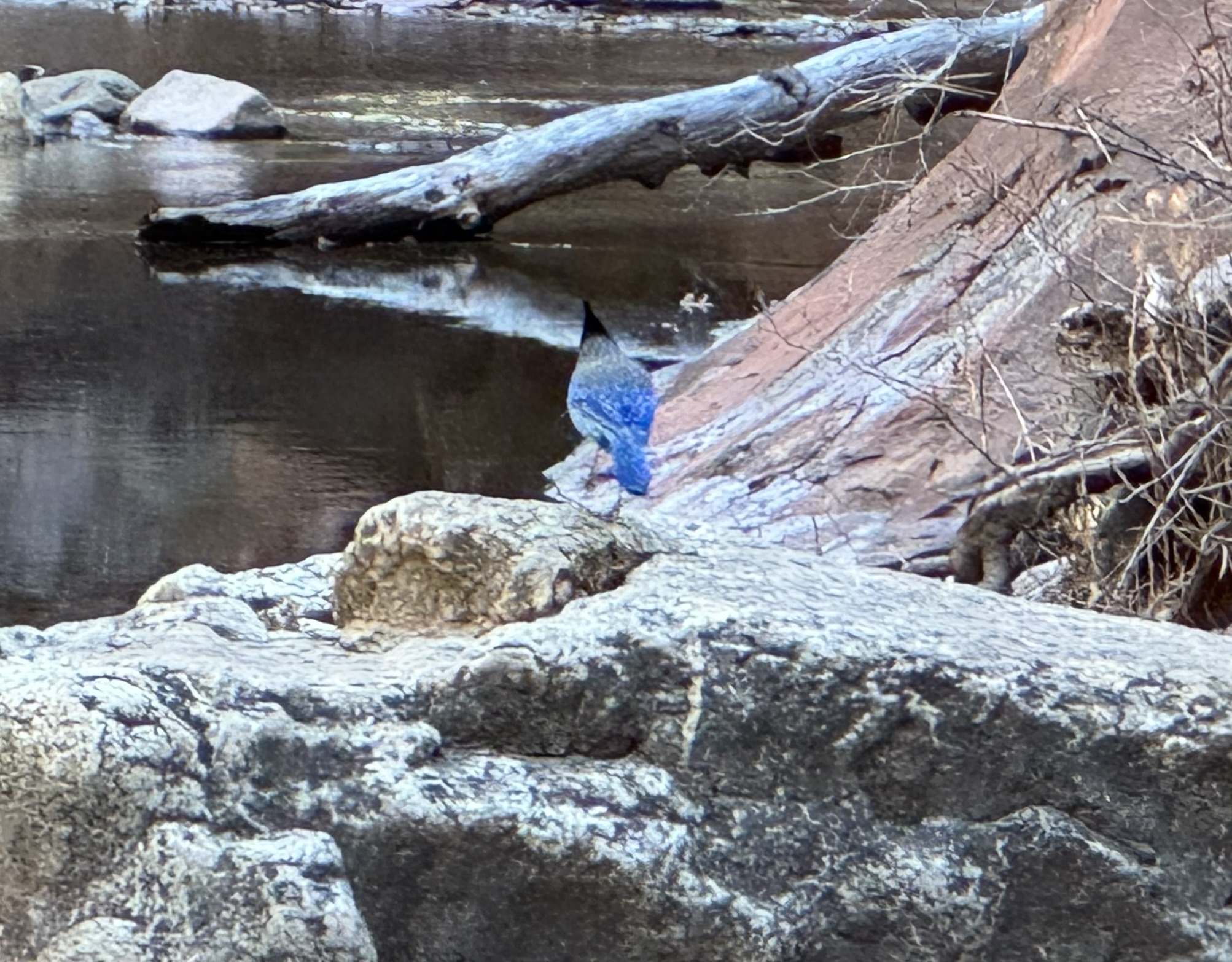
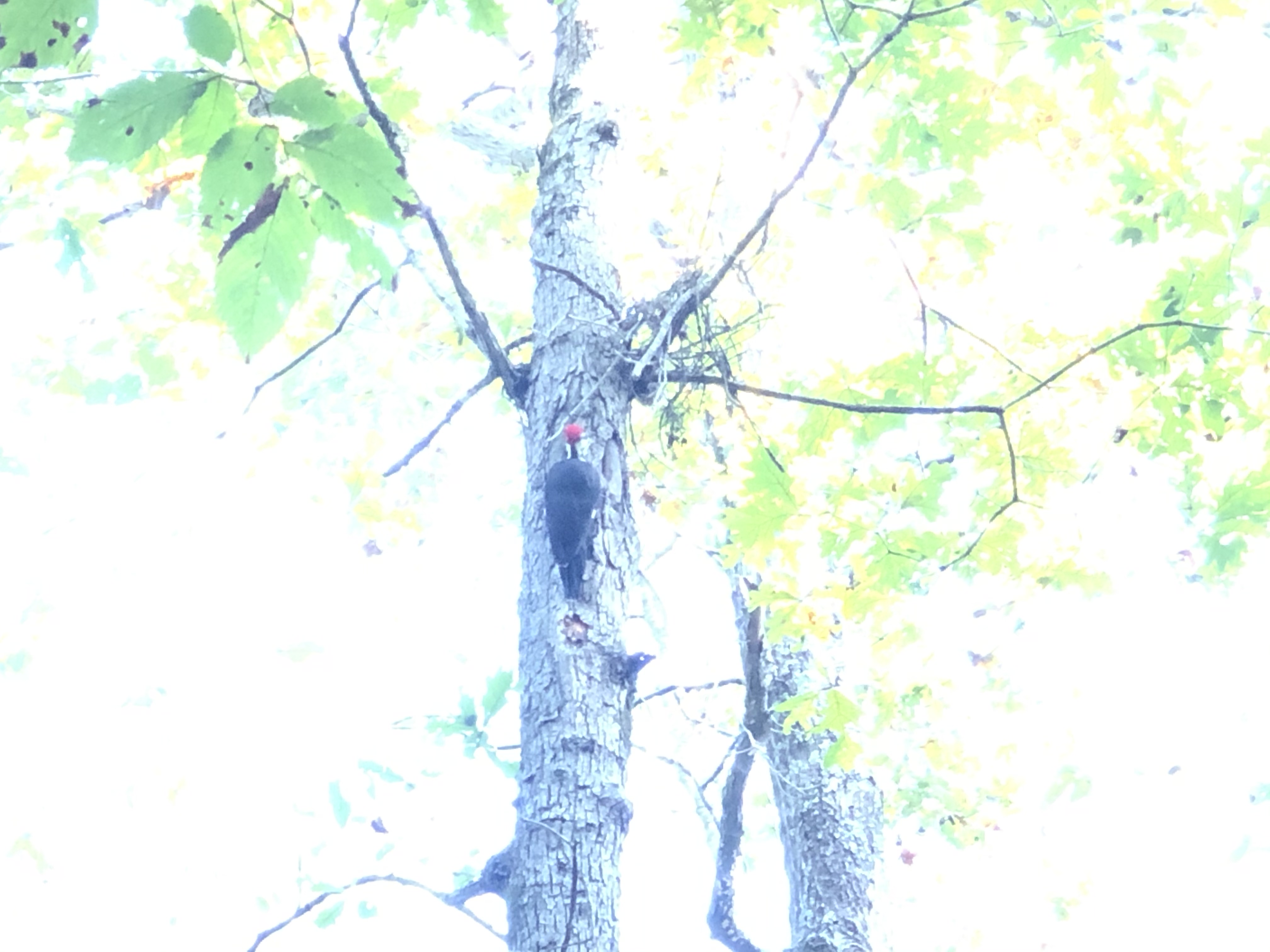
Pileated woodpecker at Bennett Spring State Park
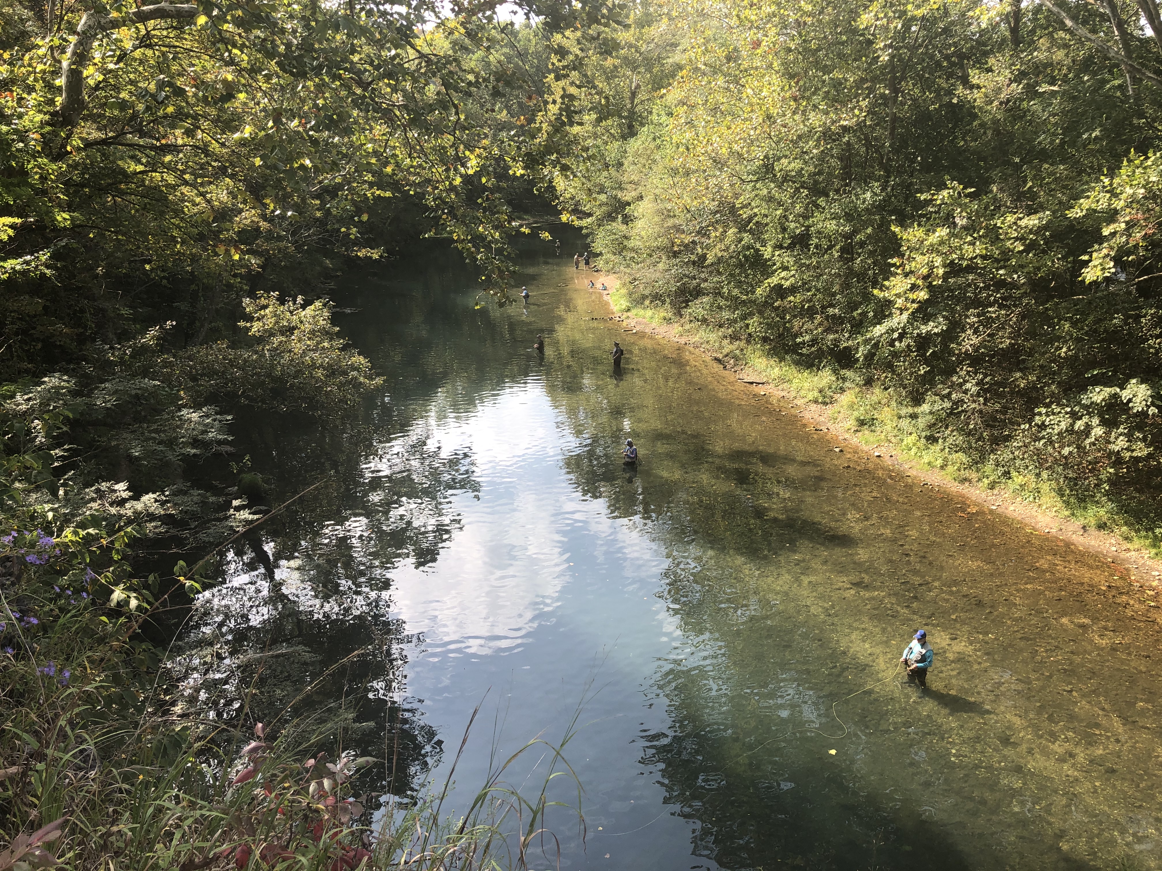
The views from Whistle Trail are quite wonderful at times, especially because of its proximity to the water and the path it cuts through the lush surrounding forest. I was lucky enough to encounter a pileated woodpecker, only my third sighting of this magnificent species to date. Typically, I prefer the solitude that hiking trails offer, but in this case, it was quite entertaining to watch people wading in the stream trying their luck at hooking a rainbow trout, which I could easily see swimming all around the anglers in the crystal-clear water. The Missouri Department of Conservation stocks the branch daily during the regular fishing season, from March through October, and there is a hatchery located near the spring. The park attracts over a million anglers a year. From what I have heard, there are so many people in the stream fishing when the season first opens that you can barely see the water!
Anglers in Bennett Spring branch
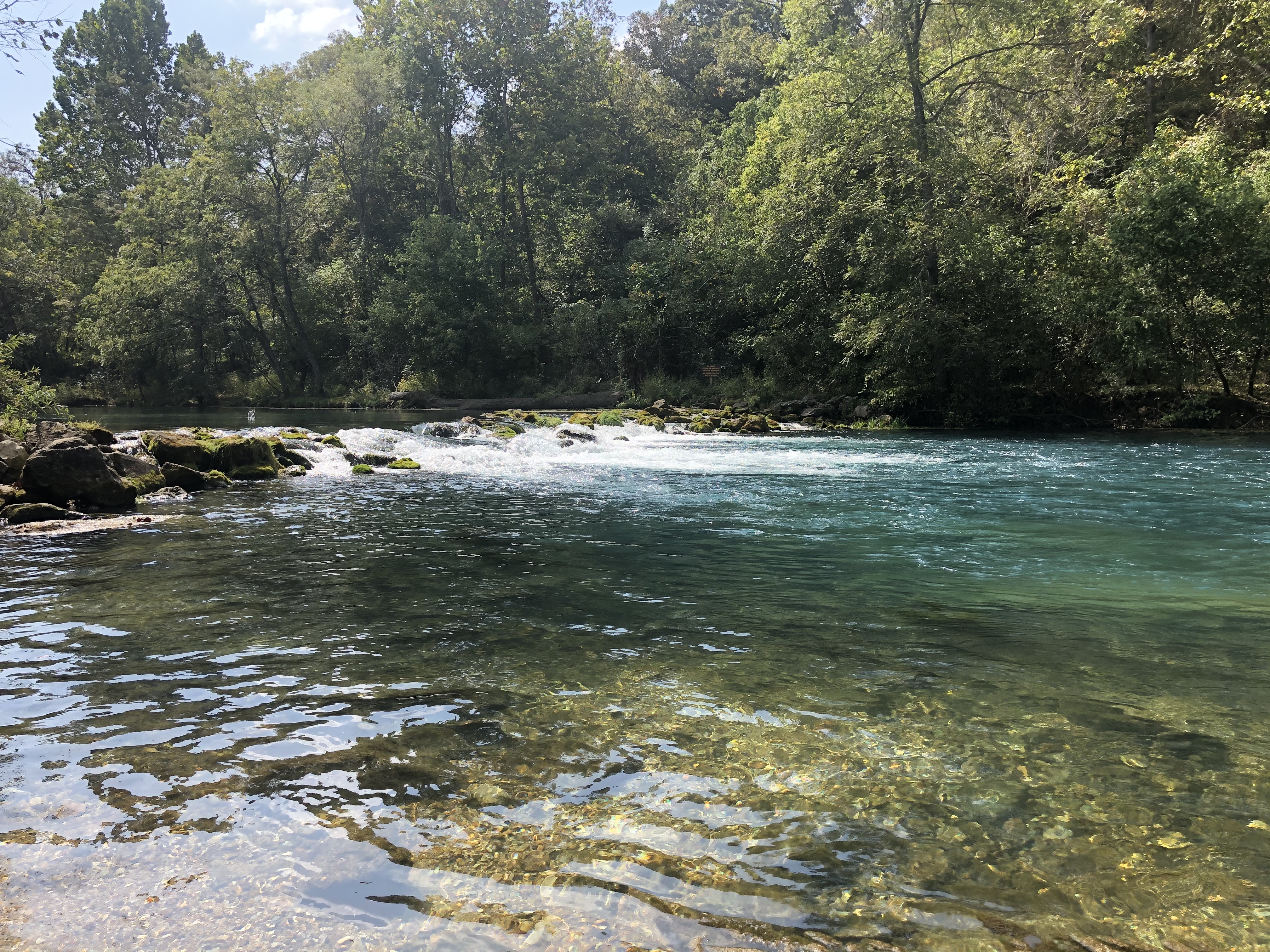
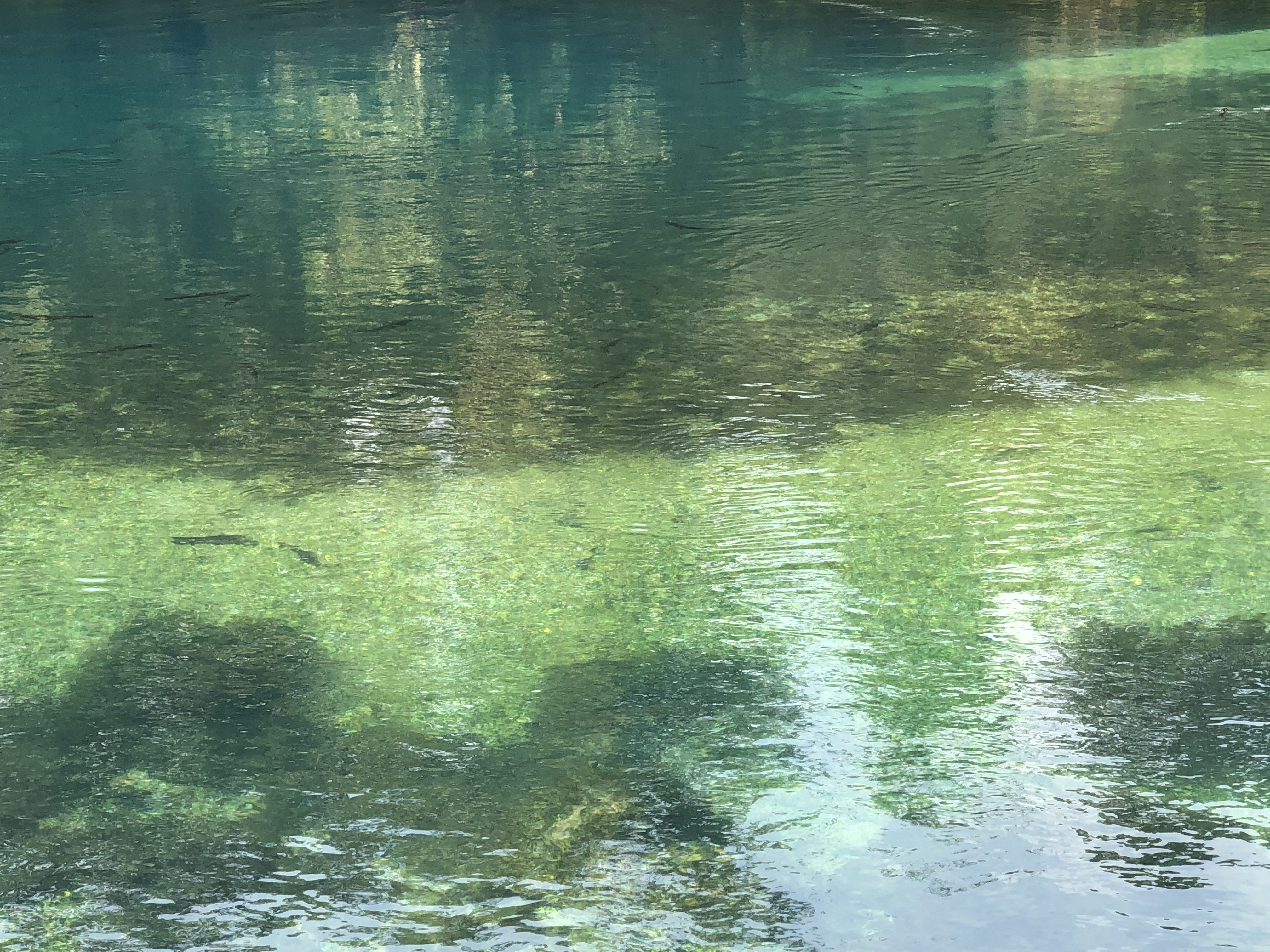
I spent the rest of my time wandering around the buildings, other structures, camping sites, and open grassy areas, just enjoying the beauty of the surroundings. I sat in a swing by the spring branch watching families fish and play in the water. For the last hour or so I explored the spring itself, which creates a gorgeous pool of blue-green water about 50 feet in diameter. Again, the trout are clearly visible swimming just below the surface. The water emerges from a 20-foot-wide seam at a temperature of approximately 57 degrees Fahrenheit. Discharging 100 million gallons per day, the spring creates the trout stream that meanders 1.3 miles through the park before flowing into the Niangua River. Bennett Spring is the principal groundwater outlet for the extensive karst geographical area in south-central Missouri.
Trout swimming in Bennett Spring pool
Missouri has over 90 state parks, and Bennett Spring is among the most popular. A variety of interpretive programs are offered at the park for all ages. The park’s concession hosts offer fly fishing classes too. Canoes, rafts, and kayaks are available to rent for floating on the Niangua. There are multiple options for lodging including a motel, cabins, and camping sites. With seven hiking trails ranging in distance from 1.3 to almost 12 miles and elevations from 849 to 1,102 feet above sea level, hikers can get their fill of exercise, wildlife gazing, and plenty of fresh air. I found the property to be just what I wanted for a day trip, but a weekend would be lovely too. Bennett Spring State Park represents the best of what the Ozarks has to offer for outdoor enthusiasts. I highly recommend a visit.
Kayakers entering Niangua River from Bennett Spring branchLosing stream behind Bennett Spring
When the Flannery O’Connor-Andalusia Foundation decided it was time in 2002 to make the author’s farm home in Milledgeville, Georgia, available for public tours, we began exploring various ways we could attract visitors to return to the property after they had already seen the house and outbuildings. Of course, the almost-worshipful fans of O’Connor would travel great distances to make the pilgrimage multiple times and never tire of standing at the door of her bedroom/study, strolling around the farm complex, or sitting in the rockers on the wide front porch to read, chat, or simply gaze across the lawn at the line of trees in the distance. I wrote a post about these folks several years back. However, as the director of the organization, I was charged with developing activities, programs, and attractions that would bring less-devoted visitors back to Andalusia, including locals.
During the thirteen years I was at Andalusia, we developed an annual lecture series, brought authors to the farm, hosted an annual Bluegrass concert, and worked with other institutions and organizations to sponsor various programs on site and around town. We also opened a gift shop that would bring local residents out to the farm, especially near the holidays. We welcomed groups to the property for school field trips, college classes, book club meetings, and even a wedding. Our ongoing restoration projects attracted people from around the state interested in historic preservation.
Bluegrass concert at Andalusia
All these efforts paid off and boosted the annual visitation numbers, which also increased revenue through sales, fees, and donations. The most ambitious project we undertook toward this end was designed to attract visitors who may not have much interest in O’Connor or her work at all – hard to imagine. Beginning in 2003, the Foundation applied for and received a series of grants from private organizations to develop an outdoor learning center. This long-term project helped us expand the interpretation of Andalusia by making the natural connection between O’Connor’s work and the landscape that inspired so much of it.
A good portion of Andalusia is covered in trees, with open fields interspersed across the property. In some areas, the forest is dense enough to act as a buffer from the encroaching development that surrounds Andalusia. A common image in many of O’Connor’s stories is a line of trees, which often serves as a metaphorical passageway to revelation. The woods can be an area of sanctuary or the place for terrifying encounters. At other times, trees are personified, like witnesses to the events unfolding in the story.
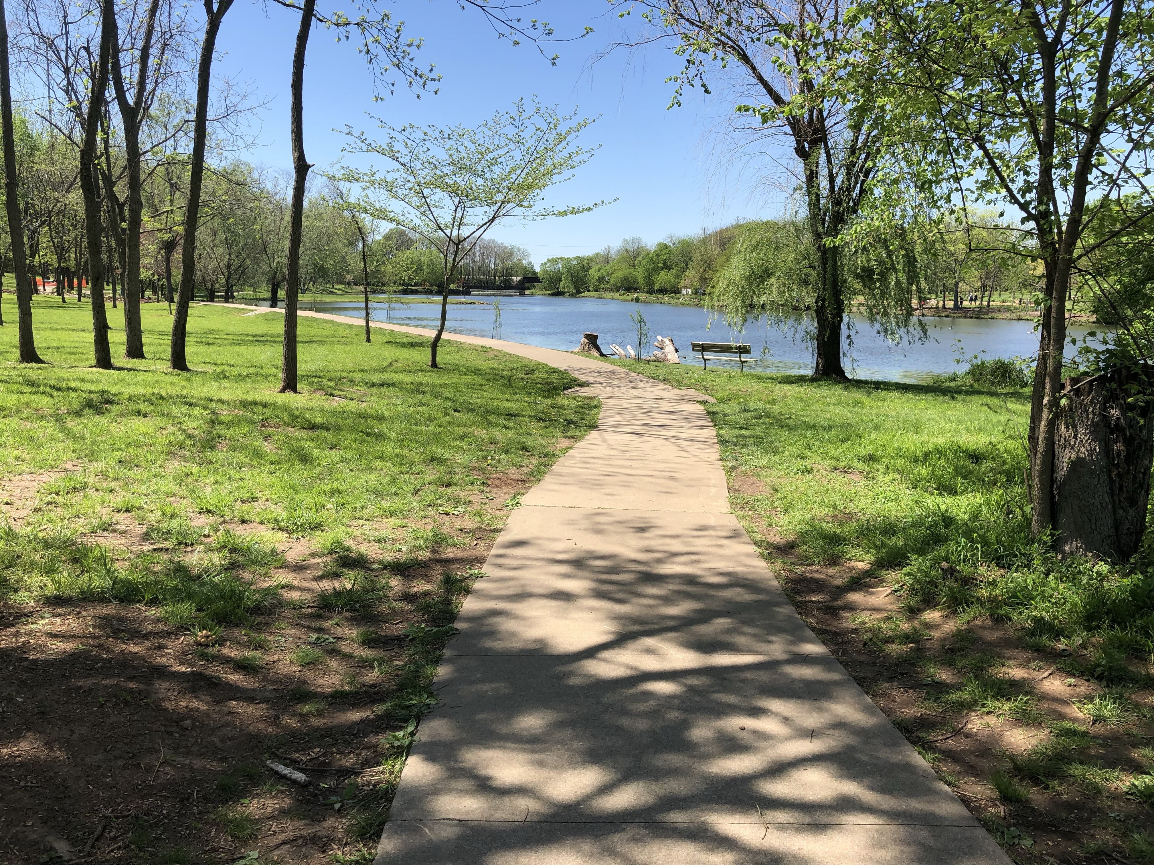
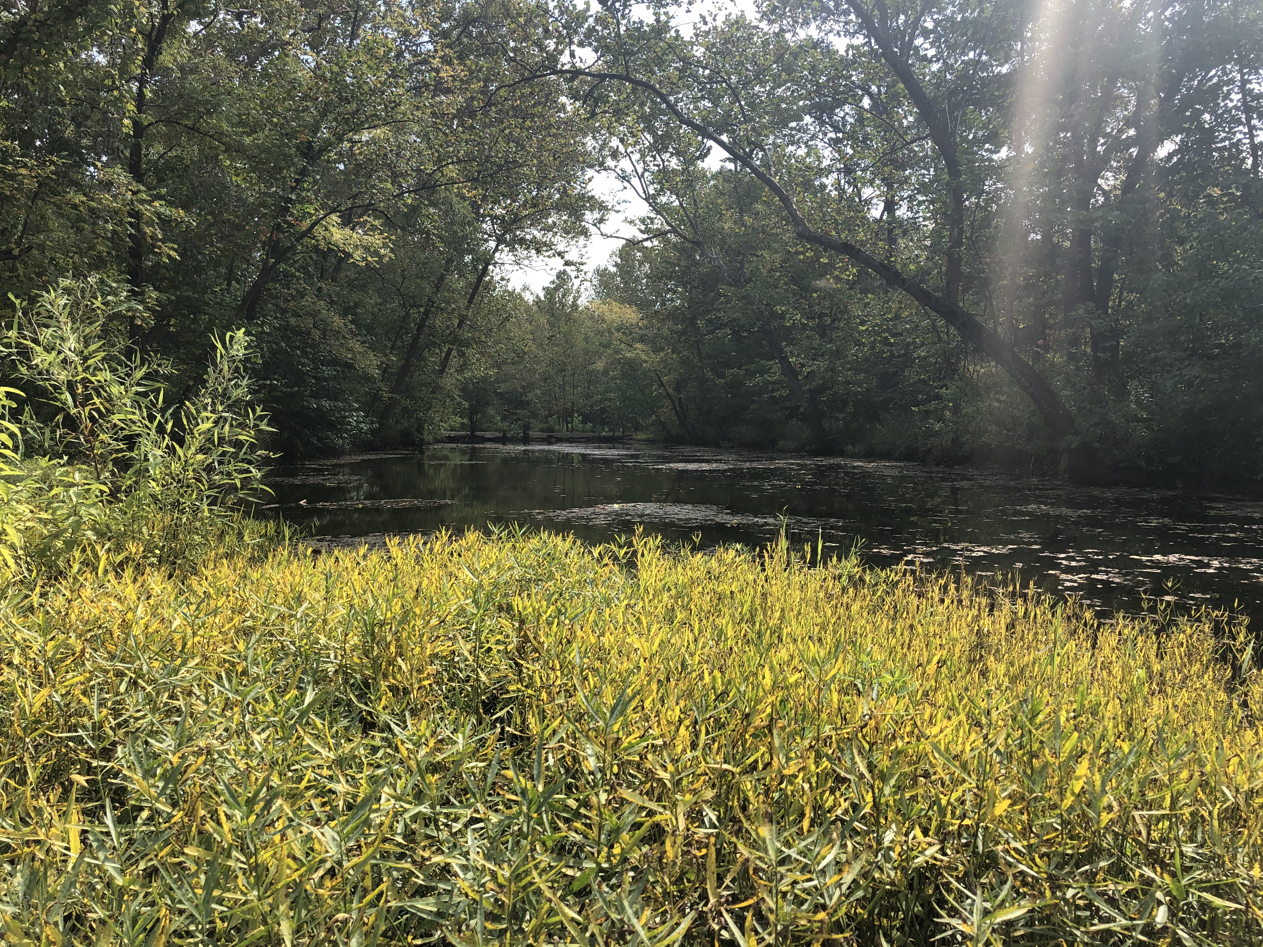
The first phase of the outdoor learning center was the renovation of a half-acre livestock pond located down the hill and in view from the front porch of the main house. The pond dated back to the 1950s when the farm was operating as a dairy. Understandably, when in 1976 the PBS producers were looking for a location to shoot their film adaptation of O’Connor’s short story, “The Displaced Person,” they selected Andalusia. Both the opening and closing scenes of that movie were filmed from the dam of the pond, looking back up the hill at the main house. We hired a local independent contractor who had retired from the U.S. Soil and Conservation Department. His team drained the old pond and completely rebuilt the dam with a new drainage pipe. It took several months for the spring fed pond to completely fill again. It was beautiful.
Restored pond and main house at Andalusia
All visitors to O’Connor’s home could appreciate this easily accessible water feature, but for her readers, the pond may have taken on even greater significance. As a devout Roman Catholic, Flannery O’Connor understood the symbolic importance of water, especially the Sacrament of Baptism, and incorporated the theme in her fiction. To many of O’Connor’s characters, water represents purity, initiation, sanctuary, and salvation. Water provides both literal and figurative cleansing. Some of the most climactic scenes in her fiction involve water.
Restored pond at Andalusia
The second phase of the project took several years to fully accomplish and consisted of two nature trails. The first was a short trail around the pond. The second was a much longer trail through the forest taking off on either side of the dam of the pond. Again, we hired our local pond builder to design the trail and cut the eight-foot wide path through the trees. In two places it crossed Tobler Creek, which runs through the middle of the 544-acre property. In the following years after the trail’s completion, we installed bridges over the creek, other foot bridges over wet areas, benches and picnic tables, and interpretive signs. We were fortunate to have plenty of volunteers from the community, from Georgia College in Milledgeville, and from boy scout troops to help with these enhancements to the trail.
Bridge over Tobler Creek at Andalusia
Again, this feature of the property is attractive to a broad audience, including school groups and locals looking for a place to enjoy the outdoors and perhaps to get a glance at wildlife. Andalusia is home to a variety of birds, mammals, reptiles, and amphibians. Natural stands of pine and hardwoods, along with the open field areas, are ideal habitats for deer, songbirds, dove, quail, turkey, and squirrels. The undergrowth in the forest offers an environment suitable for smaller animals such as rabbits, chipmunks, armadillos, lizards, and snakes. The waterways and floodplains provide food and shelter for beavers, frogs, turtles, and aquatic birds, including the great blue heron. Natural predators on the property include foxes, coyotes, and birds of prey such as hawks and owls.
Nature trail at Andalusia
In 2010, the Foundation decided to name the outdoor learning center after Dr. Bernard McHugh Cline, an uncle of Flannery O’Connor. Dr. Cline was a physician who practiced in Atlanta and acquired the Andalusia property in the early 1930s. He enjoyed raising and riding horses on the farm when he came down from Atlanta on the weekends. Dr. Cline also purchased wooded tracts to the north of the farm from other owners, which remained undeveloped for many years as a wildlife preserve.
Nature trail at Andalusia
The development of the outdoor learning center added to the aesthetic value of Andalusia, but it also provided funding opportunities from grants and donations that even extended beyond the outdoor resources. A major organization that supported the nature trail’s construction later made a significant gift toward the restoration of one of the outbuildings at the farm. Professors and students used the pond and trails to conduct various experiments and to identify and catalog the flora and fauna there. The Foundation hosted workshops, lectures, and other programs exploring the natural resources of the center. I was as pleased with the outcome of this project as I was with any of our accomplishments at Andalusia.
Ten years is a long time, or way too short, depending on the circumstances. In 2018, my wife and I celebrated our ten-year anniversary. A decade seems like a natural milestone in the course of a lifetime and a marriage, so we decided to do something special to commemorate the occasion. Traveling brings us a great deal of pleasure, so we decided to spend a few days in a place that would offer some of our favorite elements of “getting away:” rest, relaxation, beauty, hiking, sightseeing, and of course, good food. Shortly after we married, we made a trip to Phoenix, rented a car, drove up to the Grand Canyon, and came back through the mystical and magical town of Sedona, Arizona. We told ourselves that someday we would come back and spend more time wandering around and getting a closer look at the iconic red rocks there. This special anniversary turned out to be the perfect time for a return to Sedona.
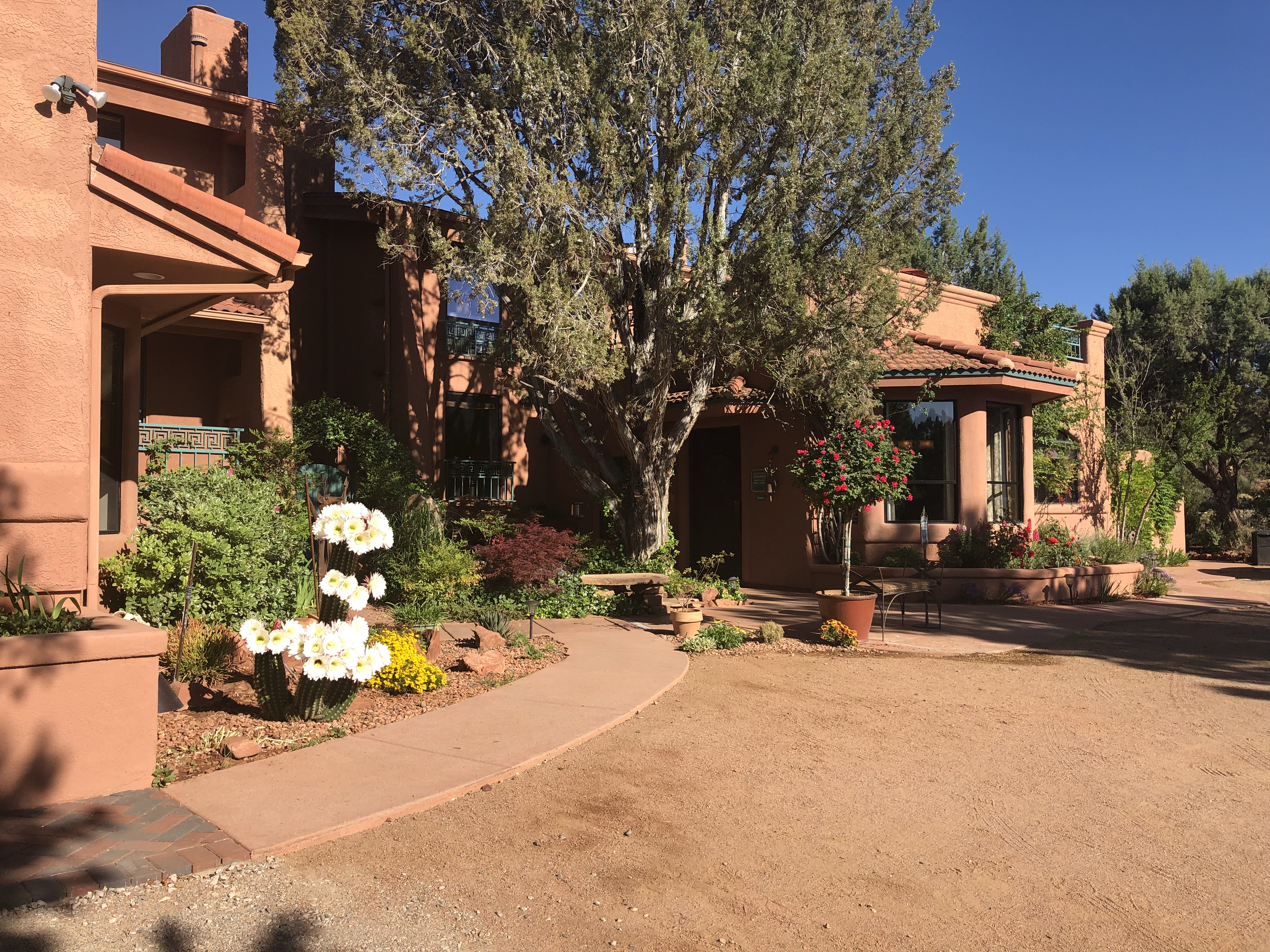
Casa Sedona Inn
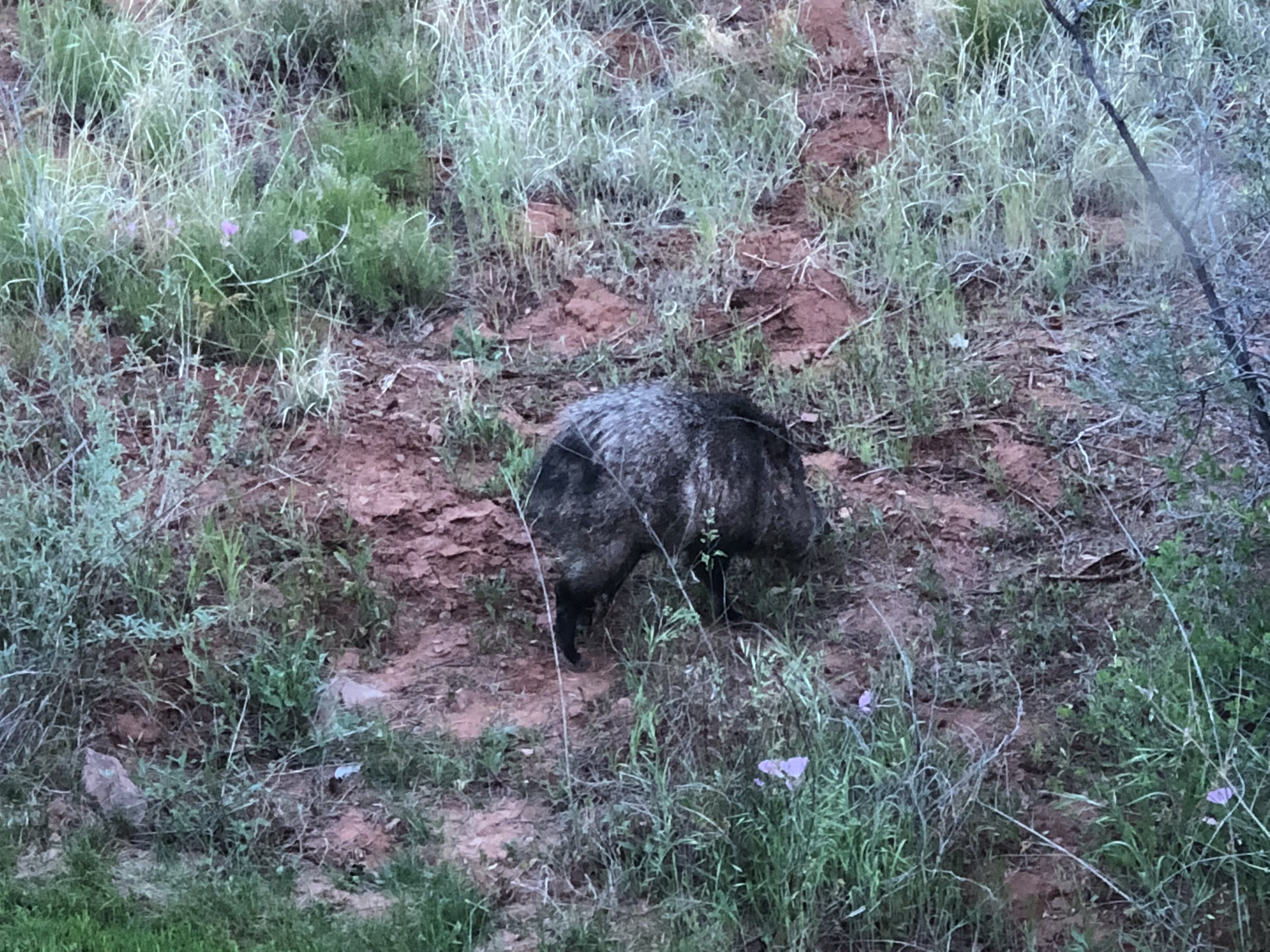
My wife found the perfect spot for us to stay a couple of nights. The Casa Sedona Inn is a small inn located on the west side of town with luscious gardens, bubbling fountains, comfortable rooms, and stunning views of the red rocks nearby. We had a private balcony overlooking the small pool and the wilderness area just beyond the property boundaries. We were both impressed with the hospitality of the staff, the quaint restaurant, the fine collection of art throughout the building, and the irresistible southwestern charm. Not nearly as exciting to my bride but an added treat for me was the wildlife we could see from our balcony and windows, including a few deer and what I mistook for a wild pig. Having previously lived in the southwest, my wife identified the creature as a javelina. Unlike the European swine most often seen domesticated on farms or in the wild in the eastern United States, these mammals are native to the Americas. Admittedly, this photo of the critter may not exactly exemplify the romantic tone of this post, but how could I resist?!
Javelina
For our anniversary hike we drove a short distance out of town to Devil’s Bridge Trail. We had grand ideas of actually making it all the way to the often-photographed natural sandstone arch, but the trail turns into more of a climb near the end. We were satisfied with the five-mile out and back trek we made, which afforded some amazing views of the red rocks and distant mountain peaks. I never get tired of turning a corner, coming out into a clearing, or cresting a hill on a hiking trail to be transported by a vista that simply defies description.
Sedona’s red rocks from Devil’s Bridge Trail
Scenic views from Devil’s Bridge Trail in Sedona
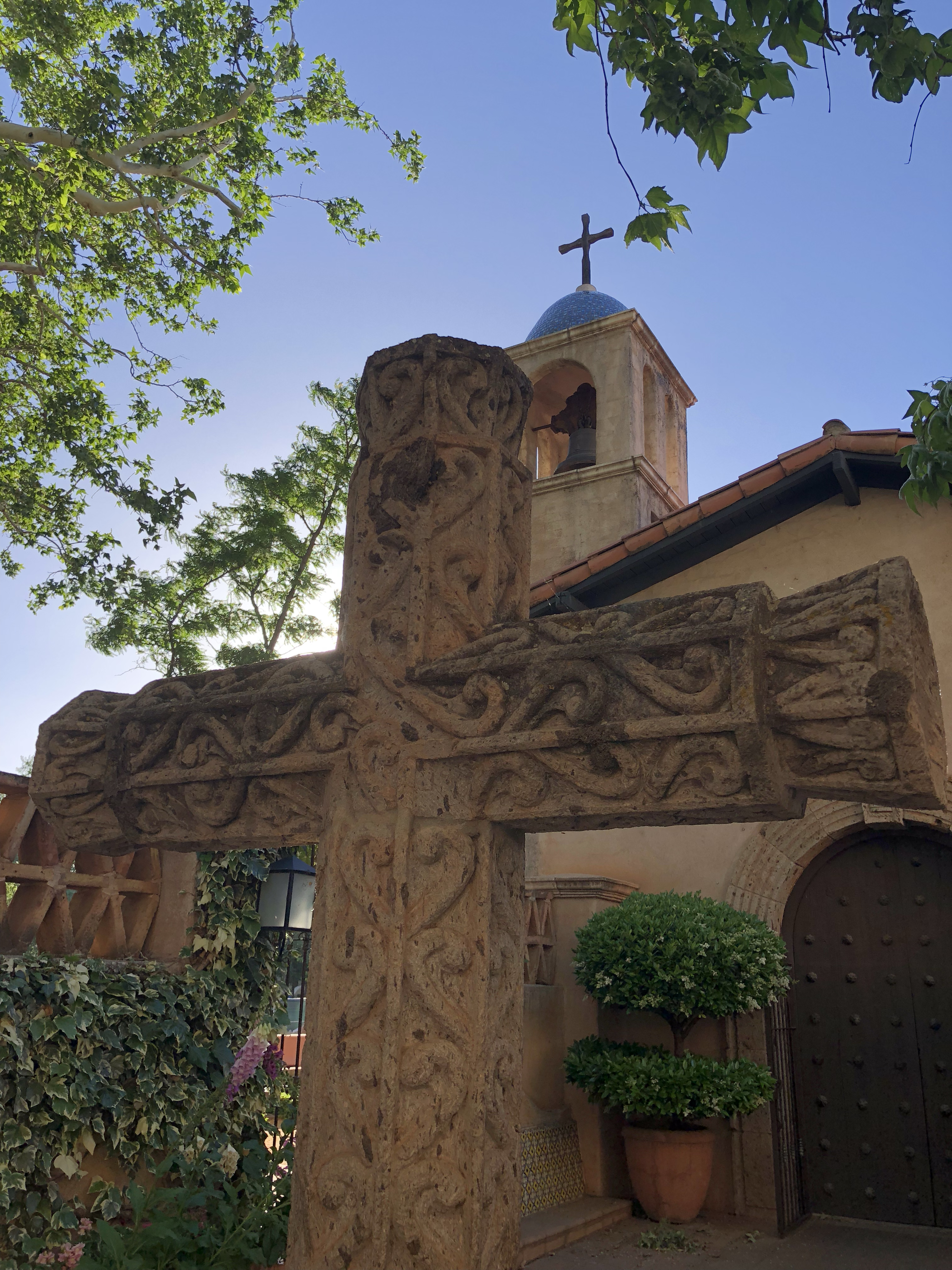
Sedona is a tourist town in the best and perhaps the worst sense of the phrase. People from around the world come here because of the town’s reputation as a center of cosmic energy that is conducive to healing, meditation, and self-exploration. Somehow the red rocks, with their high concentration of iron-oxide, are thought to create a gravitational field of exceptional force. I have my doubts, but I do know that the force of commerce is quite real in Sedona — there are plenty of retailers. It is a fine vacation spot for families, with plenty to see and do. We especially enjoyed spending time in Tlaquepaque Arts and Crafts Village, where we had an exquisite dinner at Rene Restaurant and Wine Bar. We were seated next to a table of twelve — a wedding party that had just finished up in the little village chapel around the corner. They were an entertaining bunch.
The chapel at Tlaquepaque Arts and Crafts Village
On our final day in Sedona, we visited the Chapel of the Holy Cross. One of the guides at the chapel informed us that the giant crucifix had only been installed a few months before we arrived. Regardless of one’s approach to Christian faith in general or the Catholic Church in particular, this is an impressive work of art. We both sat for a brief time on one of the modest wooden bench pews, and I felt a deep appreciation for how the design of this chapel so eloquently compliments its natural surroundings, tucked into the rocks that look almost blood-stained.
Crucifix in the Chapel of the Holy Cross
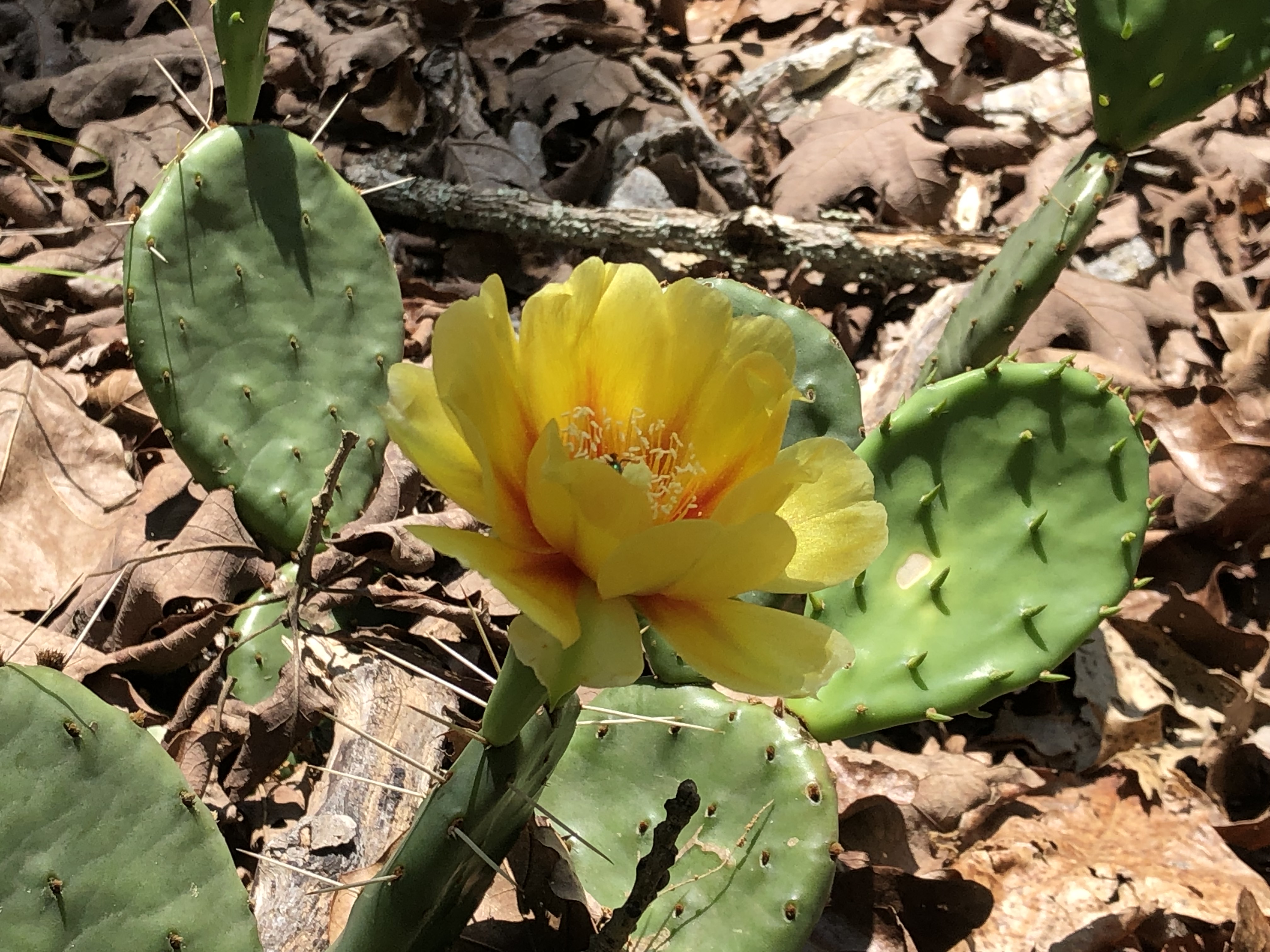
Blooming cacti near Sedona
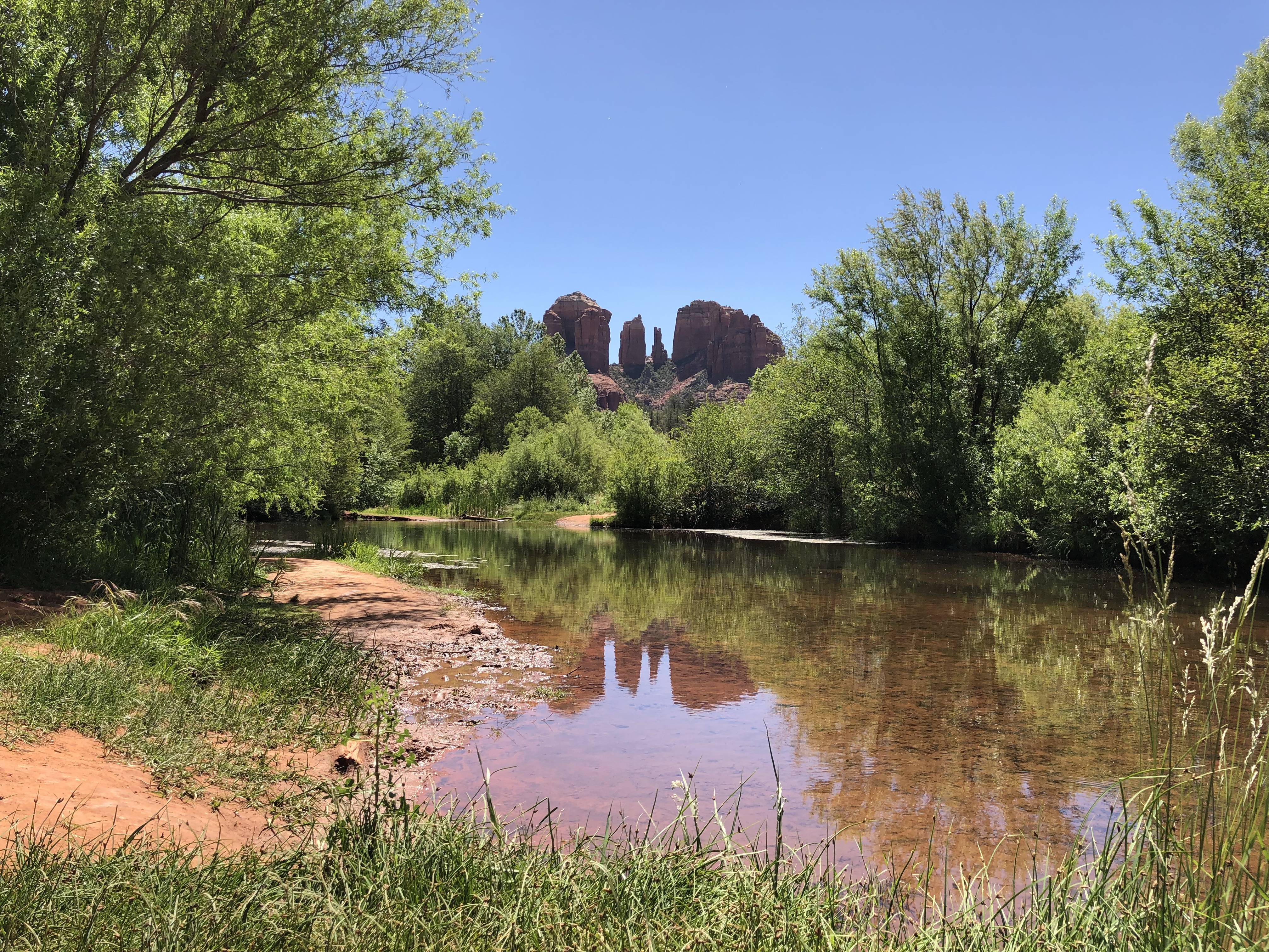
On our way out of town, we made a brief stop at Crescent Moon Picnic Area and Ranch, which was an ideal spot to walk along the banks of Oak Creek and stand in awe looking up at the peaks of Cathedral Rock. For those who think that Arizona is limited to dry desert sand and overwhelming heat, the Oak Creek Watershed is like a 50-mile elongated oasis of streams, falls, cascades, and pools in central Arizona that nourishes rich vegetation and wildlife. Somehow a metaphor about refreshing water in the desert and a relationship that continues to run even deeper and stronger after ten years seems an appropriate way to end this post. Suffice it to say, the return to Sedona was an excellent way to celebrate the “mystical” union of two people who are well married and immersed in the inexplicable power of love.
My wife and I have had the good fortune to walk and hike in some spectacular locations over the last ten years including England, France, and Italy. I have written a few posts about our treks in Montana, Arizona, New Mexico, Connecticut, Massachusetts, and California. I maintain that some of the best scenic walks or hikes in the United States are in California: around San Francisco, along the Pacific coast, and in the wine country, just to name a few. If pressed to choose my favorite hiking experience to date, that distinction would have to go to Yosemite in the Sierra Nevada mountains of California. Yosemite Valley is the most familiar destination in this region to so many visitors, but Yosemite National Park covers 1,200 square miles. First protected in 1864 by the federal government and the state of California, Yosemite is best known for its waterfalls, deep valleys, grand meadows, ancient giant sequoias, and vast wilderness.
We were at Yosemite for several days during July, 2013. A close friend who lives in California frequently visits Yosemite to relax, hike, and take fantastic photographs — a hobby that has in recent years almost become a vocation. She was generous enough to be our guide, taking us to some of her favorite places to hike and witness the beauty of this amazing place. We stayed in a comfortable cabin about 45 minutes south of the valley near the village of Mariposa. For our first outing, we explored the meadows around the Merced River between Sentinel Beach and Cathedral Beach, which offered stunning views of the rocky cliffs of El Capitan and Cathedral Spires. The meadows with their lush riverbanks are large enough to provide some privacy and a good place to escape the crowds that gather near the camping sites and the more popular attractions in the park. We spent the early afternoon taking photographs and wading in the cool waters of the Merced River where it pools in the numerous bends as it winds its way through the valley.
Wading after hiking at Yosemite
On our second day, we spent some time at two of the most familiar waterfalls in the valley. Bridalveil Fall is the thin, tall spray that is visible on the right from the famous Tunnel View, the place where Wawona Road exits the tunnel and the place where most visitors get their first glimpse and photographs of the breathtaking vista of Yosemite Valley. There is a trail that leads to the base of the fall, where the water crashes against gigantic boulders and disperses a fine mist over an area about an acre in size. The best time to view the falls at Yosemite is the spring, when the melting snow creates the largest volume of water spilling over the soaring rock cliffs. Even in July that year the water was still running enough to make for a spectacular performance. We also walked up to the base of Lower Yosemite Fall, and then treated ourselves to afternoon cocktails in the courtyard of the Ahwahnee Hotel, now called the Majestic Yosemite Hotel. While sipping our drinks under the umbrellas, my eyes were drawn upward to the cliffs rising from the valley floor. Our friend identified the peak as Glacier Point, and I asked, “Can we get up there?” She explained that Glacier Point Road takes off from Wawona Road and leads to an observation point with a picnic area and restrooms. We decided that we would have enough energy by the next morning to explore the hiking trails around Glacier Point.
When we arrived at around 9:00, the crowds had not yet started to gather at this famous lookout point, which offers one of the best views of Yosemite’s iconic Half Dome rock formation. We wandered around the site, experiencing the valley from a completely different perspective than the previous two days. Similar to standing on the rim of the Grand Canyon, words fail to describe the spectacle. Even explorers like John Muir had difficulty. Our friend, who is twelve years our senior, challenged us to take the hike from Glacier Point up to Sentinel Dome, which rises about 900 feet from the trail head and peaks out at over 8,100 feet above sea level. “I won’t be happy unless I’m at the top,” I said. We strapped on our backpacks, which included our lunches, and headed up the winding trail through the evergreens toward the summit. When there were breaks in the trees, the views along the way were fabulous. The last hundred feet of the trail opened up to bare rock and was fairly steep. The reward for making it to the top was well worth the effort. Sentinel Dome presented far-reaching vistas in all directions: to the west down the valley to the Merced River canyon and to the north the massive expanse of El Capitan and Yosemite Falls. At this elevation, the peak of Half Dome is in clear sight and is only 700 feet higher. I couldn’t resist hopping up on the large rock that crowns the dome for a selfie with Half Dome to commemorate the occasion.
On the peak of Sentinel Dome at Yosemite
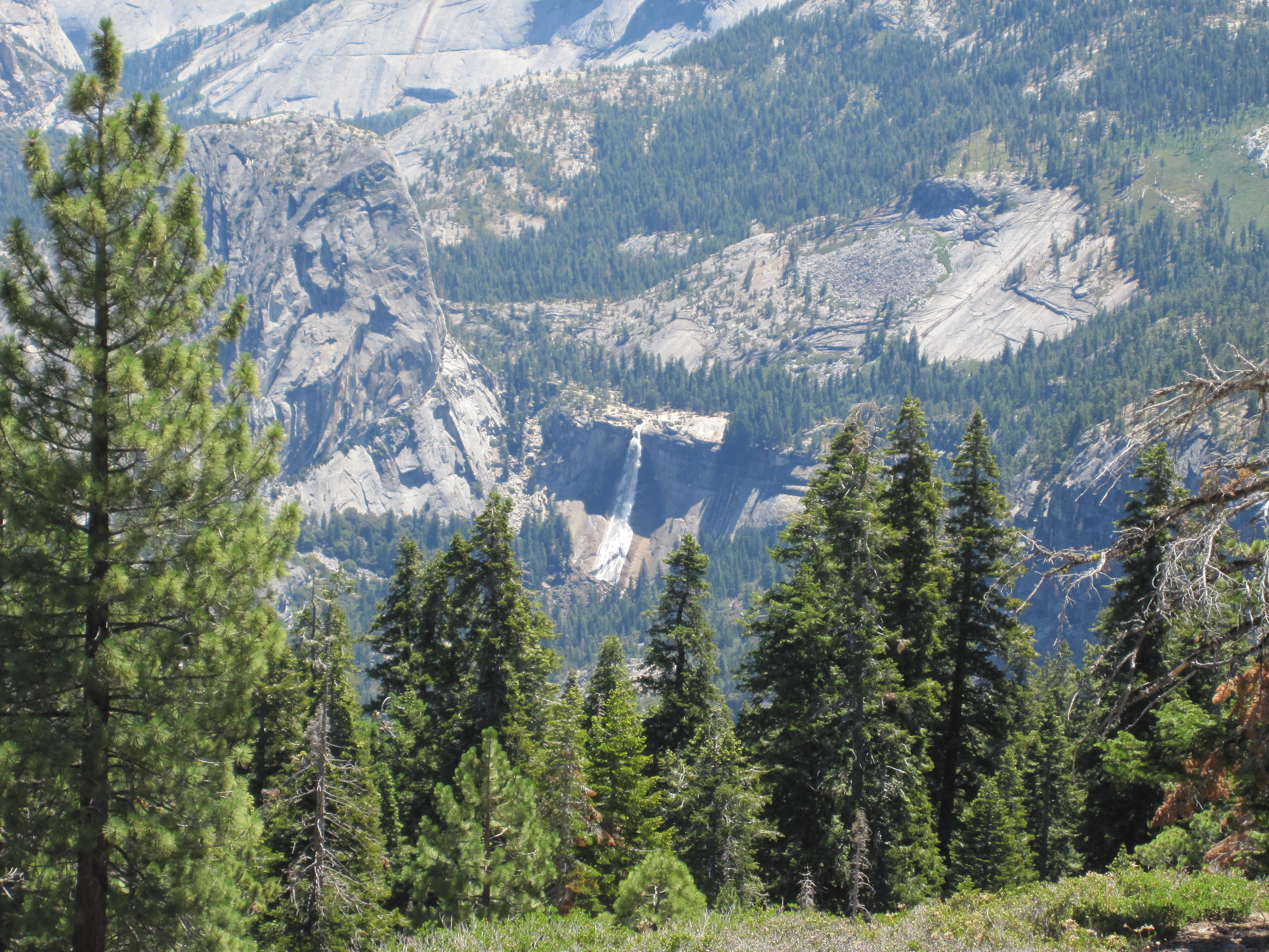
To employ poor puns to the fullest extent, how do you top such an uplifting experience? On our way back down the trail, we stopped for lunch on some large rocks at an opening looking out to the east. We could just make out the remaining snow on the High Sierra peaks in the distance. Below our perch across a considerable expanse, we could see Nevada Fall making its contribution to the Merced River. At the brief intervals when there was no wind through the trees, we could just barely hear the distant roar of the water crashing down the crag to the huge rocks at the fall’s base. With tired legs and sore feet, we refueled on sandwiches and fruit, realizing that we were totally immersed in one of those wonderful moments where friendships, nature, and a deep appreciation of life converge to present memories that never fade. My wife and I continue to travel and look for opportunities to hike, especially at locations where we can enjoy beautiful scenery. Perhaps at some point I will have an outdoor encounter that impresses me even more than the morning at Sentinel Dome did. I truly look forward to it.