Exploring Bennett Spring State Park

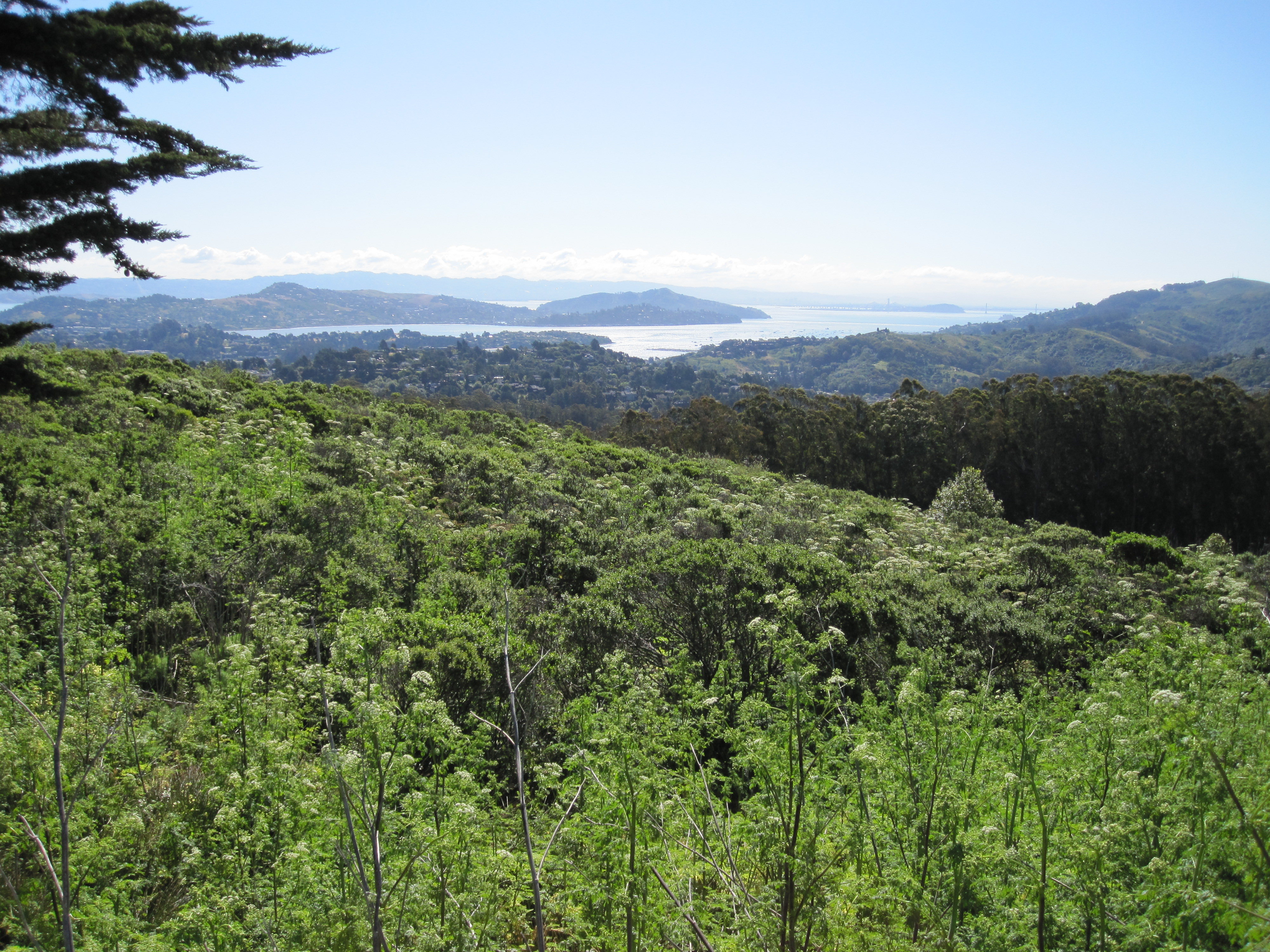
Missouri is often referred to as the “Show Me” state, a reference to a late 19th century lawmaker’s observation that its citizens as a rule prefer visible proof over blind faith. Given the political climate in Missouri in 2021, I would argue that this moniker is no longer applicable. A much more accurate appellation would be the “Float Me” state. River and stream floating trips are a major source of relaxation in Missouri with a long history and a strong tradition. According to multiple sources, flat-bottom jon boats originated, or were at least made popular, in the late 19th century in the Ozarks because they were perfect for navigating the shallow waterways characteristic of the region of southern Missouri and northern Arkansas. With an abundance of large lakes, rivers, and streams, water recreation is a huge business in Missouri attracting millions of tourists each year; however, native inhabitants have been enjoying the simple pleasures of just floating downstream for many generations.

Not only is Missouri blessed with plenty of water resources, but the Ozarks comprises one of the nation’s richest concentrations of natural springs. There are well over a thousand of them in the state. The maximum daily discharge from some of these overflowing aquifers can exceed 500 million gallons. On average, more than a billion gallons of water flow from the ten largest springs in Missouri every single day. For many centuries, springs provided drinking water for settlements and towns throughout this region of the country and were later used for powering mills and producing salt. Some springs purportedly had healing qualities. In recent decades, these groundwater flows have predominately functioned as recreational resources centered around fishing, camping, hiking, and other outdoor activities.

One of the largest springs in Missouri is Bennett Spring, located in what is now Bennett Spring State Park in Dallas County. As one of the state’s oldest parks, this spring was the site for several grist and flour mills going back to 1846, the most successful of which was operated by a man named Peter Bennett, the namesake for the spring and park. In 1924-1925, the state purchased the spring and part of the surrounding area to create the park. In the 1930s, the Civilian Conservation Corps contributed much of the present-day character of the park, building cabins, a shelter house, roads, trails, the arched bridge across the spring branch, and the rustic dining lodge.

Bennett Spring branch

Bennett Spring State Park features many different ecosystems including rich bottomland and stream habitats associated with the spring valley and oak-hickory woodlands in the upland areas. Many animals native to the Ozarks make their homes here, including numerous pickerel frogs, northern water snakes, pileated woodpeckers, river otters, muskrats, and bobcats. The park’s diverse flora includes dense forests of trees, grasses, and herbaceous plants. Wildflowers such as bluebells and purple coneflowers flourish in the summer.

Bennett Spring branch headwaters

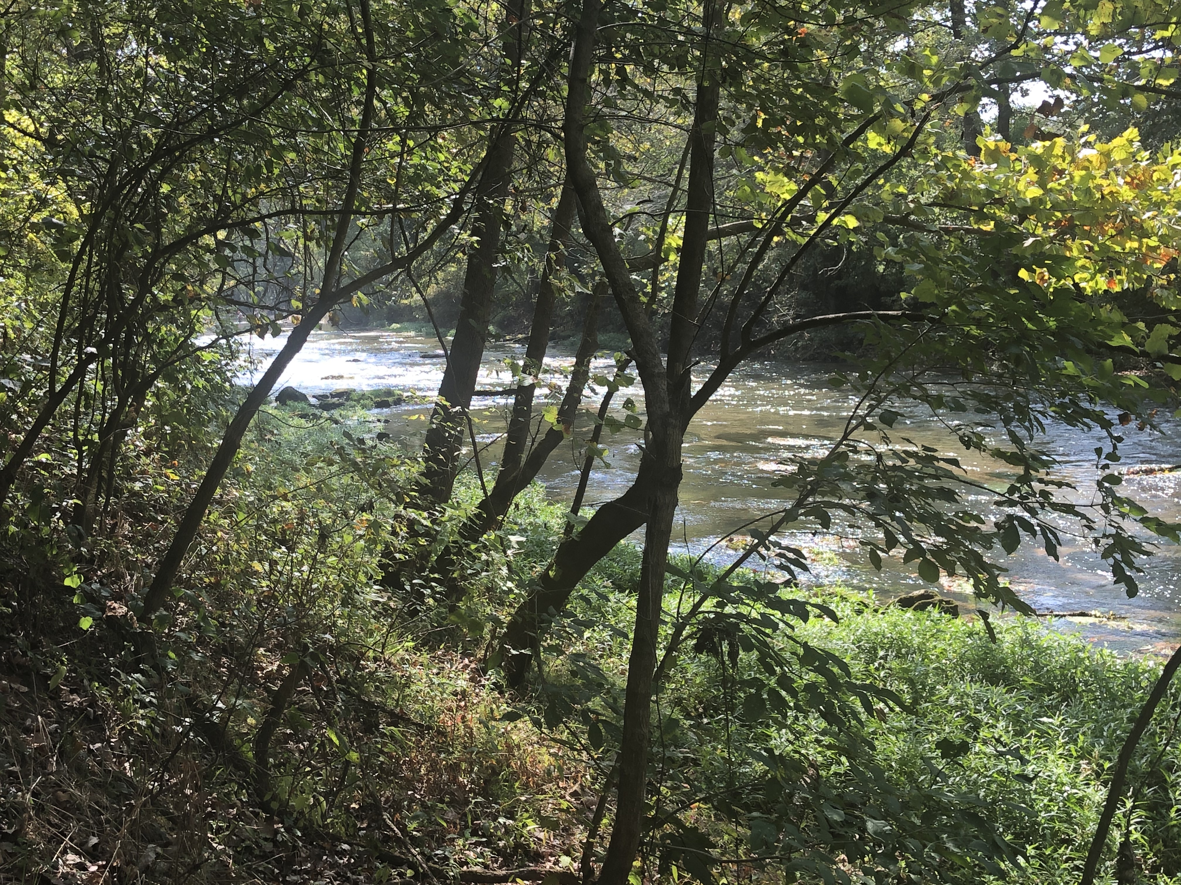
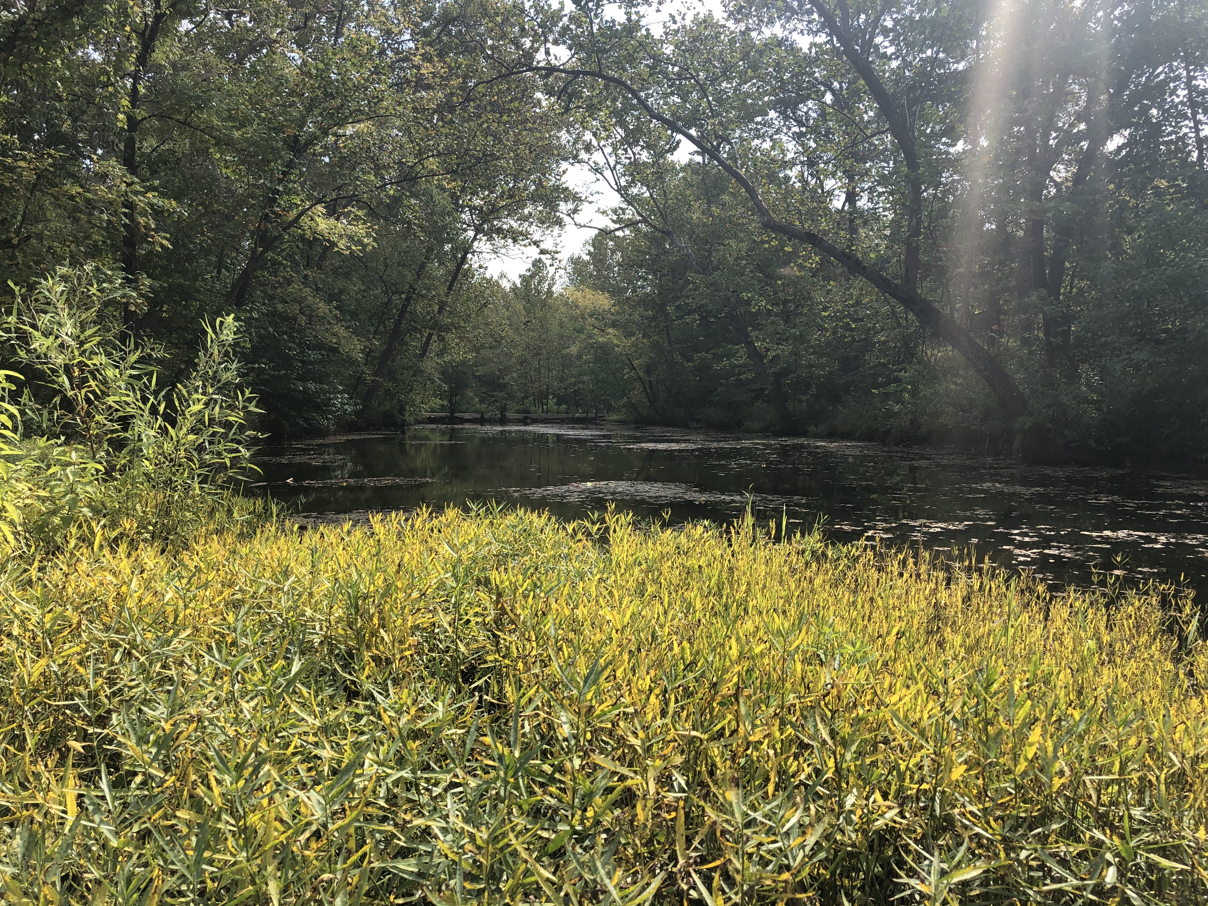
The park features a series of hiking trails, which is what sparked my interest in the late summer during the COVID pandemic and prompted a day trip to check out the site. Upon arriving at the park mid-morning, I made a quick visit to the Nature Center that serves to introduce visitors to the ecology of springs in general and to the natural resources specific to the park. I then made my way to Whistle Trail, which mostly travels along the east side of the spring’s branch, winding its way over the bluffs rising above the stream. It connects with other trails in the park that lead to the spot where the branch flows into the Niangua River, a tributary of the Osage River of south-central Missouri. According to the park’s website, Whistle Trail is likely prehistoric but was used more frequently by local inhabitants from the 1840s to the present.

Pileated woodpecker at Bennett Spring State Park

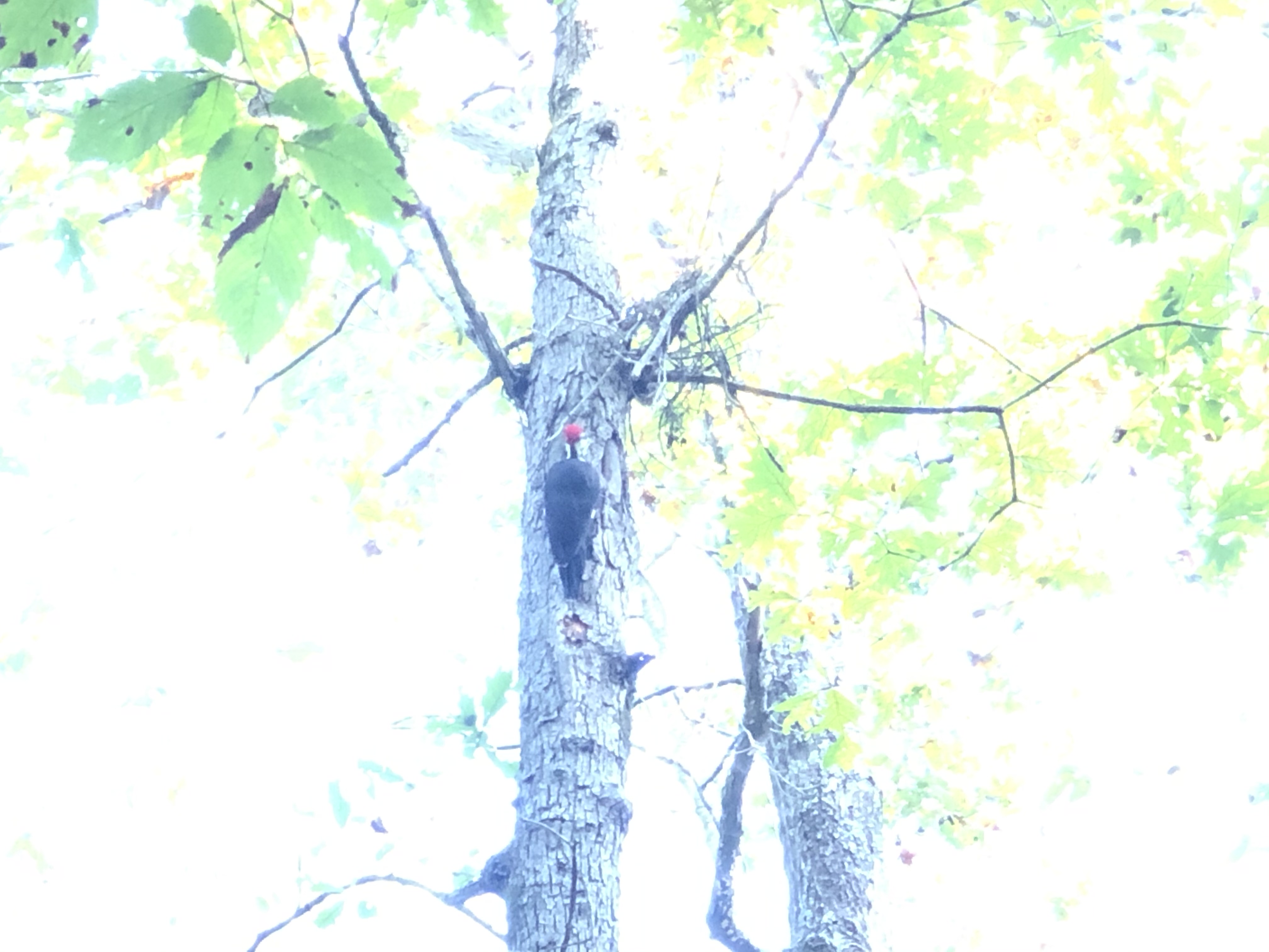
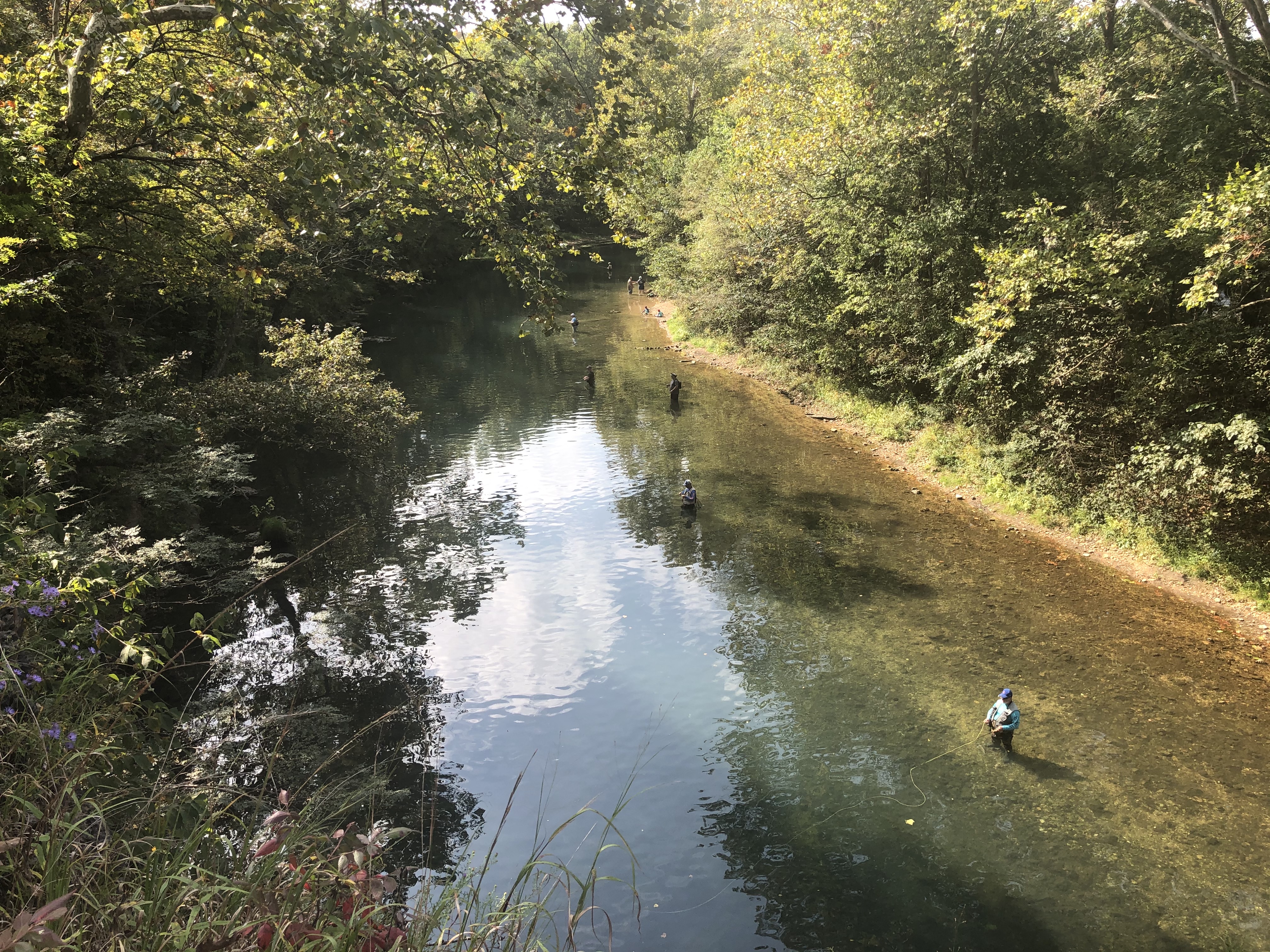
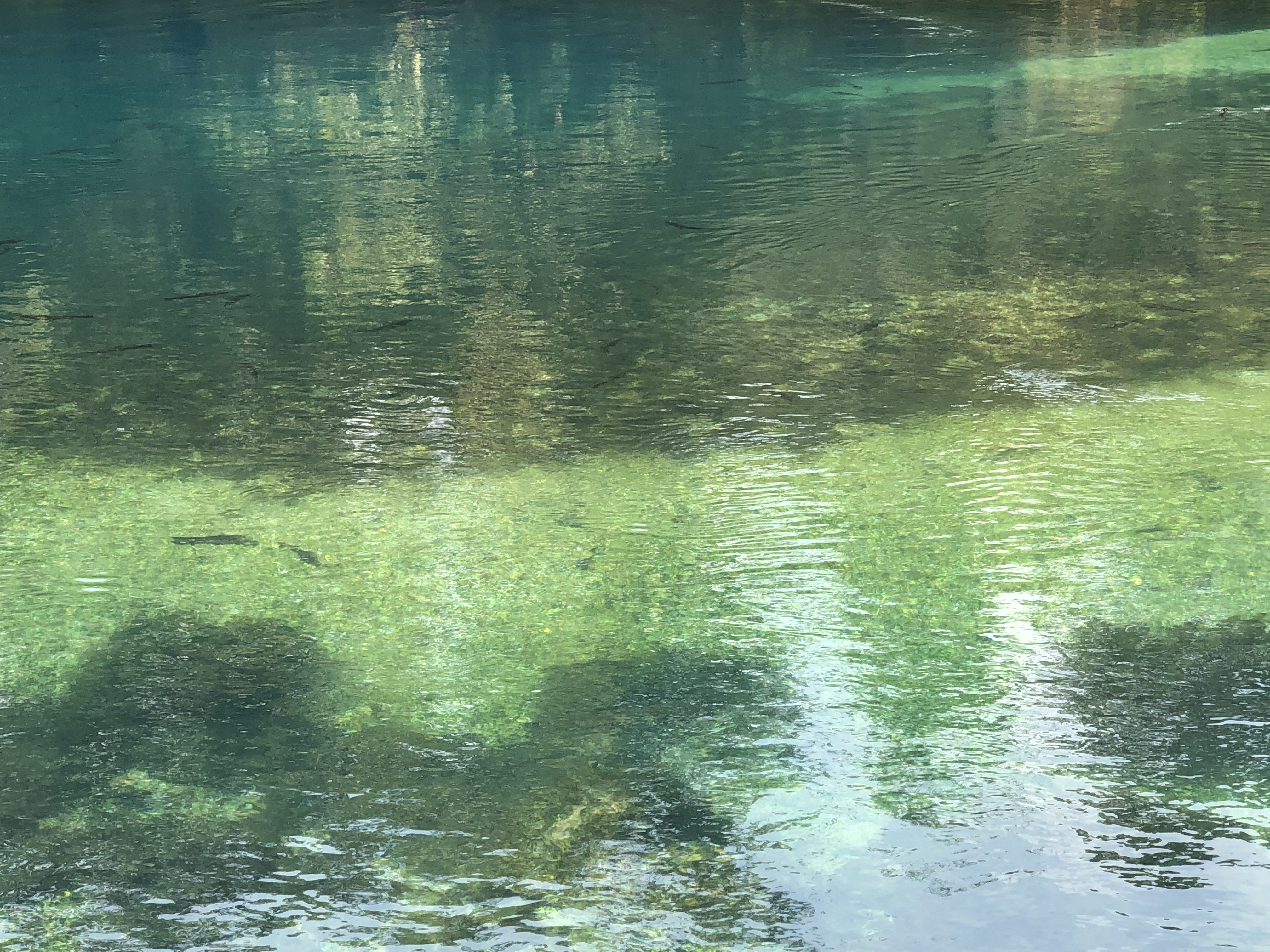
The views from Whistle Trail are quite wonderful at times, especially because of its proximity to the water and the path it cuts through the lush surrounding forest. I was lucky enough to encounter a pileated woodpecker, only my third sighting of this magnificent species to date. Typically, I prefer the solitude that hiking trails offer, but in this case, it was quite entertaining to watch people wading in the stream trying their luck at hooking a rainbow trout, which I could easily see swimming all around the anglers in the crystal-clear water. The Missouri Department of Conservation stocks the branch daily during the regular fishing season, from March through October, and there is a hatchery located near the spring. The park attracts over a million anglers a year. From what I have heard, there are so many people in the stream fishing when the season first opens that you can barely see the water!

Anglers in Bennett Spring branch

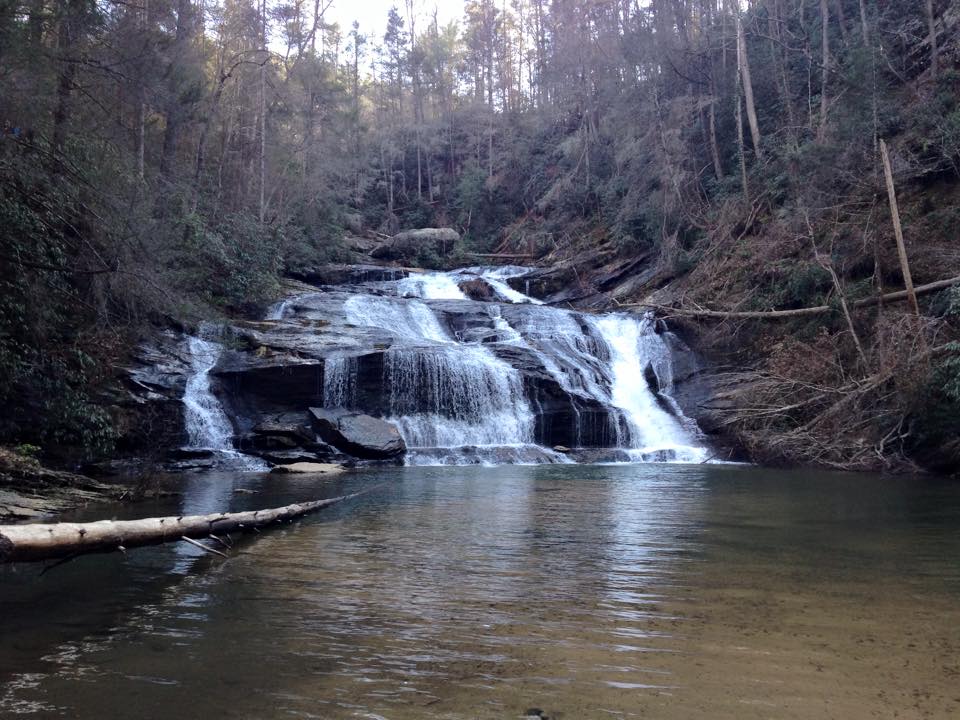
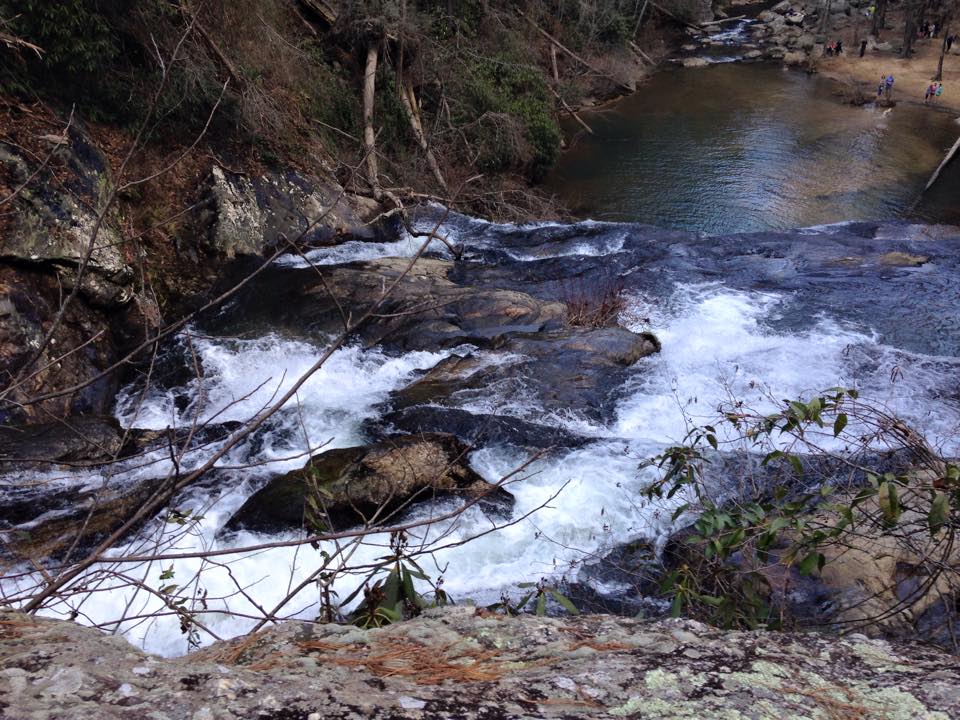
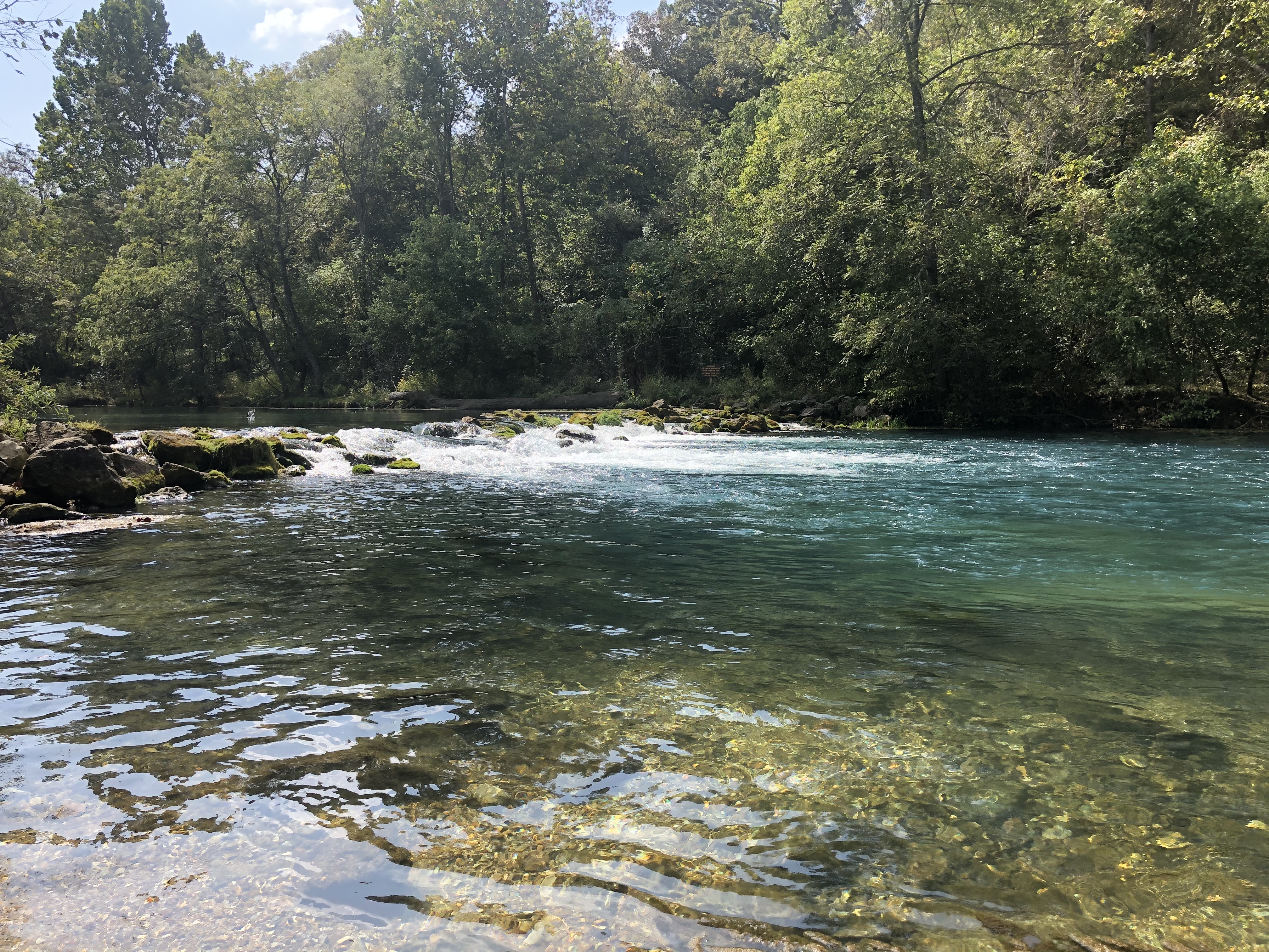
I spent the rest of my time wandering around the buildings, other structures, camping sites, and open grassy areas, just enjoying the beauty of the surroundings. I sat in a swing by the spring branch watching families fish and play in the water. For the last hour or so I explored the spring itself, which creates a gorgeous pool of blue-green water about 50 feet in diameter. Again, the trout are clearly visible swimming just below the surface. The water emerges from a 20-foot-wide seam at a temperature of approximately 57 degrees Fahrenheit. Discharging 100 million gallons per day, the spring creates the trout stream that meanders 1.3 miles through the park before flowing into the Niangua River. Bennett Spring is the principal groundwater outlet for the extensive karst geographical area in south-central Missouri.

Trout swimming in Bennett Spring pool

Missouri has over 90 state parks, and Bennett Spring is among the most popular. A variety of interpretive programs are offered at the park for all ages. The park’s concession hosts offer fly fishing classes too. Canoes, rafts, and kayaks are available to rent for floating on the Niangua. There are multiple options for lodging including a motel, cabins, and camping sites. With seven hiking trails ranging in distance from 1.3 to almost 12 miles and elevations from 849 to 1,102 feet above sea level, hikers can get their fill of exercise, wildlife gazing, and plenty of fresh air. I found the property to be just what I wanted for a day trip, but a weekend would be lovely too. Bennett Spring State Park represents the best of what the Ozarks has to offer for outdoor enthusiasts. I highly recommend a visit.

Kayakers entering Niangua River from Bennett Spring branch
Losing stream behind Bennett Spring

For more information, check out the Bennett Spring State Park website at
https://mostateparks.com/park/bennett-spring-state-park

San Francisco Hiking

For those who enjoy hiking, perhaps the first places that come to mind for the activity are wilderness sanctuaries offered at national and state parks or through the U.S. Forestry Service.  Surprisingly, there are also some major metropolitan areas that provide hiking opportunities both inside the city and in the surrounding countryside.  Inner-city parks are great places to enjoy nature and leg-stretching.  Sometimes, just walking the streets can end up being a good cardio workout, especially when cities are built in hilly sections of the country.  One of the best destinations for hiking in the U.S. is the San Francisco Bay area.  The city is characterized by steep hills and valleys, and there is an abundance of parks and wilderness all around the bay.

Transamerica building in San Francisco

The city of San Francisco is built on a peninsula in a grid pattern with a collection of over forty hills, some of which reach a height of nearly 1,000 feet.  There are plenty of books and websites devoted to urban hiking for San Francisco, and there are groups organized specifically for walking in the city for health, recreation, relaxation, social interaction, and learning about the history of the area.  There are even companies that offer guided walks, such as Urban Hiker San Francisco.  Most walks are a moderate challenge to people in fairly good health, and some of them have the added bonus of stellar views of the city.  For example, the 40-minute loop trails at Bernal Hill crisscross 26 acres of pathways, some of which lead to the summit with 360-degree views of San Francisco all the way to Daly City, Oakland, and Berkeley.

Once you get outside the city, there are loads of hiking options to the north, east, and south.  The California Coastal Trail is very popular and yields spectacular views of the Pacific Ocean and the rugged cliffs along the California Coast.  There are also nice trails with beautiful bay vistas and distant views of the Golden Gate Bridge in suburbs such as Point Richmond to the east.  Located along the rocky cliffs to the south and overlooking the ocean, Lands End is easily one of the most popular spots for a scenic walk.  The trails are accessible from a parking lot just north of the world-famous Cliff House and directly in front of another major San Francisco attraction — the ruins of the Sutro Baths, a former swim palace built in the 19th century which featured the world’s largest indoor swimming pool at the time of its opening.  The waves crashing against the giant rocks on the beach at Lands End is like something out of a movie!

Land's End waves crashing on the beach
Lands End waves crashing on the beach

Looking for a more traditional hiking experience?  Just a short drive north of the city is Muir Woods National Monument.  Named for the adventurous naturalist who devoted so much of his life to preserving the wonderful natural resources of the west, this National Park Service property is home to a primeval forest of old growth coast redwoods, cooling their roots in the fresh water of Redwood Creek and lifting their crowns to reach the sun and fog.  The diversity of flora and fauna at Muir Woods is incredible.  The redwoods themselves dominate the scene, but the humble Steller’s jay, ladybugs, ancient horsetail ferns, and the banana slug hold their own beneath the canopy.  Plants adapt to low light levels on the forest floor, while whole plant and animal communities bustle in the canopy.

Muir Woods
Muir Woods

Of course, the bay is the true centerpiece of this portion of the Pacific Coast.  With an average depth of only 12-15 feet, this large body of water looks more like a massive inland lake than a gateway to the ocean.  The main body of the bay covers about 400 square miles.  Approximately 40% of California’s water systems drains into the bay.  Most visitors to the area probably take in the view of the bay from Golden Gate Bridge, but to truly appreciate its size, the perspective from the surrounding hillsides is best.  My personal favorite vantage points are along the east side at Richmond and from the north at Muir Woods.  Hiking is a great form of exercise, but what we see along the way makes the experience so memorable.  With that objective in mind, San Francisco is a hiker’s dream.

San Francisco Bay from Muir Woods

Panther Creek Falls

I have expressed my appreciation for waterfalls in previous posts, and we are fortunate to live in an area of the country where creeks, lakes, and waterfalls are abundant.  Even better, many of these features are freely accessible at state parks, national forests, and recreational areas.  One of the most popular waterfalls close to our home is Panther Creek Falls, located a few miles south of Tallulah Gorge in northeast Georgia.  This waterfall is located in the Panther Creek Recreation Area at the end of a 3.5-mile moderate walk along Panther Creek. The National Forest parking area is located on old U.S. Highway 441 north of Clarkesville.

Panther Creek Falls Trail is 5.5 miles long and follows Panther Creek through stands of hemlock and white pine along steep, rocky bluffs of the creek. The trails passes a series of cascades as well as Panther Creek Falls. It terminates where Davidson Creek joins Panther Creek.  When my younger son and I explored the trail last February, we decided to take the 3.5-mile hike to the falls and return to the parking area for a 7-mile excursion.  We had plenty of company on that mild winter day, with other hikers and campers all along the path.  The trail is noted for its beautiful variety of wildflowers and ferns. The stream offers excellent opportunities for trout fishermen too.  Some rock scrambling is required, and there are some steep sections, but much of the hike is relatively flat.  Erosion has caused several trail sections to drop sharply and suddenly to the creek below, demanding extra caution.  I was amazed at how many families with small children were there when we hiked the trail — some were even carrying strollers with them!

Panther Creek Falls
Panther Creek Falls

I was so enamored with the trail that I took my wife back at a later date, and while we only hiked in and out about a mile or so, she could appreciate the beauty of the forest and the creek without seeing the falls.  A large, shallow pool forms at the base of the falls, which is a wonderful destination for families and hiking groups.  The setting is beautiful, surrounded by hills covered in trees and laurel.  For those who like seclusion and privacy when they commune with nature, this recreation area is probably not a good choice.  In the warmer parts of the year, I’m sure it gets quite crowded.

Panther Creek Falls
View from the top of Panther Creek Falls

The naming of the creek is a source of curiosity for me.  I have not read anything official that links the name to animals that may have inhabited the area in the past.  According to some sources, a subspecies of the puma, the Florida panther, survives in a small, isolated and precarious population at the rapidly urbanizing southern tip of Florida. However, these animals were once widespread, even inhabiting portions of Georgia.  Another subspecies, the eastern puma (also known as cougar or mountain lion) may have once occupied regions of north Georgia.  Although in recent years there have been claims of sightings in north Georgia and South Carolina, the U.S. Fish and Wildlife Service has declared the eastern puma extinct and removed it from the list of protected wildlife and plants under the Endangered Species Act.  Regardless of nomenclature of the falls, this trail offers a great opportunity to get outside and enjoy the natural resources that are so abundant in the hills and mountains of north Georgia.  We will definitely return.